

Why You Should Be Using Drones to Sell Your Land

Published date:
November 06, 2019Last updated date:
November 06, 2019By Manny Manriquez

by Laura Mueller
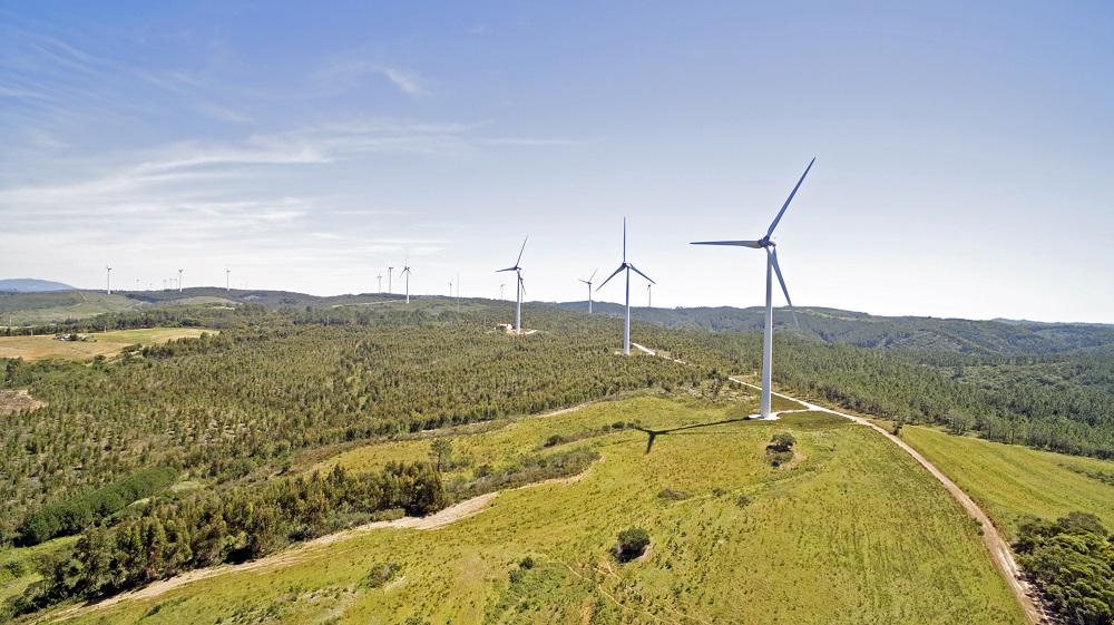
When you think of drones you might first think military reconnaissance or defense, but these innovative unmanned aircraft carriers are becoming incredibly useful in a wide range of other applications — including land real estate.
Aerial photography and videography are one of the most effective tools that land sellers have right now for optimizing their listings. And with modern drones getting more advanced (and more affordable) every day, if you’re not embracing drone technology for your land listing then you’re going to have a hard time competing with those who are.
Need a little bit more convincing? Here are five ways that drones help enhance your land listing and make it more attractive to potential buyers.
1. Capture big picture views. Land — especially vacant land — is all about the sum of its parts. But it can be hard to show how all of these parts work together when it requires dozens of pictures just to capture the expanse of your property. With drones, you can efficiently capture all of your property at once, which is ideal for giving buyers as thorough of an idea as possible about what they can expect.
2. Make your images more breathtaking. Real estate listings aren’t usually where people go to see amazing photography, but that’s all changing with increasingly widespread use of drones. Drone photography and videography can bring out the best in your property, taking features that might look just so-so in on-the-ground images and making them truly breathtaking to behold.
3. Give video tours. If a picture is worth a thousand words then it’s safe to say that a video is worth a million. Instead of walking around your land with a handheld camera, use a drone to fly over your property and give a quick but in-depth tour of what buyers will find there, from its topography to its on-site structures.
4. Share how your property feels, not just how it looks. Part of effective selling in real estate is conveying to buyers how it feels to be on a property, which is different than just how it looks. In addition to aerial imagery, you can take drone footage at eye level to “walk” a prospective buyer around your land and give them an idea of what it’s like to really be there.
5. Put your land in context. Drones allow you to capture not just your land itself but the land around it too. That’s important if you’re trying to appeal to developers, or if you have buyers who are looking for a certain amount of privacy (or alternately, want to be close to where the action is). This allows you to be incredibly detailed about what buyers can expect so that those who do come for a showing have enough information to be serious about their pursuit.
We recommend that you work with a professional drone company to capture your land in the best way that you can. Many companies offering drone services have lots of experience working in real estate photography and videography, and understand the unique needs of land listings. Reach out to your realtor if you need a recommendation, or do research on qualified drone companies in your area.
Like this article? Please feel free to share or post a link on your site: https://www.landhub.com/land-news/why-you-should-be-using-drones-to-sell-your-land/
All Land News
Leave a Reply
Land for Sale in the USA by State
- Alabama
- Alaska
- Arizona
- Arkansas
- California
- Colorado
- Connecticut
- Delaware
- Florida
- Georgia
- Hawaii
- Idaho
- Illinois
- Indiana
- Iowa
- Kansas
- Kentucky
- Louisiana
- Maine
- Maryland
- Massachusetts
- Michigan
- Minnesota
- Mississippi
- Missouri
- Montana
- Nebraska
- Nevada
- New Hampshire
- New Jersey
- New Mexico
- New York
- North Carolina
- North Dakota
- Ohio
- Oklahoma
- Oregon
- Pennsylvania
- Puerto Rico
- Rhode Island
- South Carolina
- South Dakota
- Tennessee
- Texas
- Utah
- Vermont
- Virginia
- Washington
- West Virginia
- Wisconsin
- Wyoming