Scan with Smart
Phone Camera
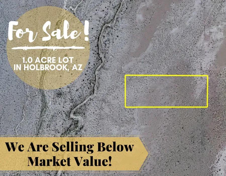
1 Acre In Holbrook, Arizona - Own For $125 Per Month Or $6500 (parcel Number: 104-64-005w)
United States /Arizona, Joseph, Arizona 86032, ,Land,For Sale,3130696, 86032, 1
For Sale
Listing ID :
3133079Acres :
1 AcresView Agent's Properties and Profile:

Contact Seller
Property Description
Great for Investors, Camping/RVs or Those Interested in Land Ownership & Wealth Building!
Own for $125 Down, $125 Per Month for 60 Months, or $6500 One-Time. No Interest. No Credit Checks. No Extra Fees!
Status: Available
Property Summary:
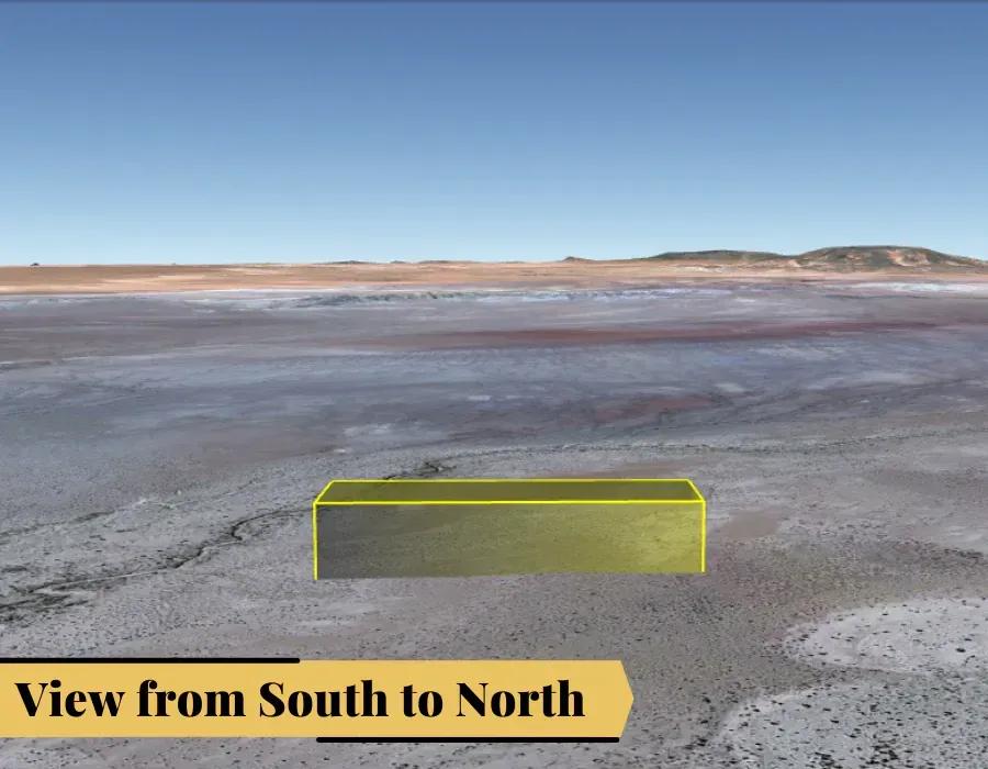
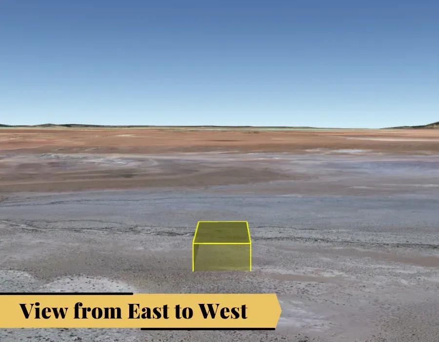
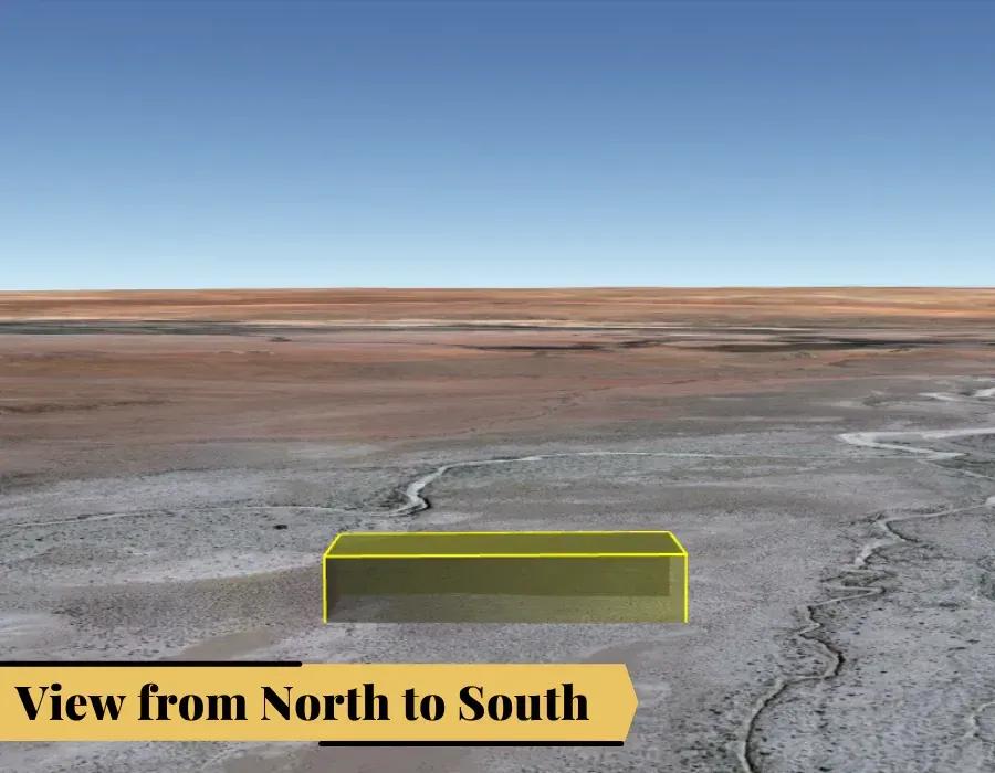
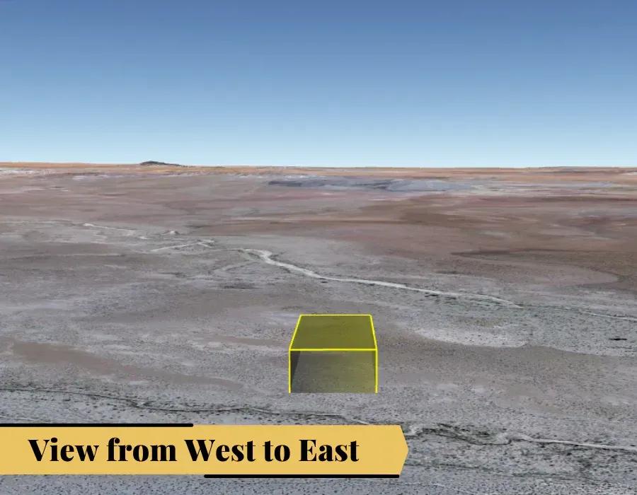
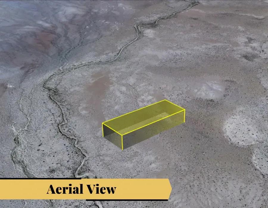
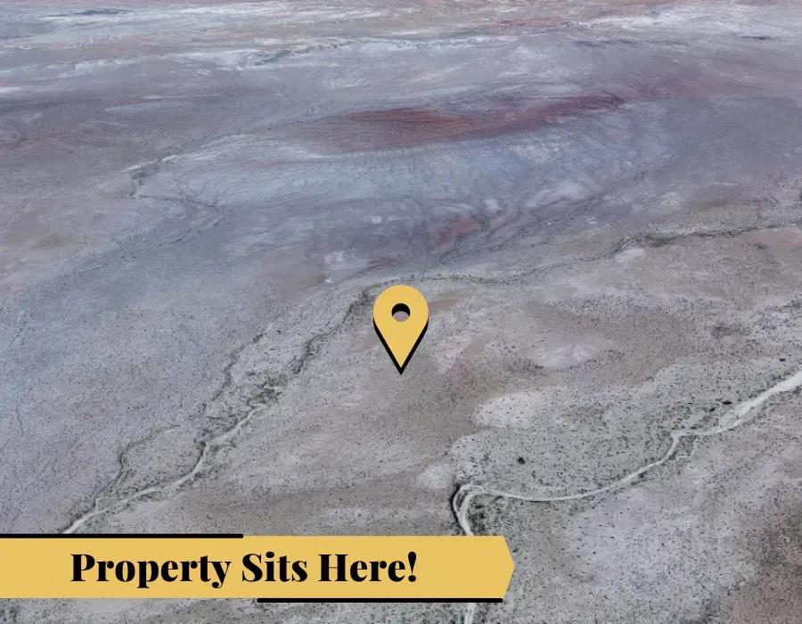
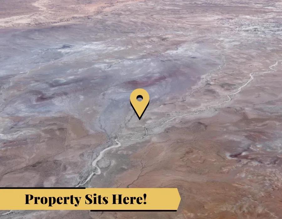
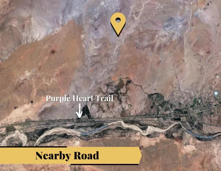
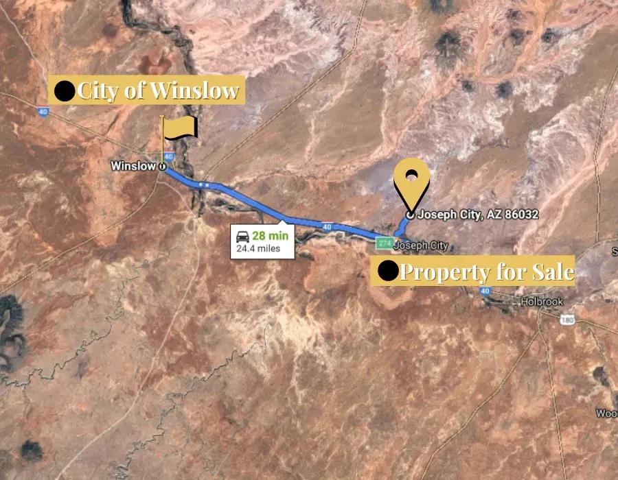
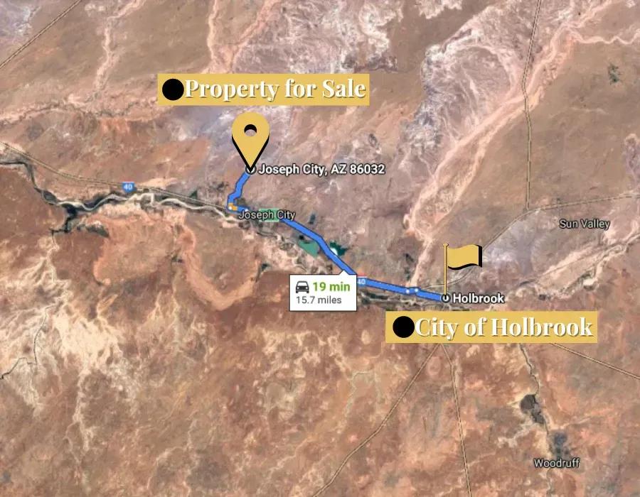
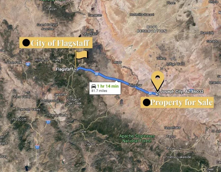
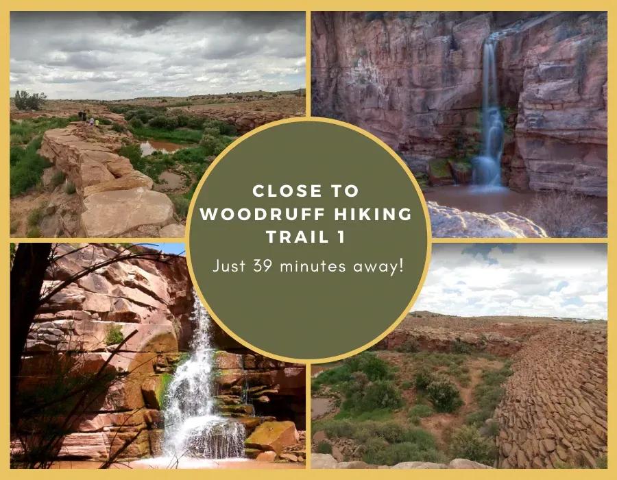
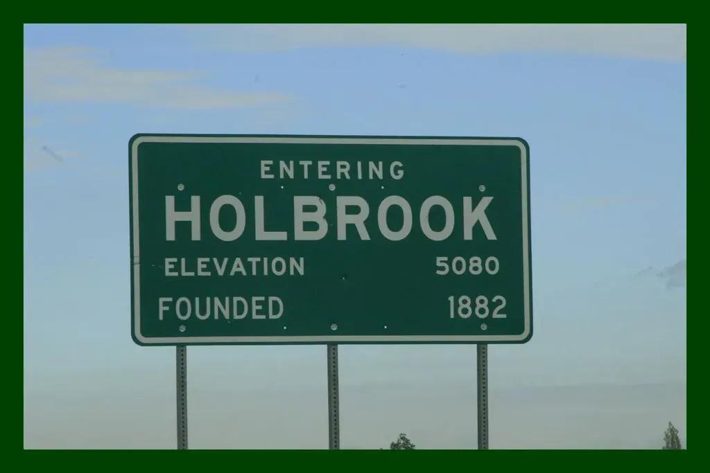
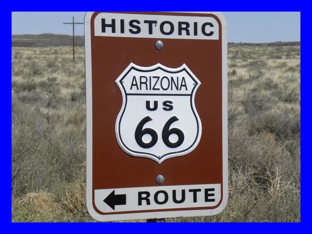
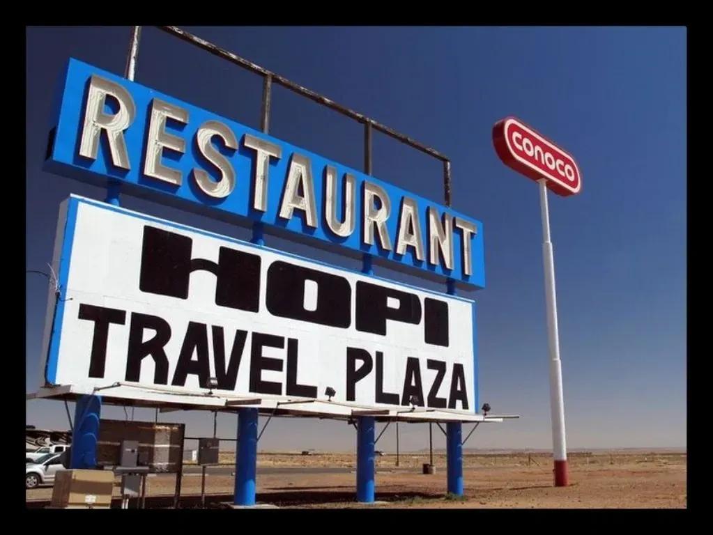
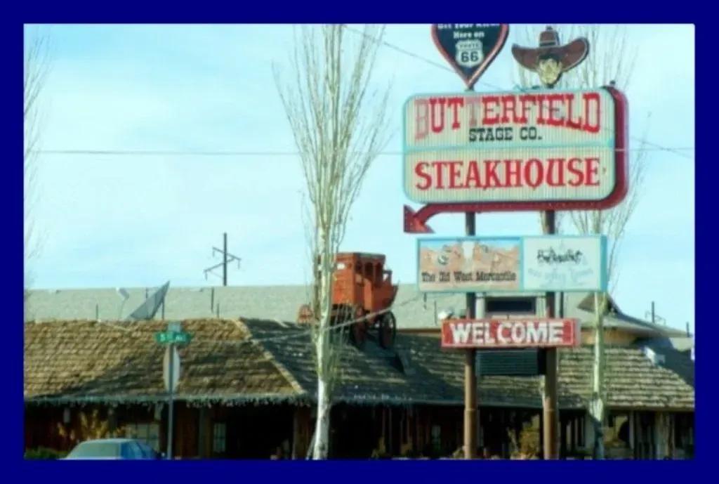
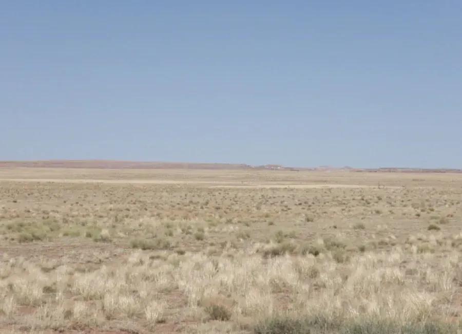
This Holbrook, Arizona property in Navajo County has amazing views! Beautiful Northern Arizona awaits you! Gorgeous views of the Midwest sunset is calling your name. Easy access from historic Route 66 and Interstate 40 make this off-grid delight easy to access. There is activity in the area, so utilities seem to be nearby! If you are wanting a private, secluded lot to call your own, look no further!
- Nichols Sportsman 16min - 9.50mi
- Future Tire 15min - 8.88mi
- Arizona Pawnman 17min - 11.18mi
- Knife City Outlet 10min - 3.23mi
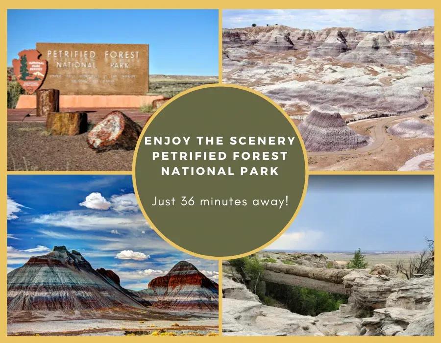
- Petrified Wood Direct 17min - 11.06mi
- Chucks Cabin 7min - 2.98mi
- Uranium Springs 19min - 7.20mi
- Holbrook Country Club 22min - 13.60mi
- The Corral 17min - 11.06mi
- Bojo’s Grill & Sports Club 48min - 43.62mi
Land will always maintain some value and will never lose the entirety of its value. This low-risk opportunity ensures you will always have a place to view the stars from.
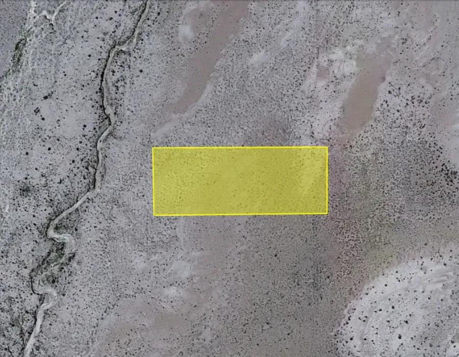
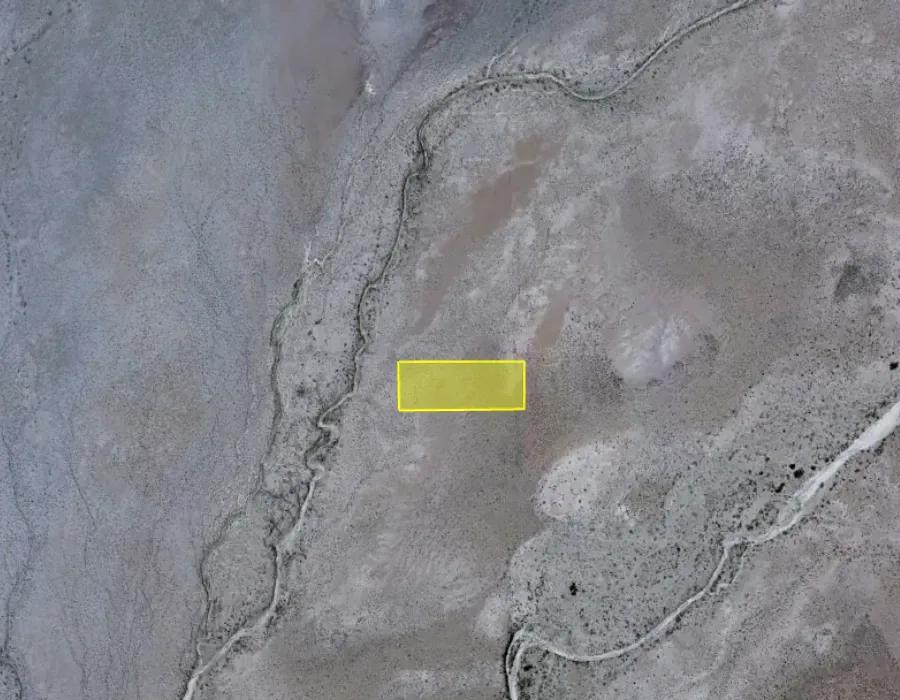
Look at the attached pictures of the area of the property. Contact us to learn more!
| Land Info Sheet | |
| QUESTION/S | DATA |
| Owner\'s name on the tax record: | Once Upon A Brick Inc |
| APN / Parcel #: | 104-64-005W |
| Account # or GEO #: | n/a |
| Property Address: | HOLBROOK, AZ, 86025 |
| County: | Navajo County |
| State: | AZ |
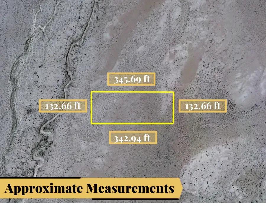
| Legal Description: | Section 31, T19N, R19E: N 132\' Of S 528\' Of E2 Se4 Ne4 Sw4 Out Of 104-64-005K For2008Roll |
| Parcel Size: | 1.0 acre |
| Subdivision: | n/a |
| GPS Center Coordinates (Approximate): | 35.00083280162099, -110.36941531210843 |
| Google map link: | https://goo.gl/maps/9zrQqtBT3KSwipnG7 |
| Elevation: | 1543.0 m or 5062.3 feet |
| Is there a Structure (Yes or No (If Yes: Explain) | None |
| County Contacts | |
| QUESTION/S | DATA |
| Assessor Website | https://www.navajocountyaz.gov/Departments/Assessor |
| Assessor Contact | (928) 524-4086 |
| Treasurer Website | https://www.navajocountyaz.gov/Departments/Treasurer |
| Treasurer Contact | (928) 524-4172 |
| Recorder/Clerk Website | https://www.navajocountyaz.gov/Departments/Recorder |
| Recorder/Clerk Contact | (928) 524-4194 |
| Zoning or Planning Department Website | https://www.navajocountyaz.gov/Departments/Planning-and-Zoning |
| Zoning or Planning Department Contact | (928) 524-4100 |
| County Environmental Health Department Website | http://www.navajocountyaz.gov/Departments/Public-Health-Services |
| County Environmental Health Department Contact | 928-289-6830 |
| GIS Website | https://webmap.navajocountyaz.gov/WebMap.aspx |
| CAD Website | n/a |
| Electricity Company Name & Phone Number | Navopache Electric Co-Op Inc - 928-535-4307 |
| Water Company Name & Phone Number | Arizona Water Co. - 928-535-4469 |
| Sewer Company Name & Phone Number | Winslow Water Sewer Sanitation - 928-289-5533 |
| Gas Company Name & Phone Number | El Paso Natural Gas Co - 928-657-3226 |
| Waste Company Name & Phone Number | Waste Management - Pinetop Lakeside Hauling & Lone Pine Transfer Station - 928-368-5472 |
| TAX DATA | |
| QUESTION/S | ANSWERS FROM THE COUNTY |
| How much is the annual property tax? (Current Year if available, if not get the previous year) | $0 |
| Are there any back taxes for this property? If yes, how much is the amount owed? ( From what year to what year) | No back taxes |
| What is the zoning of the property? (Residential/Commercial/Agricultural/etc) | A-General |
| Is the property buildable? (Yes/ No/Maybe/ etc.. write whatever the county has to say) | Yes |
| What can built on the proeprty? | \"1. Single-family dwellings - including conventional site-built homes, Manufactured Homes (including rehabilitated Mobile Homes) and Factory-Built Buildings 2. Churches 3. Farms including customary agricultural uses. 4. Public schools, elementary and secondary. 5. Public and private forests and wildlife reservations. 6. Utility Facilities - Facilities for the delivery to the public, by a regulated public utility or a public entity, of water, gas, electricity, steam, hot or cold air, telecommunications and cable television service, or sewer service. This shall include the pipes, lines and cables required for the actual delivery of the foregoing, as well as facilities and appurtenances directly related thereto (such as pumping or booster stations along pipelines and substations along transmission lines). It shall not include generating plants, treatment plants, storage yards, business offices or other major utility facilities which may be allowed with a special use permit pursuant to article 20. It likewise shall not include television, radio or telecommunications towers and stations, which shall require a special use permit 7. Publicly owned or operated properties including but not limited to fire stations, police stations and post offices. 8. Golf courses including club houses located thereon, including miniature courses or practice driving tees operated for commercial purposes. 9. Libraries, museums, parks, playgrounds, tennis courts and community buildings. 10. Hospitals and institutions of an educational, religious, charitable or philanthropic nature may be allowed with a use permit issued by the Board of Adjustment, provided the buildings for such uses are set back from all lot lines a distance of not less than two (2) feet for each foot of building height. Homes for the aged, nursing homes and convalescent homes may be allowed with a Use Permit issued by the Board of Adjustment. 11. Home occupations. 12. Except as otherwise specified, all agricultural uses and the production, harvesting, curing, processing, packaging, shipping and roadside stands offering for sale only farm products produced on the premises. 13. Commercial feed lots, dairy farms, the raising of fur-bearing animals or the raising or feeding of animals that could create noise, odors, dust, or pose a problem of health or sanitation to neighboring properties if within six hundred (600) feet of a property line, will be subject to securing a Use Permit, and periodic inspection to assure compliance. 14. Public riding stables and boarding stables provided the site contains at least ten (10) acres and the building housing the animals is set back from all property lines a distance of not less than one hundred (100) feet. 15. The keeping of horses, providing that: a. Corrals, stables, watering areas and feeding stations are set back from all property lines a distance of not less than that required for building setbacks. b. Corrals contain at least six hundred square feet (600 sq. ft.) per horse. 16. Plant nurseries and greenhouses for the propagation, cultivation and wholesale distribution of plants produced on the premises. Open storage shall be limited to plants or packaged fertilizer, and the buildings and structures used in connection therewith are set back from all lot lines a distance of not less than that required for residential building setbacks. 17. Fences or free-standing walls not to exceed a height of six feet (6\') 18. Accessory buildings and uses customarily incidental to above uses, including: a. Barns, sheds and stable buildings. b. Guest houses and quarters for servants and caretakers employed on the premises, providing that the lot be a minimum of ten thousand square feet (10,000 sq. ft.) in area, that all buildings meet all building setbacks, that the ,guest house or servants and caretakers quarters be no greater than seventy-percent (70%) of the square footage of the principal dwelling and subject to securing a use permit. If kitchen facilities are provided therein, any use permit approved for such quarters shall continue if, upon inspection, satisfactory evidence indicates that such buildings are continuing their function as bona fide guest houses, servant\'s or caretakers’ quarters and not as a rental unit. 19. Feed Stores on not less than two and one half (2.5) acres of land. 20. Group Homes for the Disabled 21. A use similar to any of the foregoing permitted uses may be allowed upon a written determination by the Director of Development Services that the proposed use is similar in nature and impact to the permitted use and is consistent with the overall purposes of the zoning district. The Director’s determination may be appealed to the Board of Adjustment pursuant to Article 28 hereof. The burden shall be upon the property owner to prove by clear and convincing evidence that the proposed use is similar to the permitted use.\" |
| What can you do on the property? | Since the property is zoned as A-General you can do as what can be build on the property. |
| Can you camp on on the property? (If we buy this property can the owner camp there?) Yes/No | Yes |
| Notes on Camping (please take note of the allowed time for camping or whatever the county has to say) | Once per calendar year for a period of up to 30 consecutive days. |
| Are RV\'s allowed on the property? (Please ask if there are any restrictions.) Yes/ No | Not as a residence. |
| Note\'s on RV\'s (jot down notes whatever the county has to say) | Can be stored on a property, subject to zoning standards, following the construction of a primary residence. |
| Are Mobile homes allowed on the property? (Please ask if there is restrictions.) Yes/No | Yes |
| Notes on mobile homes (jot down notes whatever the county has to say) | Basic DetailsProperty Types: LandListing Type: For SaleListing ID: 3133079Price: $6,500Acres: 1 AcresAddress MapCountry: United StatesState: ArizonaCounty: Navajo CountyCity: JosephLatitude: 35.000833Longitude: -110.369417Street Address: Joseph, Arizona 86032, ,Land,For Sale,3130696Land for Sale in the USA by State
Land for Sale in Costa Rica, Mexico & CanadaProperty For SaleCopyright ©️ 2024 by LandHub.com. LandHub ©️ is a registered trademark and cannot be used without permission. |