Scan with Smart
Phone Camera
Online Auction Irrigated Cropland In Oklahoma Panhandle
United States /Oklahoma, Road Z & Road 19 ,Goodwell,Oklahoma 73939,Road Z & Road 19,152553, 73939, 879
Sold
Listing ID :
153426Acres :
879 AcresView Agent's Properties and Profile:

Contact Seller
Property Description
ONLINE ONLY AUCTION
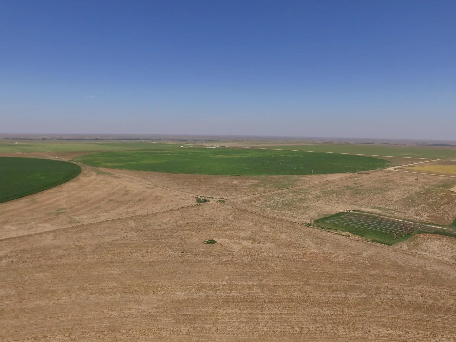
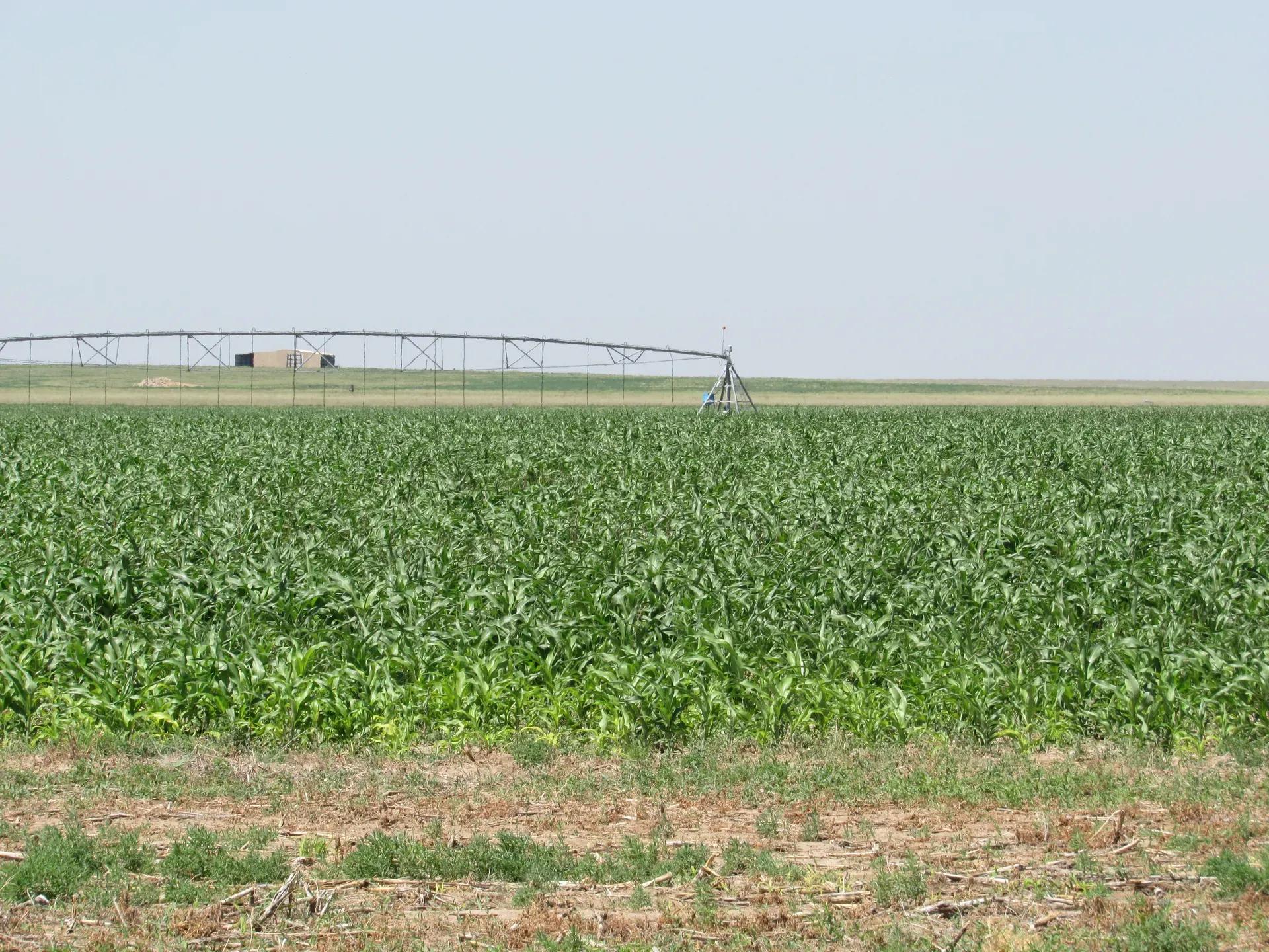
879 +/- ACRES IRRIGATED CROPLAND
GOODWELL, TEXAS COUNTY, OKLAHOMA
AUCTION DATES: Bidding opens August 22, 2020 at 6:00pm CST
Bidding closes September 22, 2020 at 6:00pm CST
DIRECTIONS TO PROPERTY: From Goodwell, Oklahoma, go ½ mile north to Rd. Bb. Take Bb west 3 miles to Rd 19, then 1 mile north to the southeast corner of Tract 2. Continue North on 19 Road for 1 mile to the southwest corner of Tract 1. (watch for signs)
LEGAL DESCRIPTION: See Property Information Packet for complete legal descriptions.
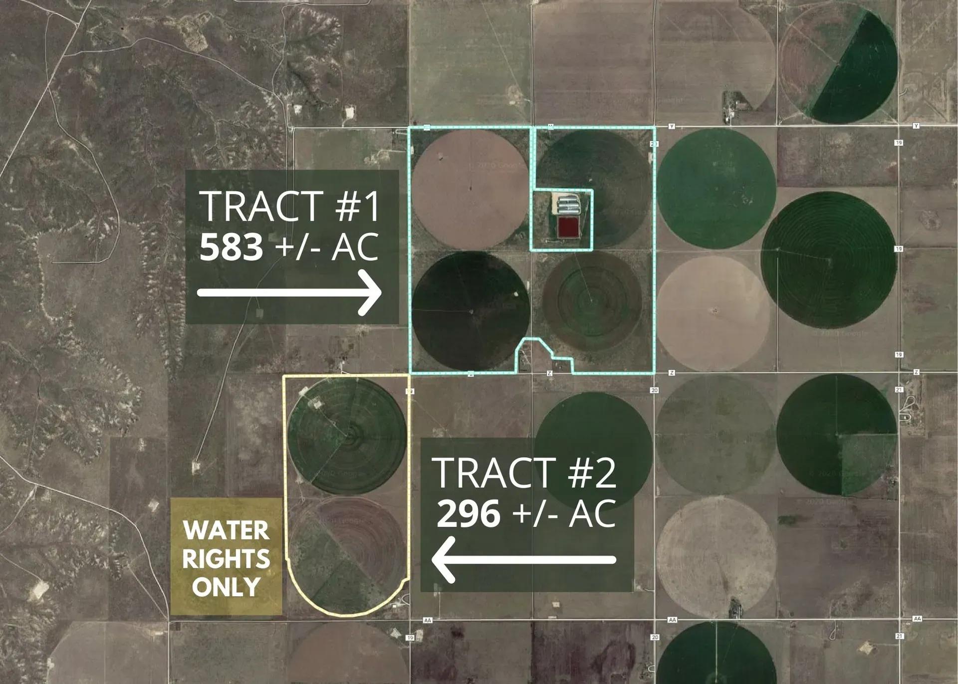
Tract #1: (583+/- acres) in the W/2 S17 T2N R13E and E/2 S17 T2N R13E less and except a (40 +/- acre tract in the NE/4) and a (10 +/- acre tract in the S/2)
Tract #2: (296+/- acres) in the E/2 S19 T2N R13E less and except a (11.5 acre tract in the SE corner) and a (12.13 acre tract in the SW corner)
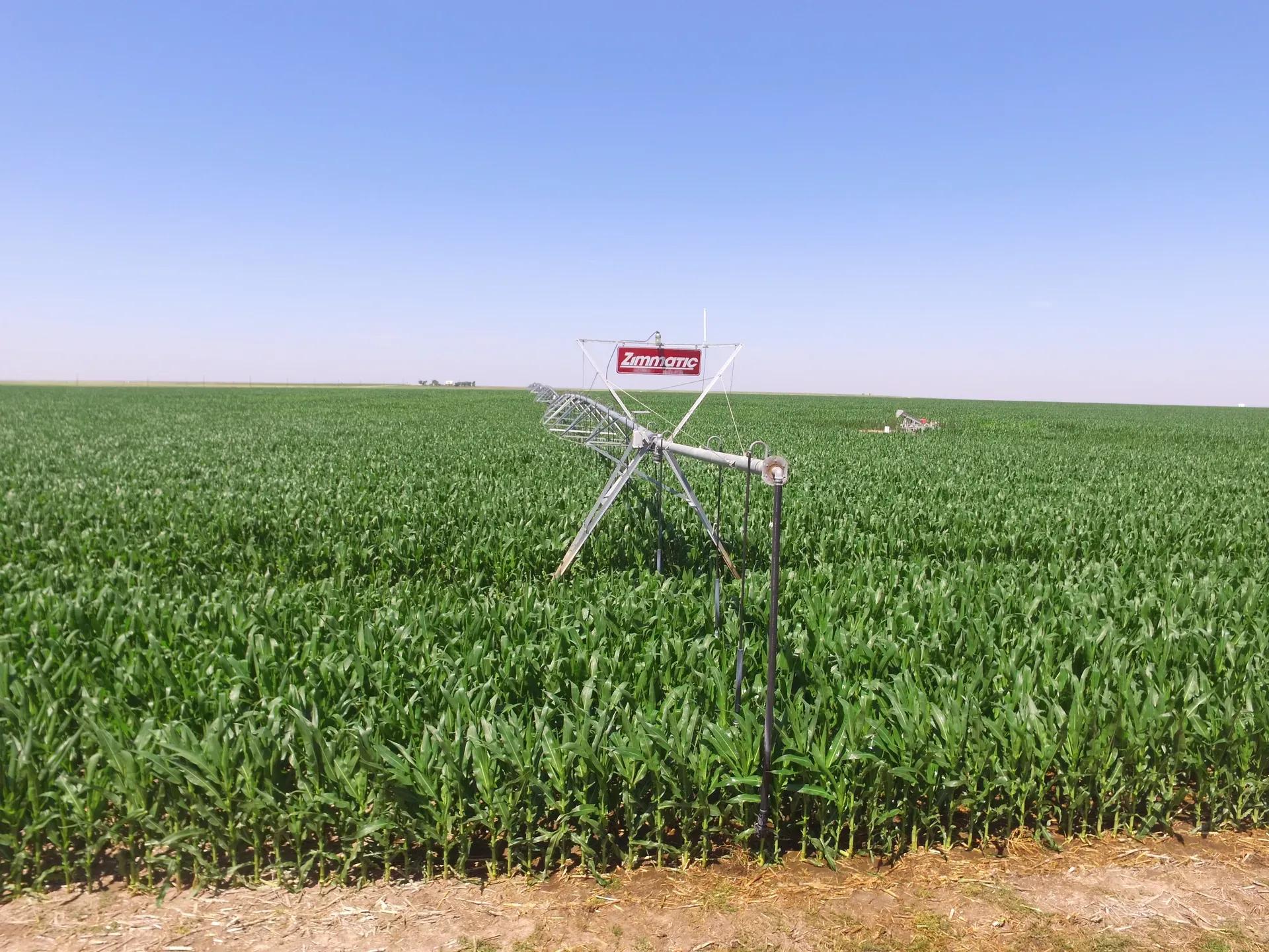
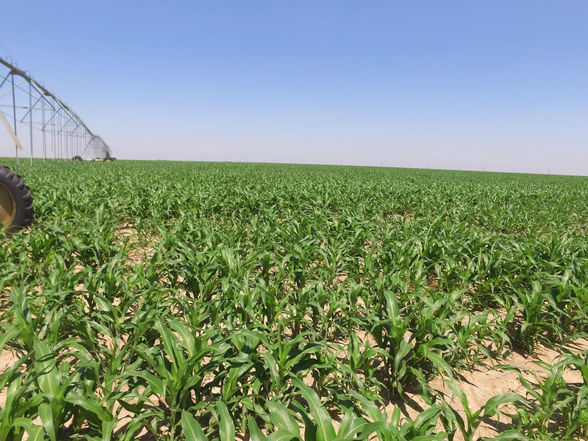
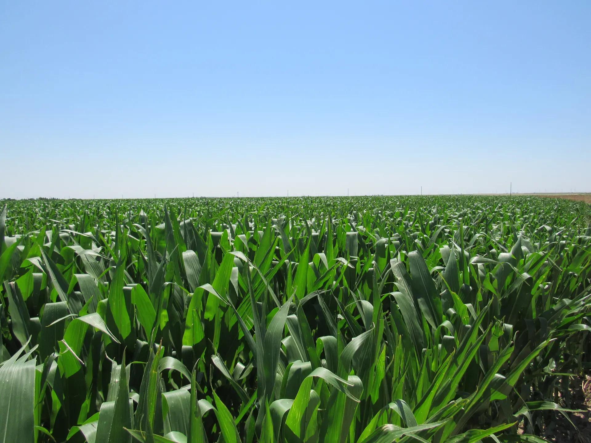
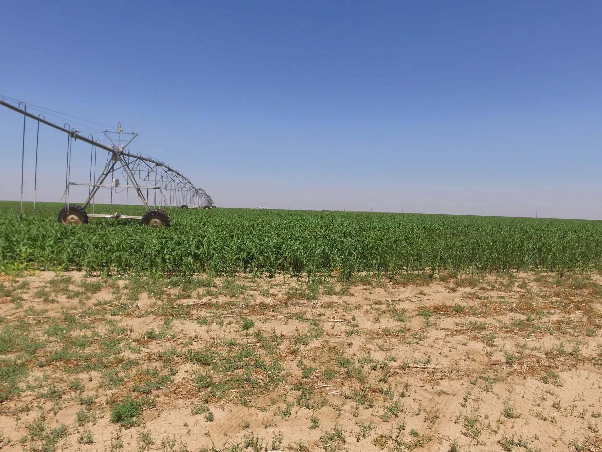
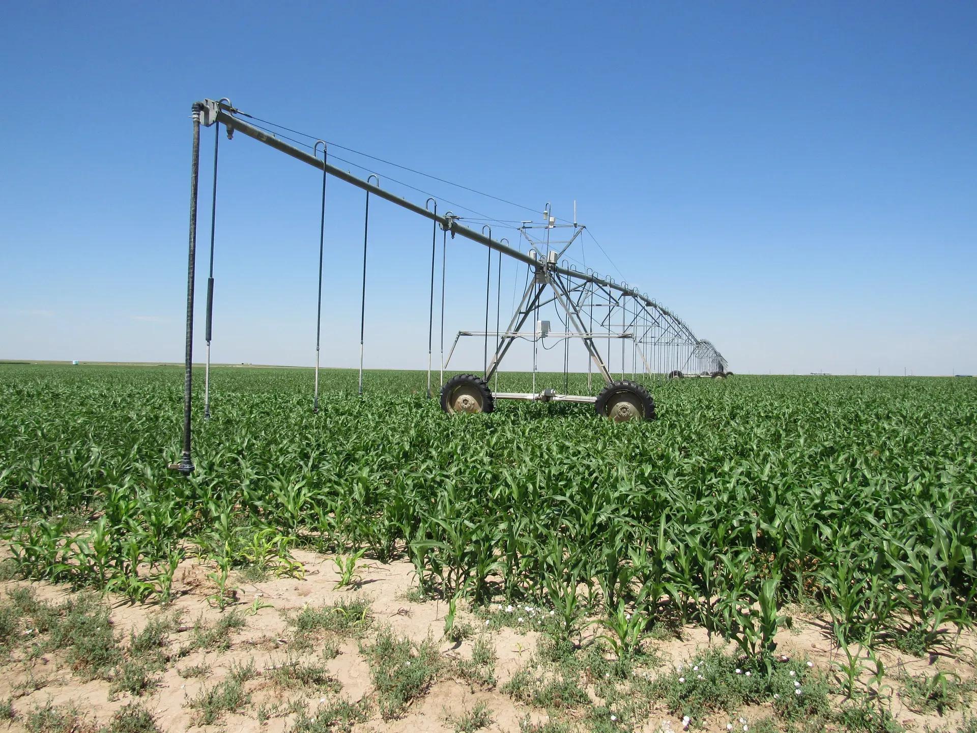
AUCTIONEERS NOTE: This is an excellent opportunity to own irrigated cropland in Texas County, Oklahoma. Located just 2.5 miles Northwest of Goodwell, these farms have well maintained irrigation equipment and offer good quality cropland.
FSA INFORMATION: According to the Texas County Farm Service Agency
Tract #1 (Farm #7690) consists of 526.80 farmland acres.
BASE ACREAGE PLC YIELD
Wheat 360.90 41
Corn 158.50 154
Sorghum 7.40 96
Tract #2 (Farm #7415) consists of 281.10 farmland acres.
BASE ACREAGE PLC YIELD
Wheat 235.80 39
Corn 34.30 98
Sorghum 0.70 37
Barley 10.30 28
TRACT #1
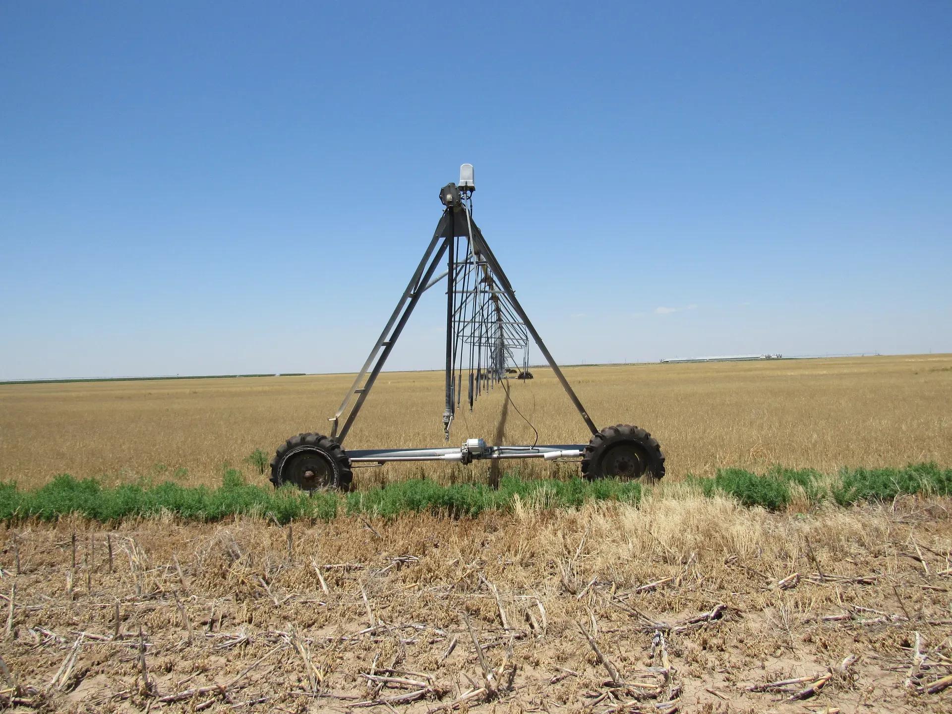
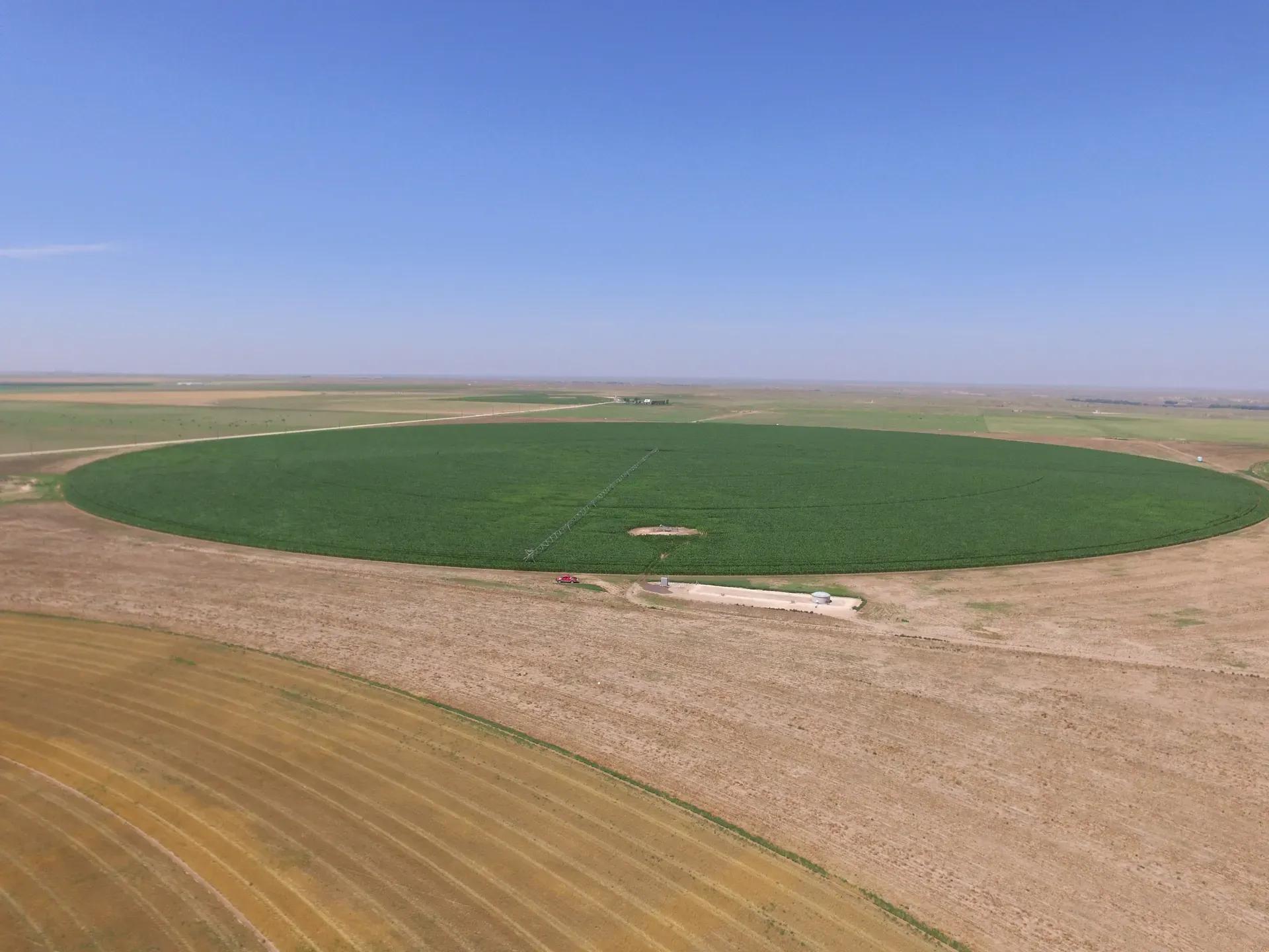
There are (4) farms which total 583 +/- acres according to Texas County OK tax records. According to the Seller, there are (2) water wells along the west side of the Section currently in use on Tract 1, with all of the pivots and water wells tied together with a series of 8” pipelines and valves. Review the current water permits for additional information and permit status (see attachments on website). .
Northwest Quarter (NW/4) Section 17 Township 2N Range 13E
- Cropland Acres - 178.8 +/- Acres
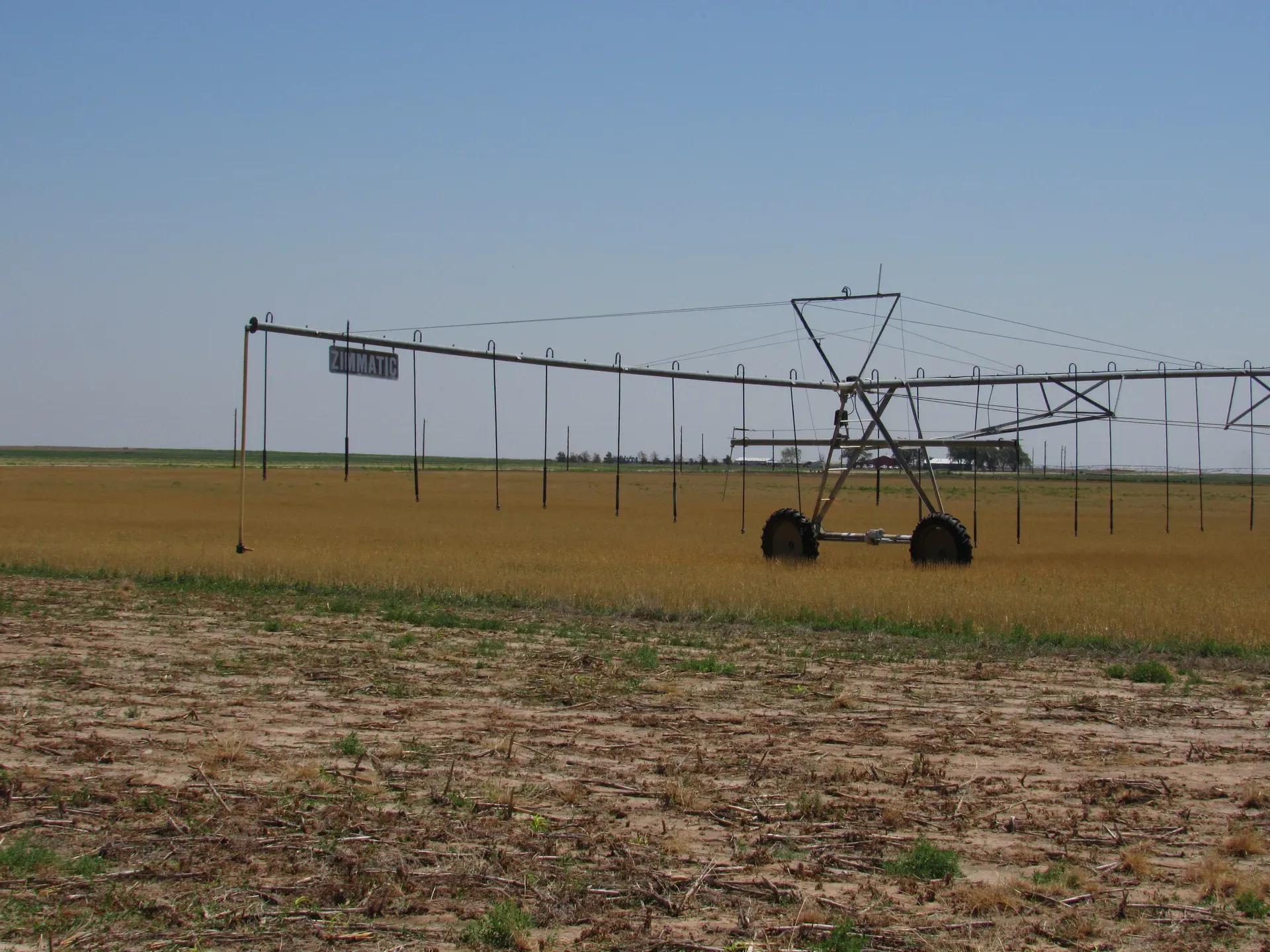
- 7 tower Valley 6000, 60” nozzle spacing w/ Senninger LDN
- Center pivot nozzle set at 600 GPM
- Well Permit #1964-179 and #2001-543 (See Attachments)
- 454 IRRIGATION MOTOR (OWNED BY TENANT)
- Natural gas to run pivot motor
- Currently in Milo crop
- 2019 Taxes $353.00
Southwest Quarter (SW/4) of Section 17-02N-13E
- Cropland Acres - 138.7 +/- Acres
- 7 Tower Zimmatic, 5’ nozzle spacing w/ Senninger LDN
- Centerpivot nozzle set at 600 GPM
- Well Permit #1964-179 and #2001-543 (See Attachments)
- 454 IRRIGATION MOTOR (OWNED BY TENANT)
- Natural gas to run pivot motor
- Currently in Corn Crop
- 2019 Taxes $271.00
Northeast Quarter (NE/4) of Section 17-02N-13E
- Cropland Acres for NE/4 and SE/4 combined 259.6 +/- Acres
- 8 tower Zimmatic, 60” nozzle spacing w/ Senninger LDN
- Well Permit #1993-617B (See Attachments)
- Centerpivot nozzle set at 300 GPM
- Planting Wheat (fall 2020)
Southeast Quarter (SE/4) of Section 17-02N-13E
- 6 tower Valley 6000, 60” nozzle spacing w/ Senninger LDN
- Centerpivot nozzle set at 300 gpm
- Well Permit #1993-617B (See Attachments)
- Planting wheat (fall 2020)
- 2019 Taxes $545.00
TRACT #2
There are 2 farms which total 296 +/- acres according to Texas County Oklahoma tax records
East Half of Section 19 Township 02 N Range 13 E
3 wells with 8” pipeline connecting wells and center pivots together
Northeast Quarter (NE/4) of Section 19-02N-13E
- Cropland Acres - 160 +/- Acres
- 7 Tower Zimmatic, 5’ nozzle spacing w/ Senninger LDN
- Centerpivot nozzle set at 350 GPM
- 1 well (permit #1998-512) 1120 acre feet per calendar year (shared permit, with 3 total wells) (See Attachments)
- 454 IRRIGATION MOTOR (OWNED BY TENANT)
- Natural gas to run pivot motor
- Currently in Milo crop
- 2019 Taxes $295.00
Southeast Quarter (SE/4) of Section 19-02N-13E
- Cropland Acres - 136.46+/- Acres
- 7 Tower Zimmatic, 5’ nozzle spacing w/ Senninger LDN
- Centerpivot nozzle set at 350 GPM
- 1 well (permit #1998-512) 1120 acre feet per calendar year (shared permit) (See Attachments)
- 454 IRRIGATION MOTOR (OWNED BY TENANT)
- Natural gas to run pivot motor
- Currently fallow, will plant wheat (fall 2020)
- 2019 Taxes $244.00
Additional Water Rights and Water Well Only (No Land Selling)
Southwest Quarter (SW/4) of Section 19-02N-13E
- 1 well (permit #1998-512) 1120 acre feet per calendar year (shared permit) (See Attachments)
- 150 HP Gearhead (only)
Soil Types:
- Gruver clay loam
- Ulysses clay loam
- Veal- Potter
- Coalen loam
LEASE INFORMATION :
Tract 1: Lease agreement with 50/50 crop share - Tenant planning to plant wheat on the Northeast and the Southeast Quarters this fall 2020. Tenant will also be planting wheat on all the corners. Landlord (Buyer) to pay for 50% of the production costs to include: natural gas for irrigation motors, seed, fertilizer, and chemical (as needed). Owner pays all center pivot and water well expenses. 50% of the 2021 wheat crop will go to Buyer.
Tract 2: Lease agreement with 50/50 crop share agreement - Tenant planting wheat this fall on south quarter, and all the corners. Landlord (Buyer) to pay for 50% of the production costs to include: natural gas for irrigation motors, seed, fertilizer, and chemical (as needed). Owner pays all center pivot and water well expenses. 50% of the 2021 wheat crop will go to Buyer.
SELLER: Don Graber, ETAL.
Basic Details
Property Types:
Acreage, Farm, Farm Auction, Land, Land AuctionListing Type:
SoldListing ID:
153426Price:
$0Acres:
879 AcresAddress Map
Country:
United StatesState:
OklahomaCounty:
Oklahoma CountyCity:
GoodwellLatitude:
36.63398881Longitude:
-101.6970066Street Address:
Road Z & Road 19 ,Goodwell,Oklahoma 73939,Road Z & Road 19,152553Directions:
From Goodwell, Oklahoma, go ½ mile north to Rd. Bb. Take Bb west 3 miles to Rd 19, then 1 mile north to the southeast corner of Tract 2. Continue North on 19 Road for 1 mile to the southwest corner of Tract 1. (watch for signs)Land for Sale in the USA by State
- Alabama
- Alaska
- Arizona
- Arkansas
- California
- Colorado
- Connecticut
- Delaware
- Florida
- Georgia
- Hawaii
- Idaho
- Illinois
- Indiana
- Iowa
- Kansas
- Kentucky
- Louisiana
- Maine
- Maryland
- Massachusetts
- Michigan
- Minnesota
- Mississippi
- Missouri
- Montana
- Nebraska
- Nevada
- New Hampshire
- New Jersey
- New Mexico
- New York
- North Carolina
- North Dakota
- Ohio
- Oklahoma
- Oregon
- Pennsylvania
- Puerto Rico
- Rhode Island
- South Carolina
- South Dakota
- Tennessee
- Texas
- Utah
- Vermont
- Virginia
- Washington
- West Virginia
- Wisconsin
- Wyoming