
Scan with Smart
Phone Camera
File 63es- 157.5 Acres In Matheson Township
Canada /Ontario, 157.5
For Sale
Listing ID :
2039718Acres :
157.5 AcresView Agent's Properties and Profile:

Contact Seller
Property Description
HUNTERS WILL LOVE THIS PROPERTY!
Have you thought about buying a nice chunk of bush a little closer to Gods country?
157.5 ACRES
Look no more as this is definitely do-able.
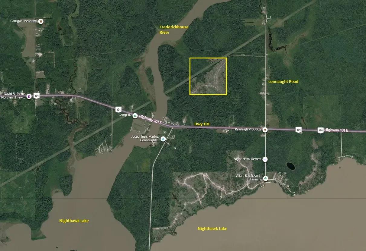
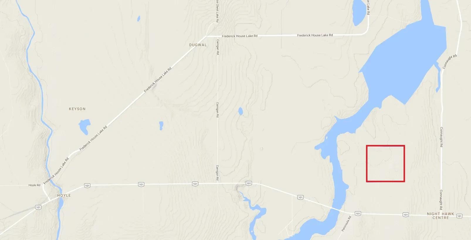
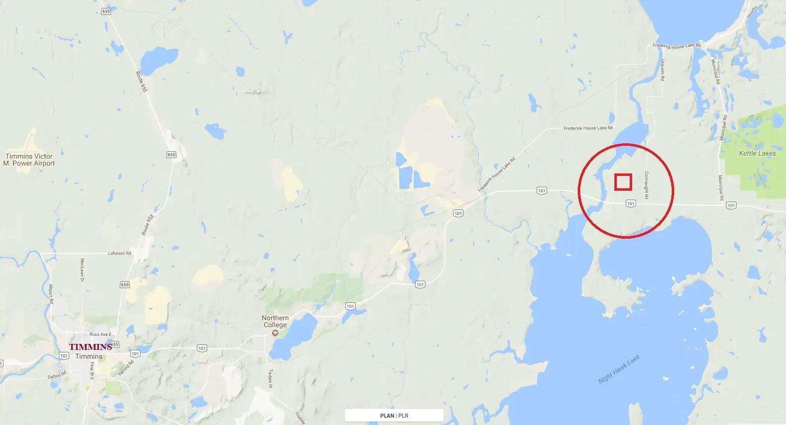
Located east of the City of Timmins in Northeastern Ontario in Matheson Township.
Matheson Township is within the Boundary of the City of Timmins so it is an ORGANIZED TOWNSHIP.
An exciting opportunity to own an awesome hunting property and build your private HUNT CAMP.
or
This is a property where you can start a replanting operation.
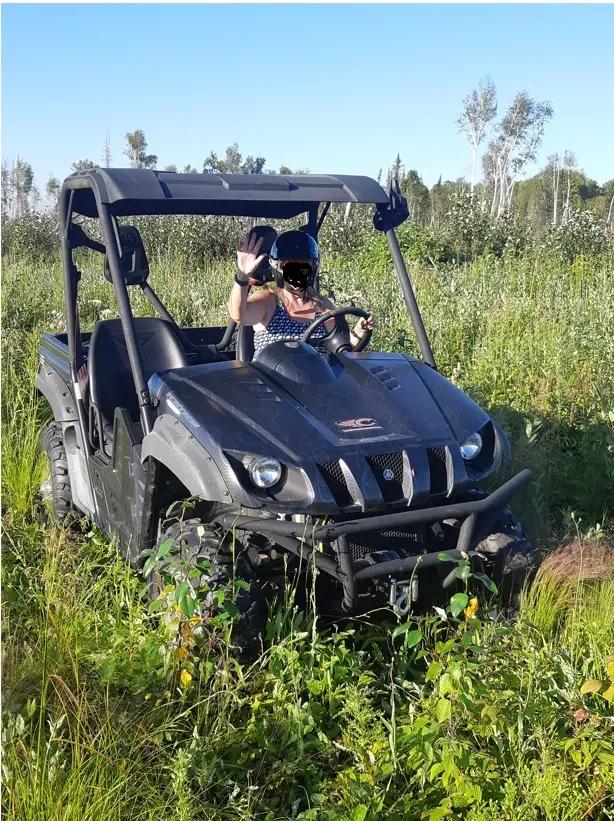
THIS IS NOT A DRIVE TO PROPERTY IN A CAR OR A TRUCK!
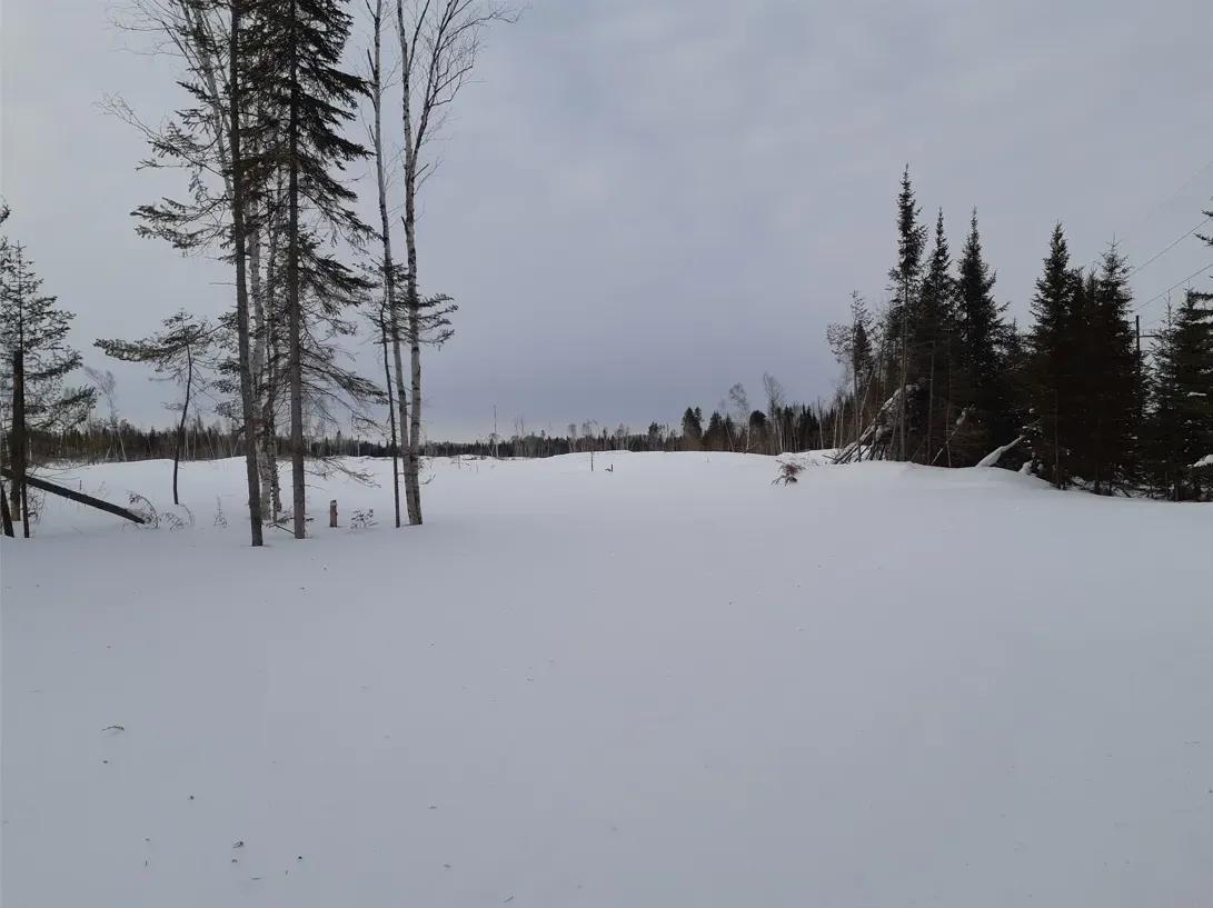
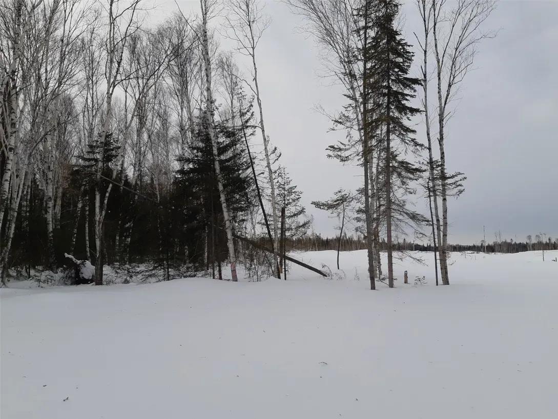
This is what we believe is a prime secluded hunting property that requires you to use an ATV or an ARGO or a SNOWMOBILE to get to it.
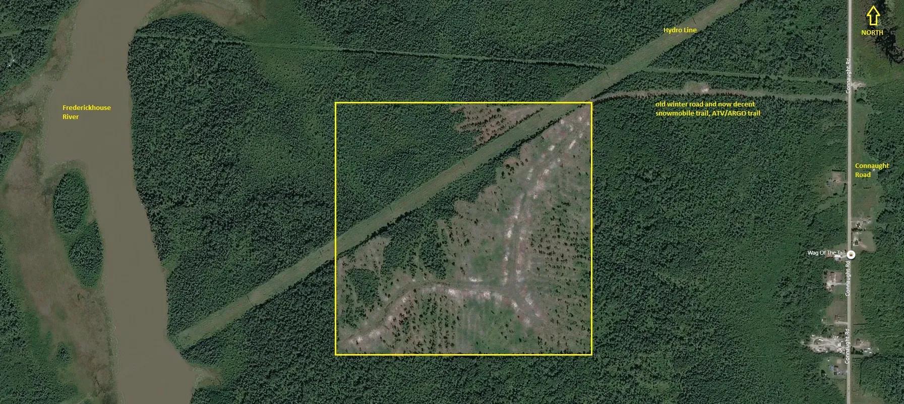
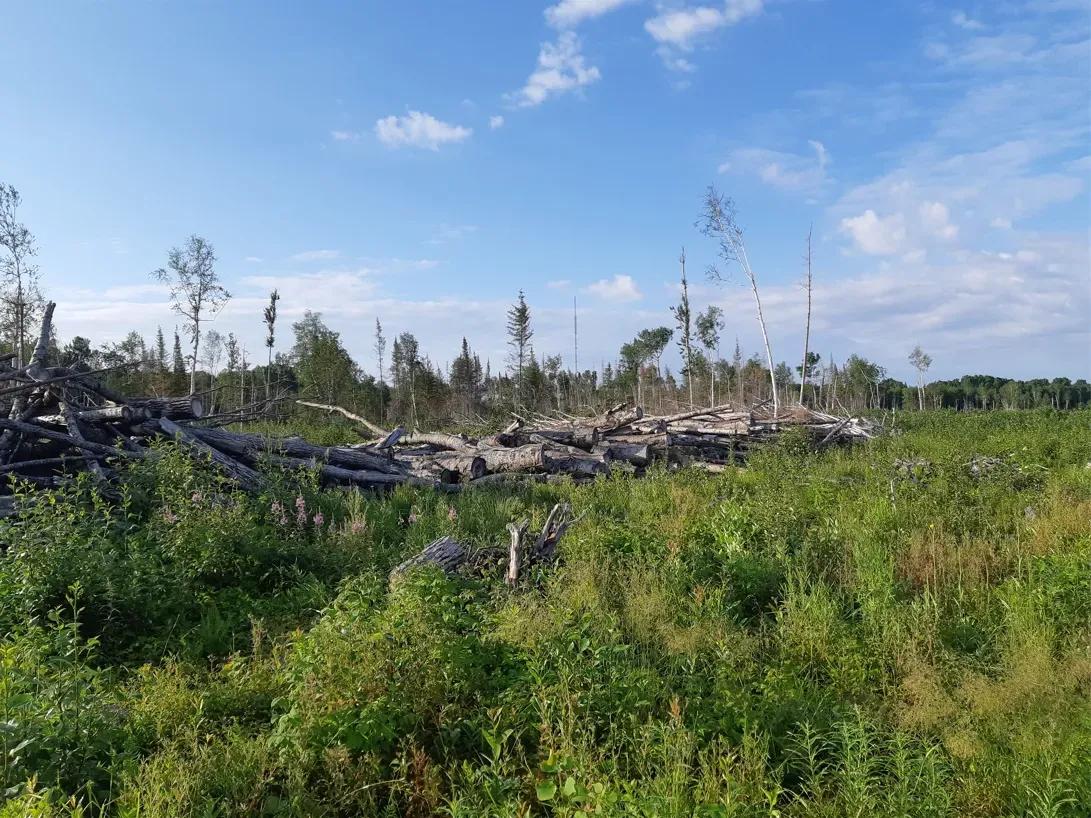
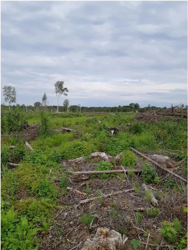
THE TREES
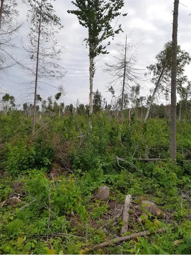
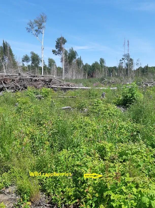
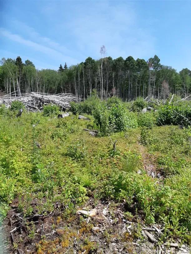
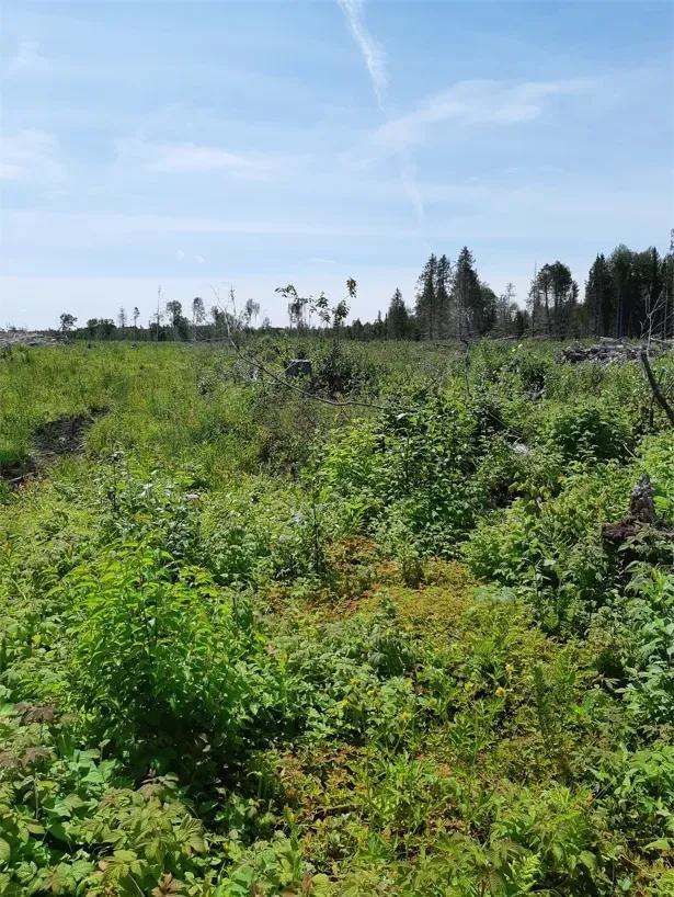
The mature timber was harvested in the winter of 2017 and 2018.
Before the timber harvesting was done the property was forested with a mix of Spruce trees, Balsam trees, Poplar trees and Birch trees.
All the mature timber was harvested in tree length and the younger trees were left.
Since the winter of 2017/2018 new growth has started to regenerate and you can see Poplar and Birch growing plus Spruce trees growing.
FIREWOOD
The remnant of the timber harvesting operation is a fantastic opportunity for someone to come in and start cutting firewood from the portions of the trees that were left on the ground.
You can easily make money selling firewood that you cut up yourself or by allowing people to come in and cut firewood themselves.
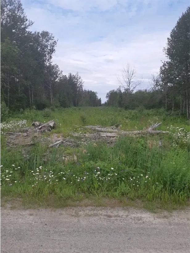
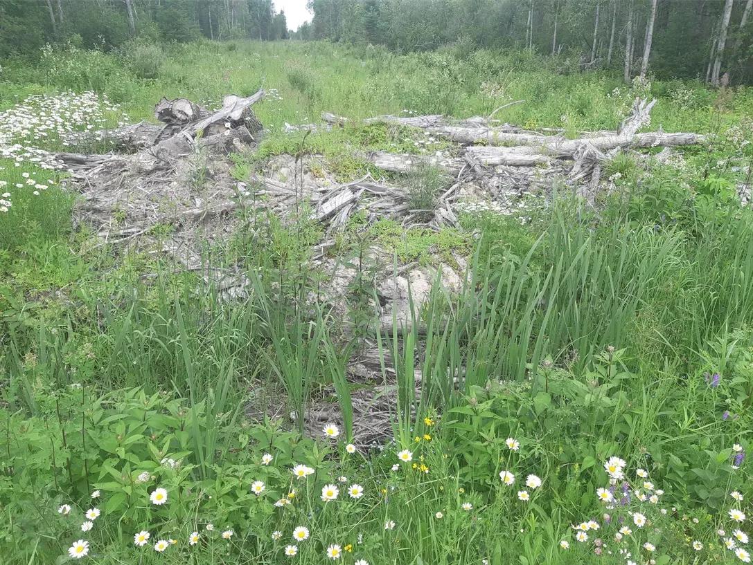
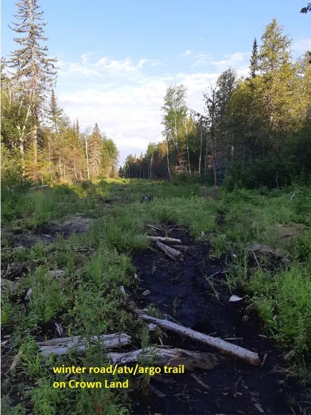
ACCESS
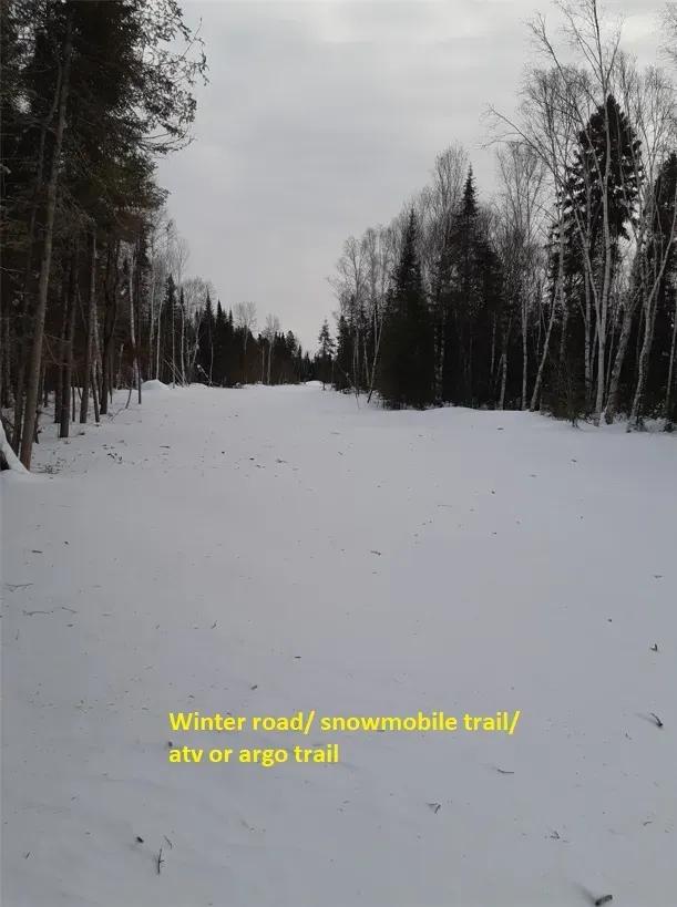
Access to the property is via a trail that originated as a winter road that was created by the timber contractor when the timber was harvested.
The former winter road and now a trail starts at the Connaught Road and goes west for a half mile or 0.8 kilometers through Crown land and to the property and then the former winter road and now trail continues diagonally southwest into the property.
In winter there is plenty of opportunity to snowmobile into this property..
When the snow is gone you have an awesome really wide ATV/ARGO trail.
Some of the skid trails in the property become ATV/Argo trails.
The former winter road and now trail is on CROWN LAND.
YOU CAN APPROACH THE MNR TO GET A PERMIT TO CONSTRUCT A ROAD TO THE PROPERTY.
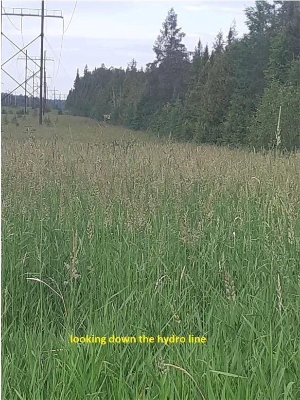
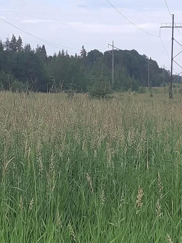
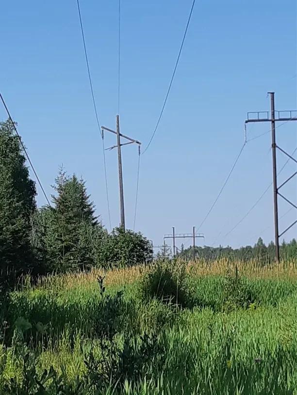
ELECTRICAL POWER TRANSMISSION LINE
A hydro line cuts through the property in a diagonal line.
The hydro line is a good place to go hunting on.
In fact there is a tree stand on the property on the north side of the hydro line that has a view in both directions.
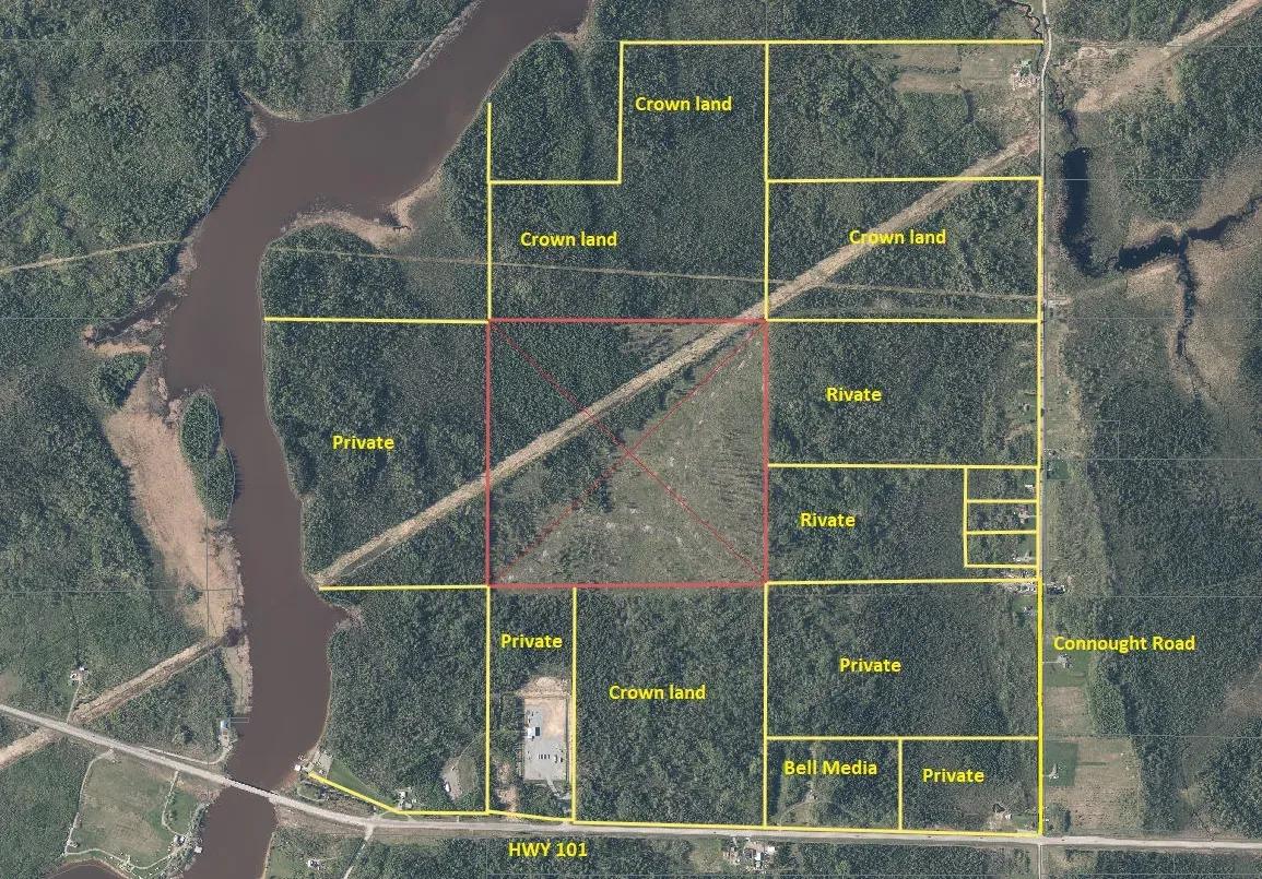
PROPERTY RIGHTS
We have checked the original patent of this property to determine what rights come with this land.
SURFACE RIGHTS COME WITH THE PROPERTY
MINERAL RIGHTS COME WITH THE PROPERTY
TREE RIGHTS COME WITH THE PROPERTY except for the “Pine Trees” which are reserved to the Crown.
Please Note that there is a 2% net smelter royalty reserved to a previous owner.
If you don’t plan to mine this property then that 2%reserve will mean nothing but if you do make a deal with a mining company to mine the property then be aware that a previous owner gets a 2% royalty.
THE TERRAIN
A review of the contour map shows that a good portion of the property appears to be relatively level and the southeast section of the property being about 10 meters (about 32 feet) higher than the northwest section.
The incline is gradual and not severe.
PICTURES
the Seller has provided us with the pictures of the property.
ZONING
The property is zoned RD-RU (RURAL).
Some of the permitted uses in this zoning include the following;
Adventure Game Agricultural Use
Agricultural Related Uses Club or Clubhouse
Camp Seasonal Dwelling
Forestry Use Kennel
PLUS A LOT MORE!
In the Zoning By-Law a camp is defined as follows:
Camp (Hunt Camp, Fishing Camp, Back Country Camp)
Means a building or structure having a floor area of up to 46.5 m2 [ 500 ft. 2], including any live able basement area, located in a rural area intended to provide basic shelter and accommodation on a temporary basis for persons engaged in such activities as hunting, fishing, snowmobiling, hiking or other similar forms of recreation but does not include a seasonal dwelling.
LIKE TO FISH
It may be possible to take an ATV or ARGO from the property down to the Frederickhouse River via the hydro line.
From the westerly line of the property it is about 600 meters or 1,980 feet to the river.
Place a 12 foot boat on the ATV or Argo, use a small outboard motor and go fishing up and down the Frederickhouse River.
Continue south on the river and you can fish Nighthawk Lake.
LIKE TO HUNT?
The new growth that is coming up is attracting the big game like moose.
This property is located in WILDLIFE MANAGEMENT UNIT (WMU) 29.
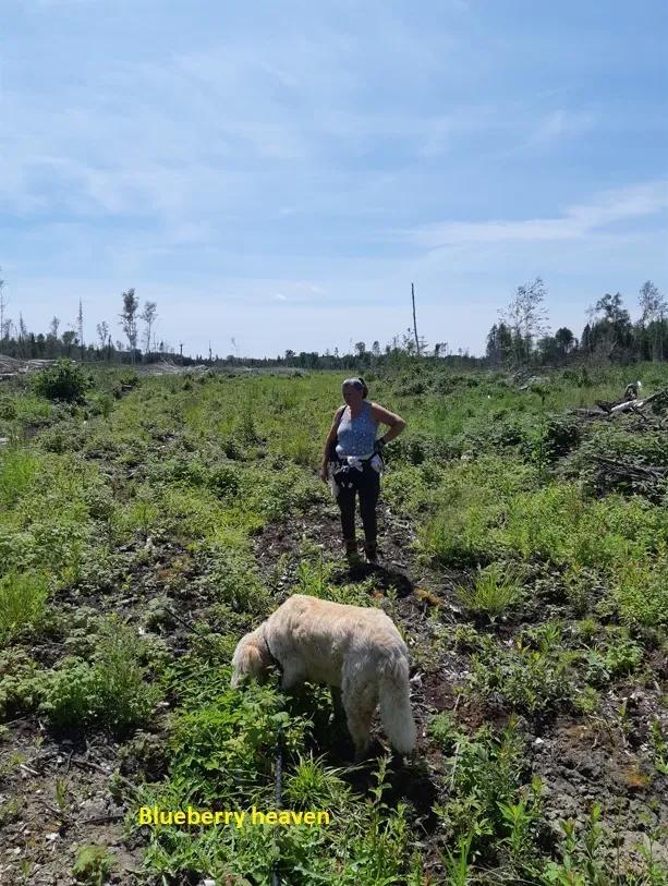
LIKE BLUEBERRIES?
If you like picking wild blueberries then you can pick many baskets of your own here.
If you like to hunt Black Bear then you know that the blueberries will attract them.
HST
It is our opinion that HST is not applicable to this sale.
Distances
From the City center of Timmins it is only 33 kilometers to the property, roughly 20 miles.
From the property it is about 36 kilometers to the Town of Matheson.
According to Google this property is only
670 kilometers to Toronto
765 kilometers to Niagara Falls
557 kilometers to Barrie
666 kilometers to Ottawa
PLEASE NOTE: when we state GPS Co-Ordinates in our information or story WE GET THE GPS CO-ORDINATES FROM THE MNR MAKE-A-TOPO-MAP WEBSITE
Attachments
Basic Details
Property Types:
Hunting Land, Timberland, Land - Hunting, Land - Recreational, Land - Forest - PlantedListing Type:
For SaleListing ID:
2039718Price:
C$95,000Acres:
157.5 AcresFeatures:
Timber, HuntingAddress Map
Country:
CanadaState:
OntarioCity:
Matheson TownshipDirections:
Access to the property is via a trail that originated as a winter road that was created by the timber contractor when the timber was harvested. The former winter road and now a trail starts at the Connaught Road and goes west for a half mile or 0.8 kilometers through Crown land and to the property and then the former winter road and now trail continues diagonally southwest into the property. In winter there is plenty of opportunity to snowmobile into this property.. When the snow is gone you have an awesome really wide ATV/ARGO trail. Some of the skid trails in the property become atv/argo trails. The former winter road and now trail is on CROWN LAND. YOU CAN APPROACH THE MNR TO GET A PERMIT TO CONSTRUCT A ROAD TO THE PROPERTY.Land for Sale in the USA by State
- Alabama
- Alaska
- Arizona
- Arkansas
- California
- Colorado
- Connecticut
- Delaware
- Florida
- Georgia
- Hawaii
- Idaho
- Illinois
- Indiana
- Iowa
- Kansas
- Kentucky
- Louisiana
- Maine
- Maryland
- Massachusetts
- Michigan
- Minnesota
- Mississippi
- Missouri
- Montana
- Nebraska
- Nevada
- New Hampshire
- New Jersey
- New Mexico
- New York
- North Carolina
- North Dakota
- Ohio
- Oklahoma
- Oregon
- Pennsylvania
- Puerto Rico
- Rhode Island
- South Carolina
- South Dakota
- Tennessee
- Texas
- Utah
- Vermont
- Virginia
- Washington
- West Virginia
- Wisconsin
- Wyoming