

Scan with Smart
Phone Camera
Rufus Woods River Ranch
United States /Washington, 2135 Strahl Canyon RD, 99133, 2135
Under Contract
Listing ID :
15999168Acres :
2135 Acres$2,323,000
View Agent's Properties and Profile:

Hayden Outdoors
 Show Number
Contact Seller
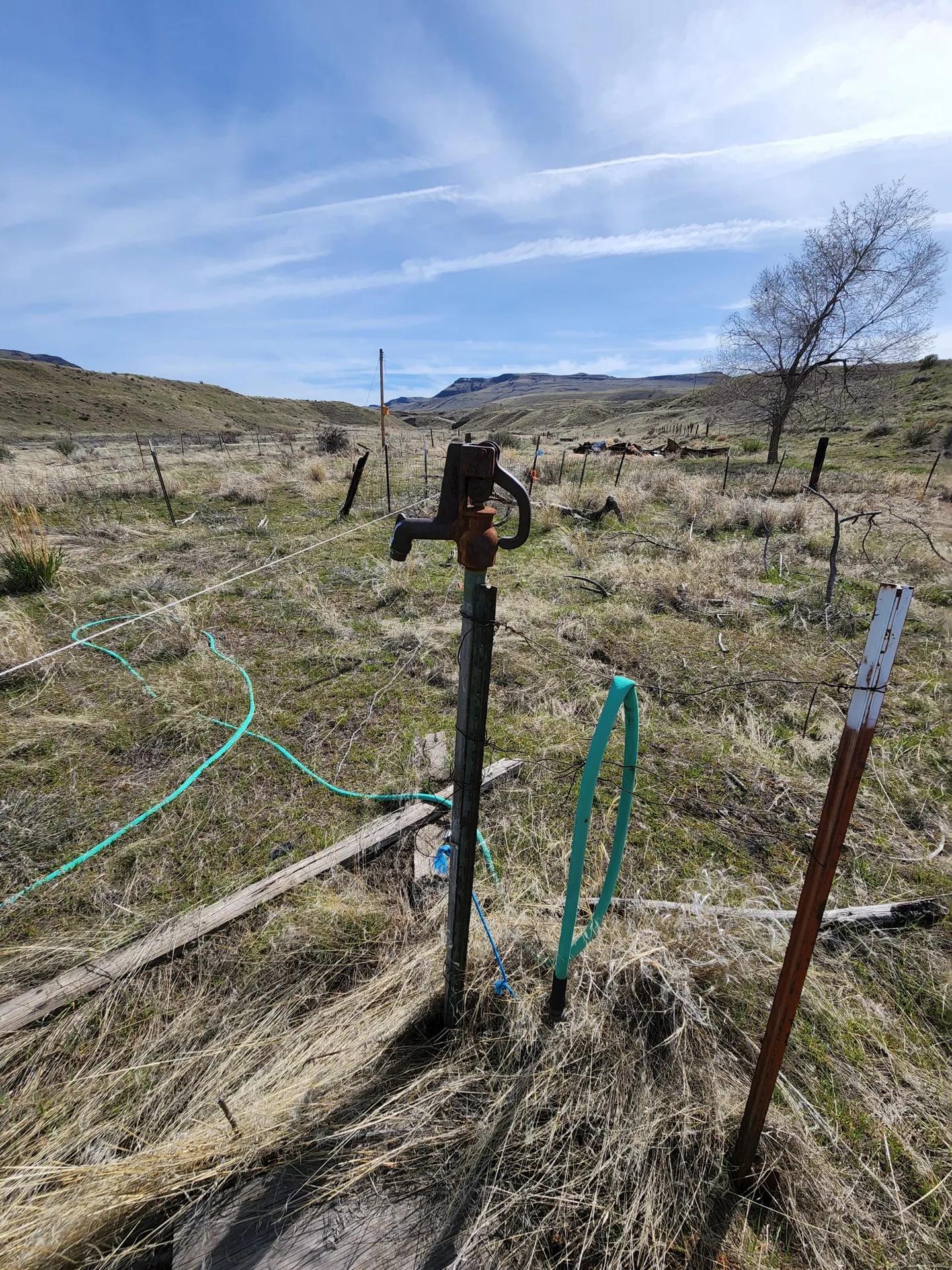
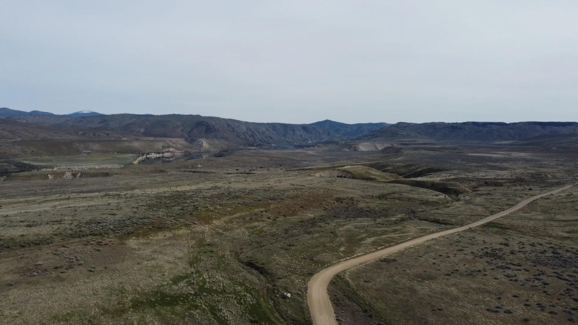
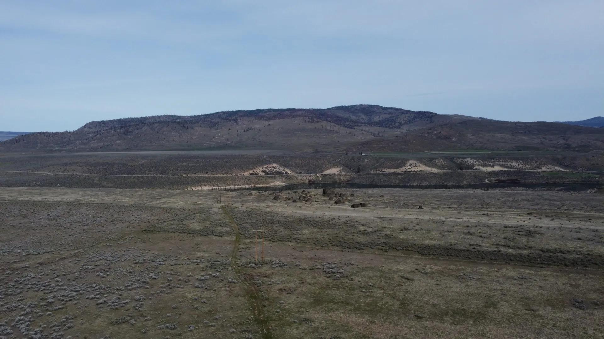
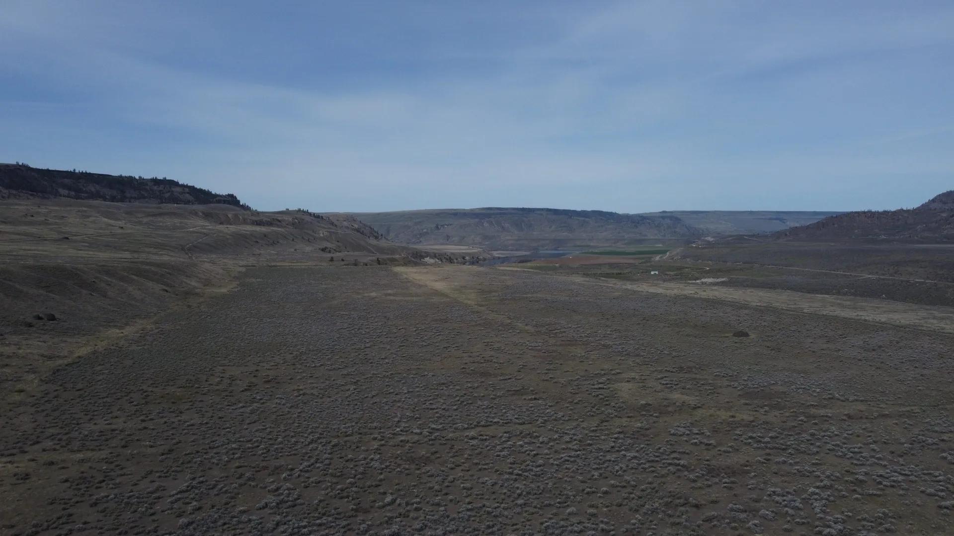
Property Description
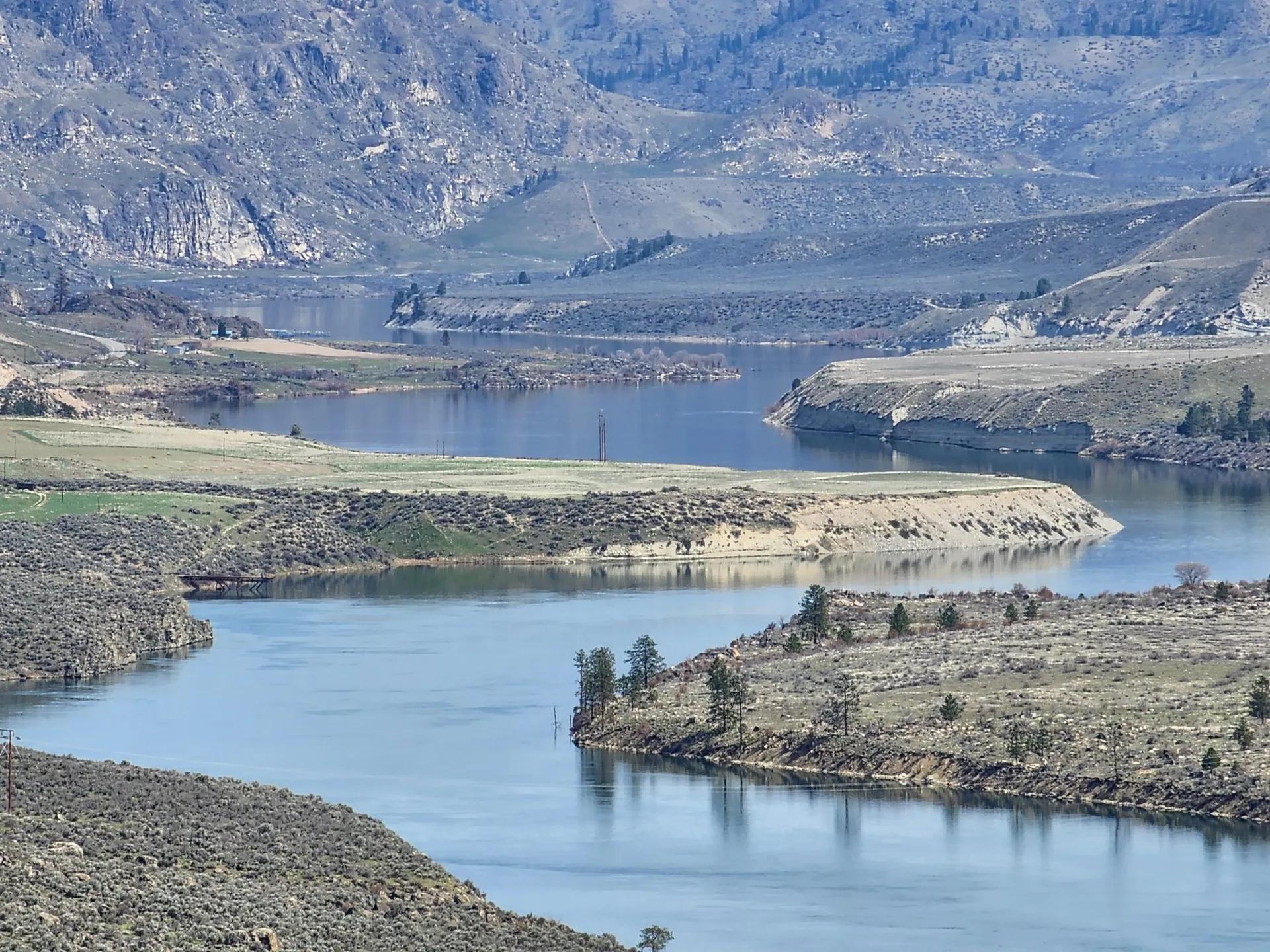
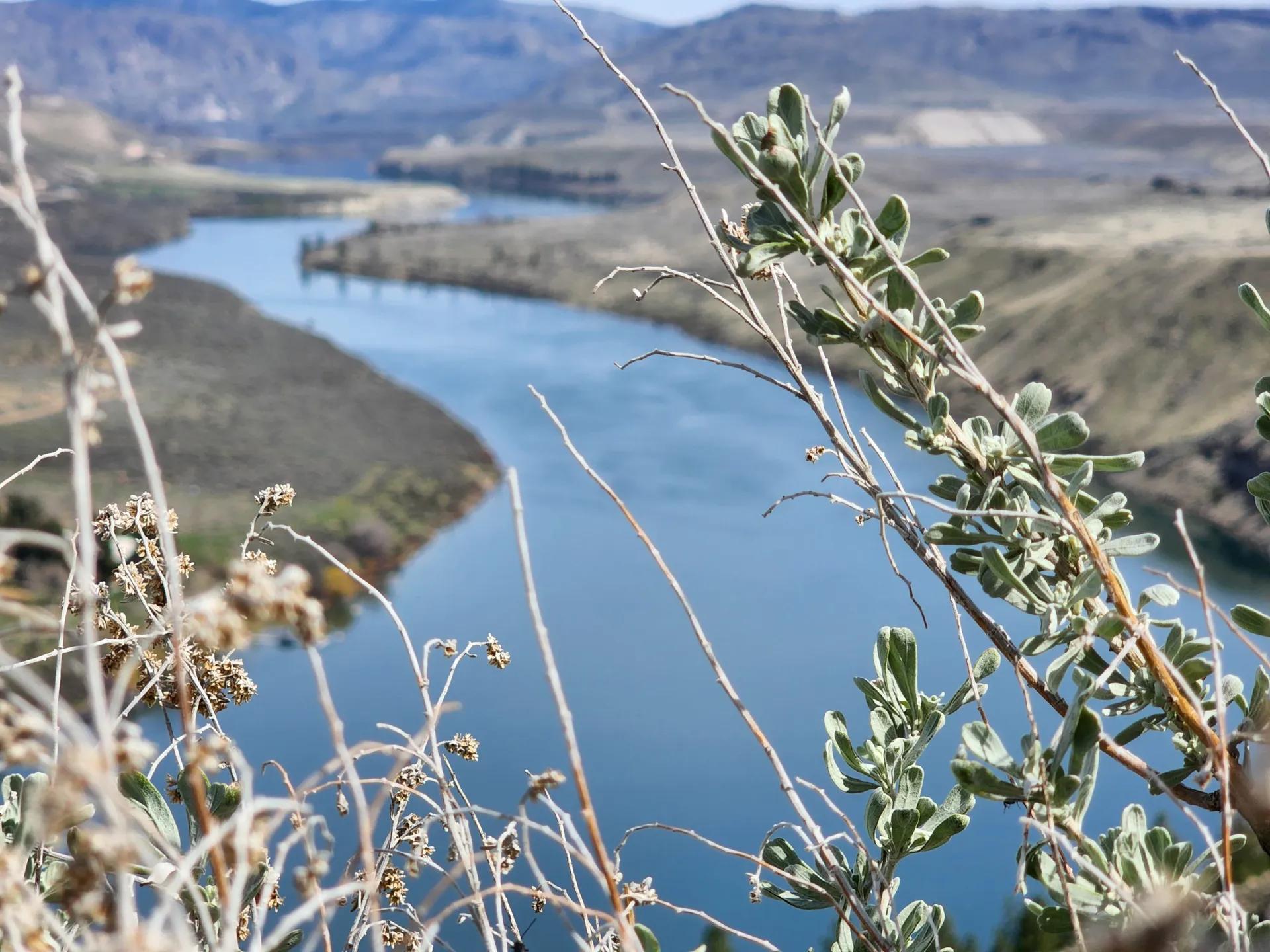
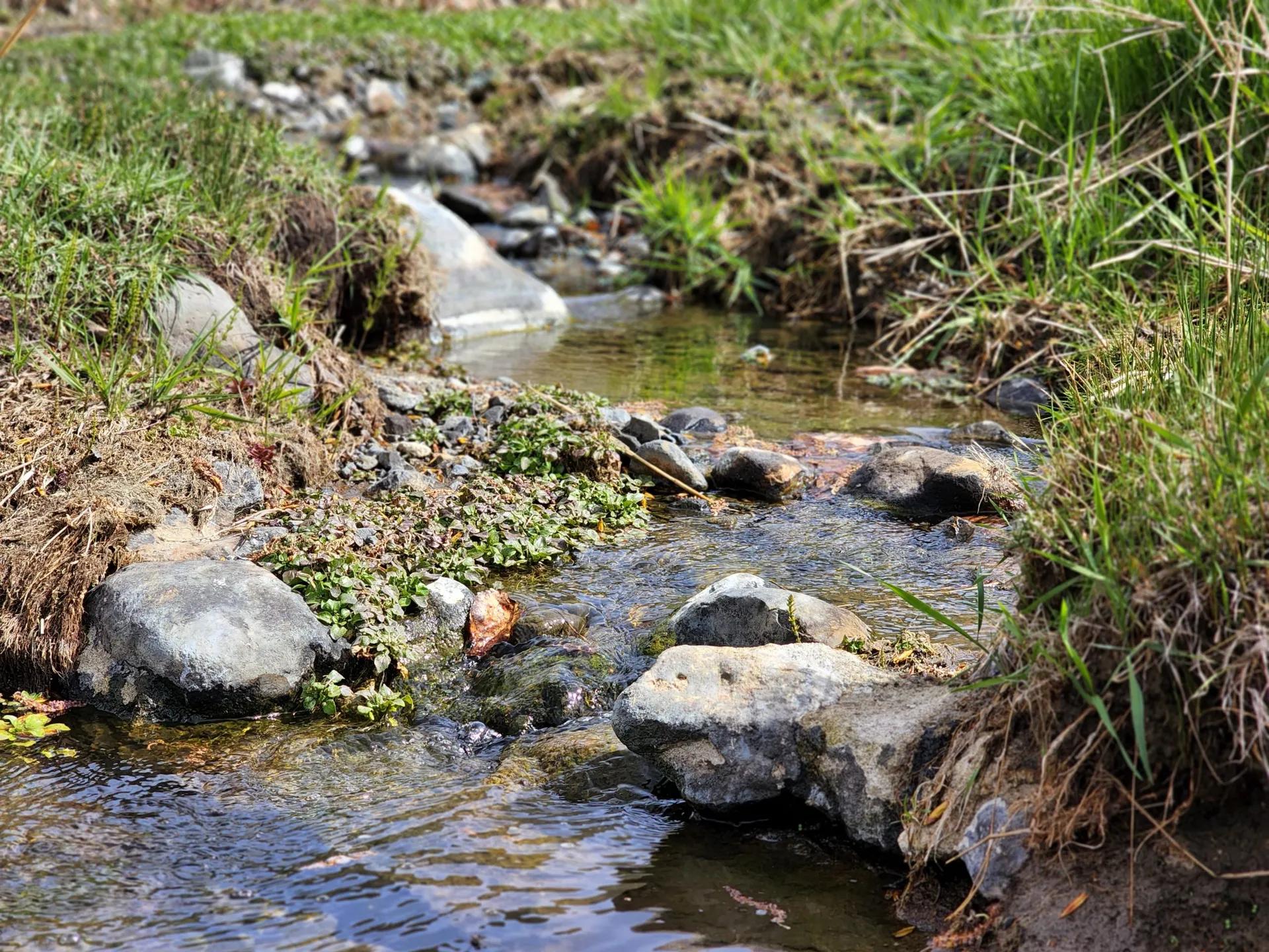
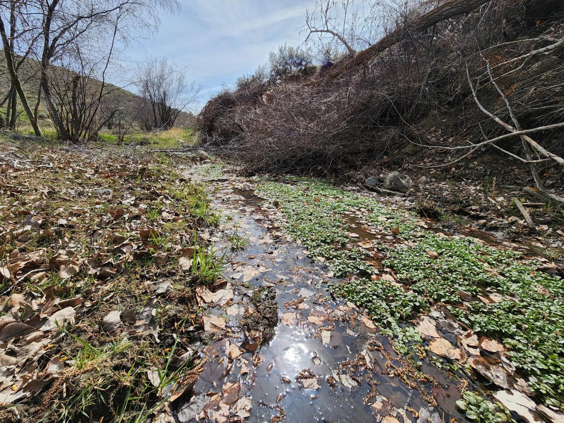
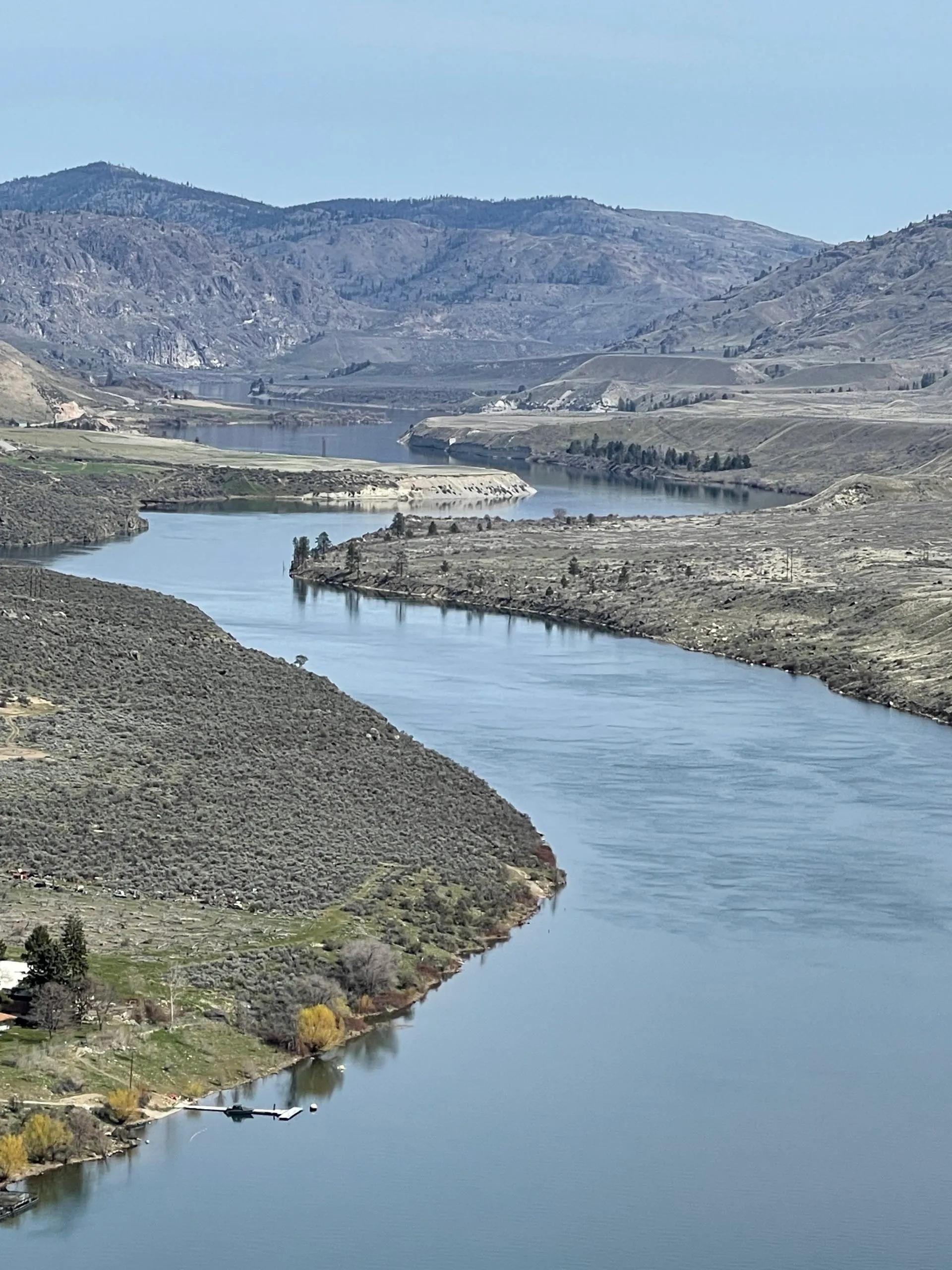
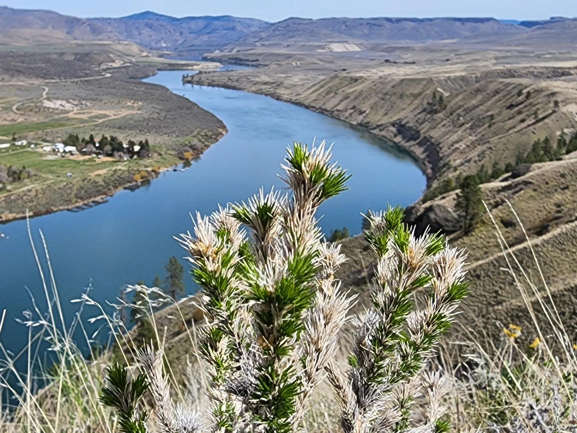
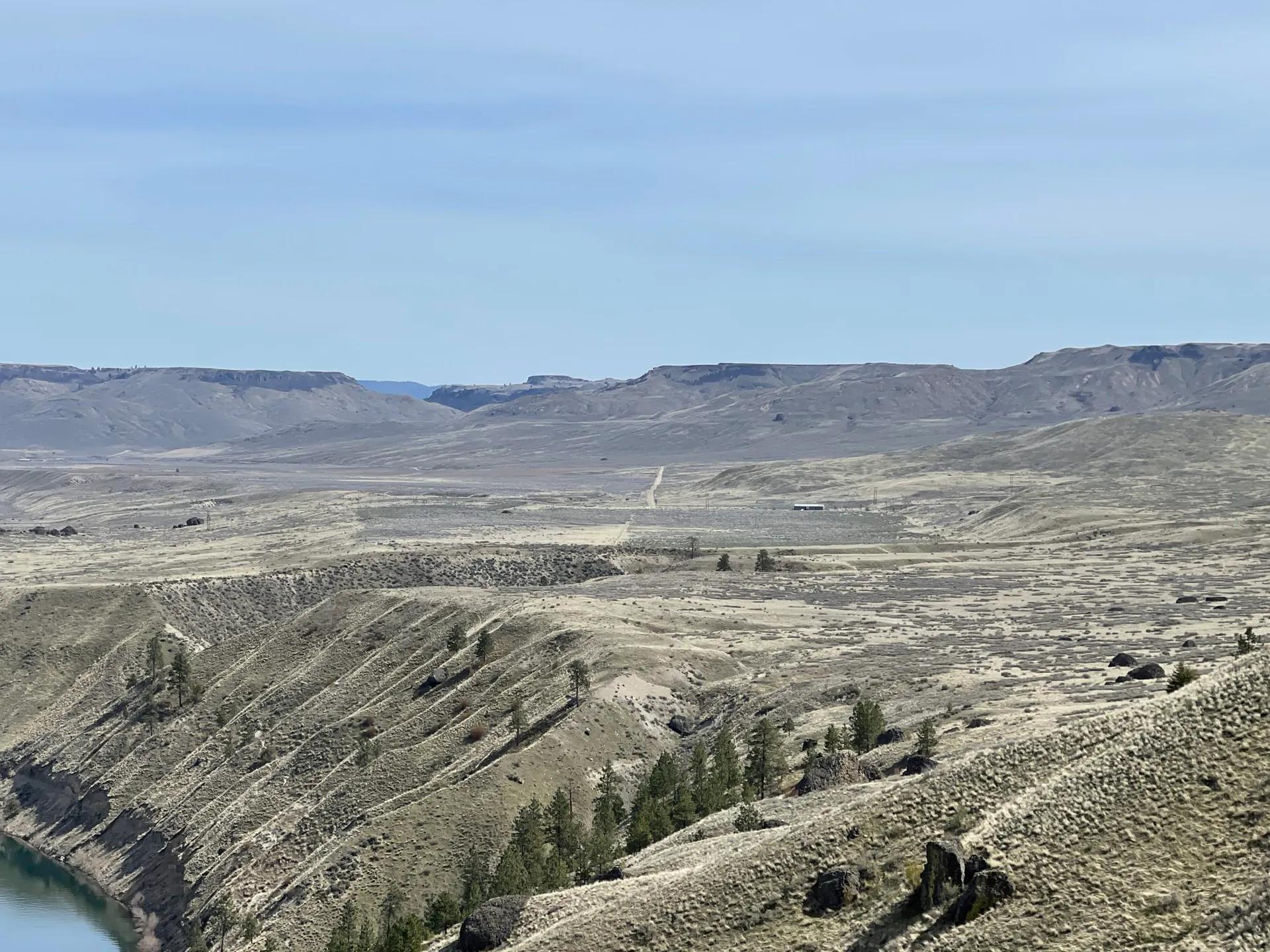
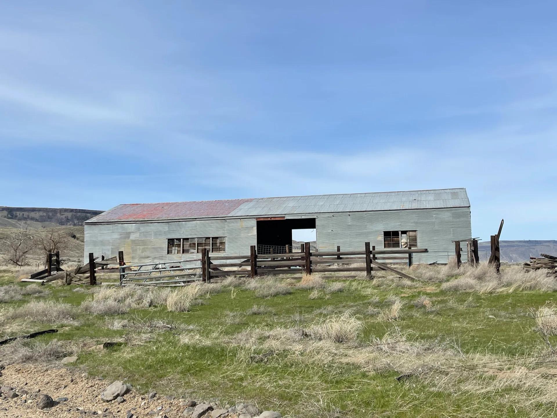
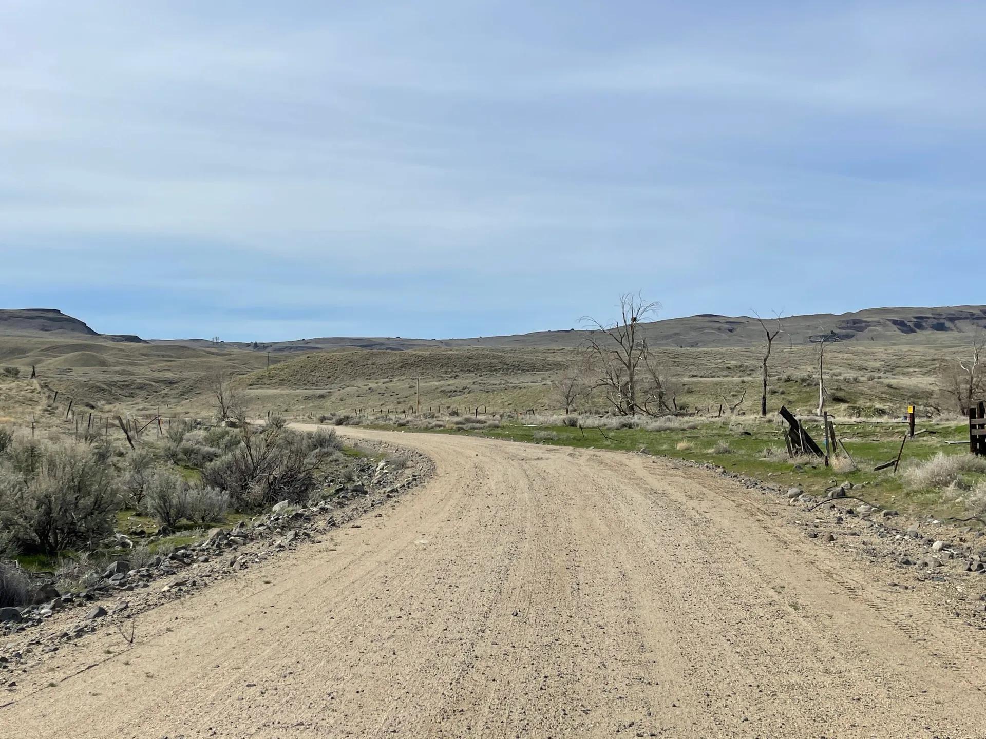
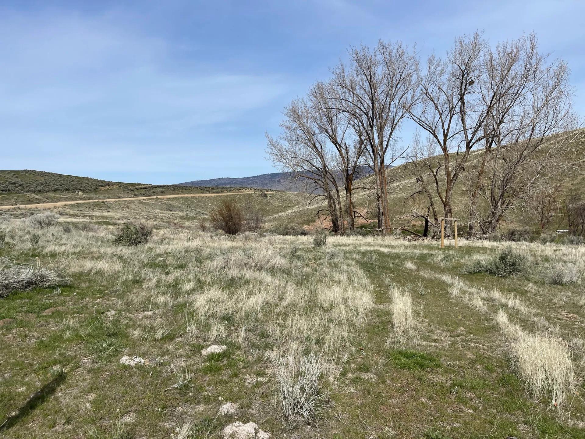
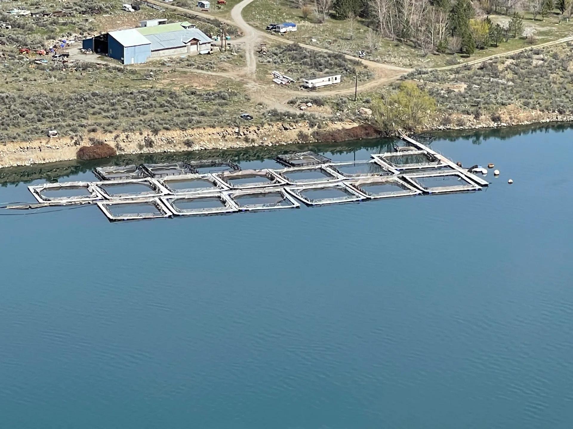
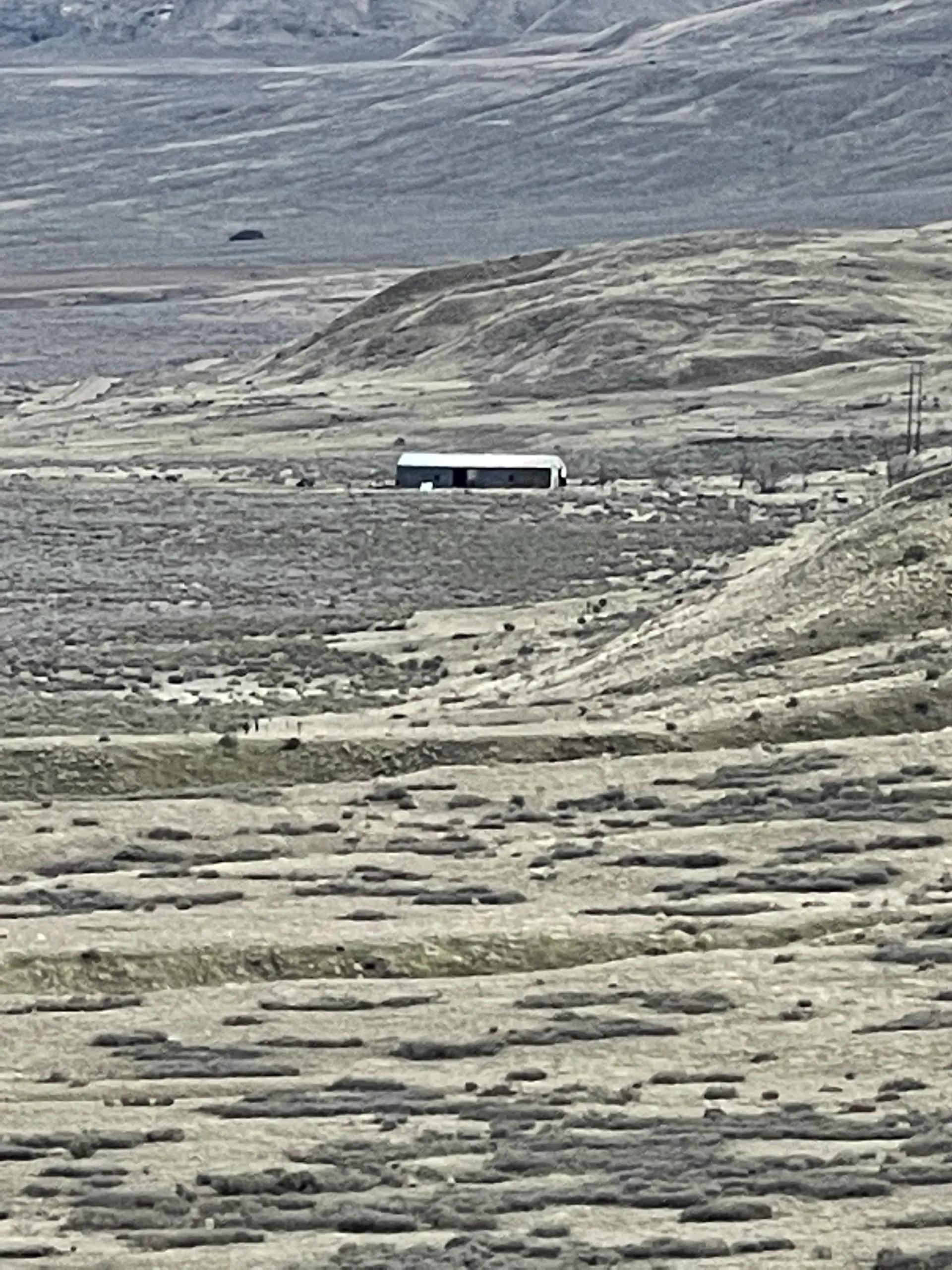
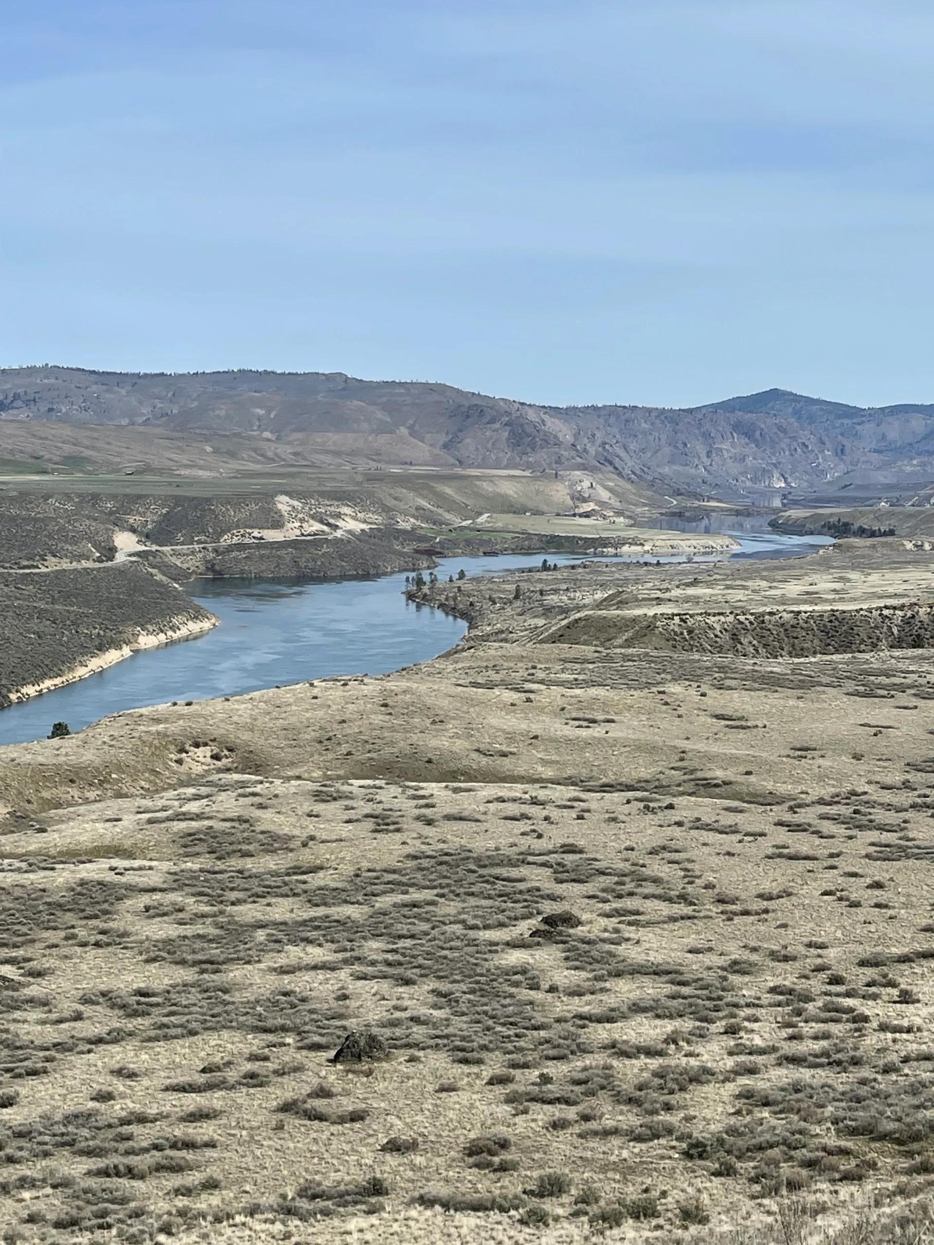
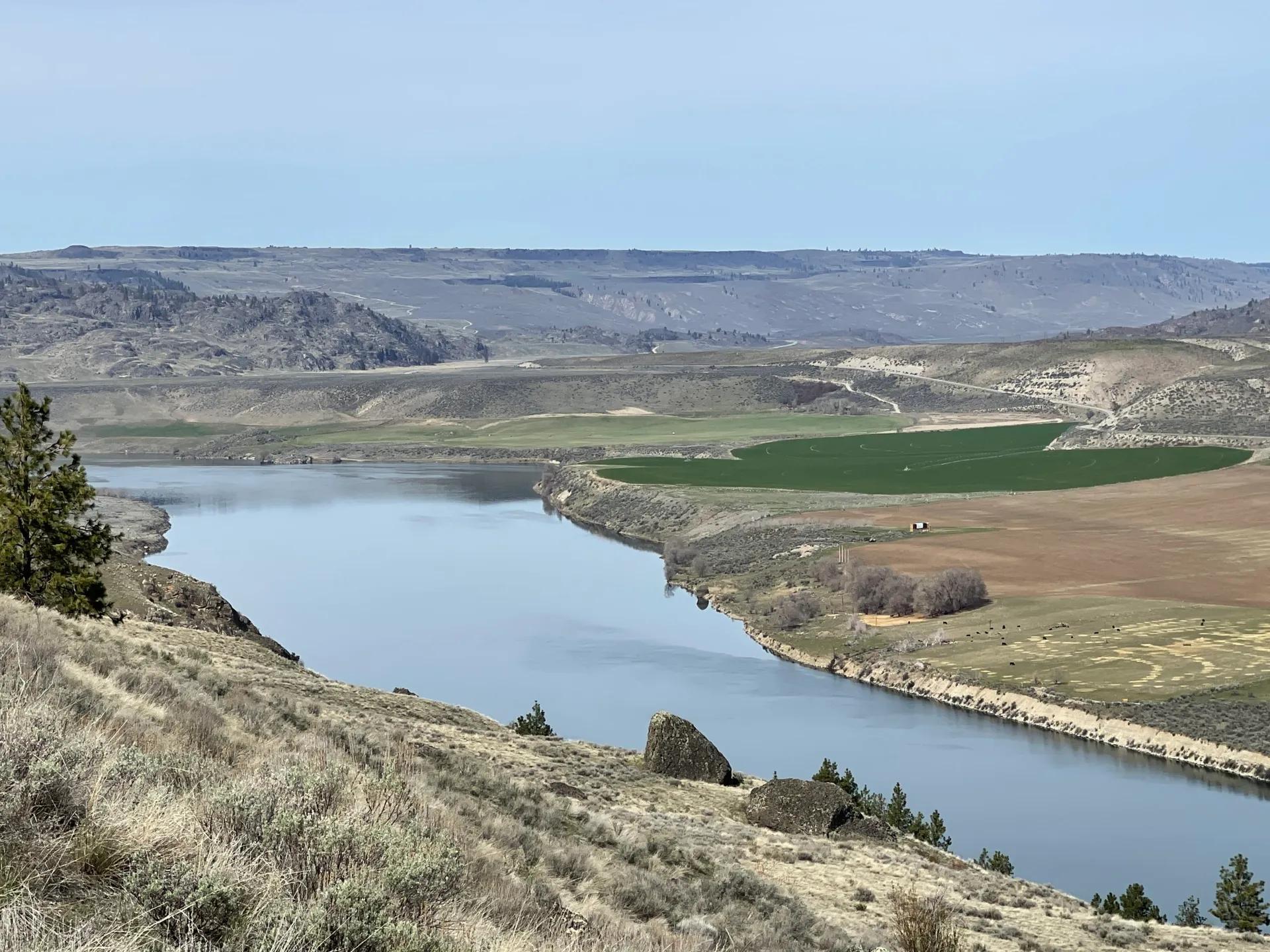
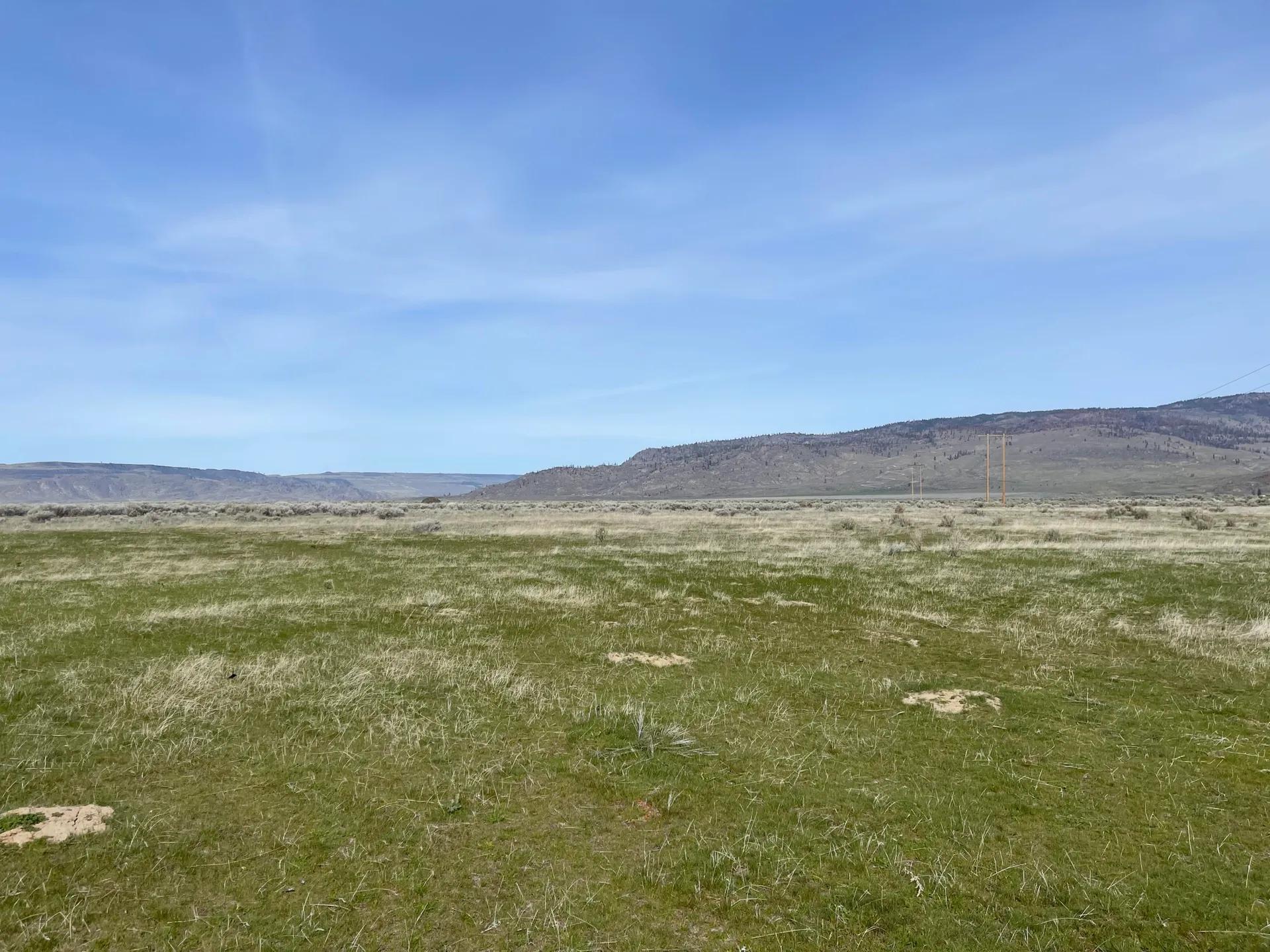
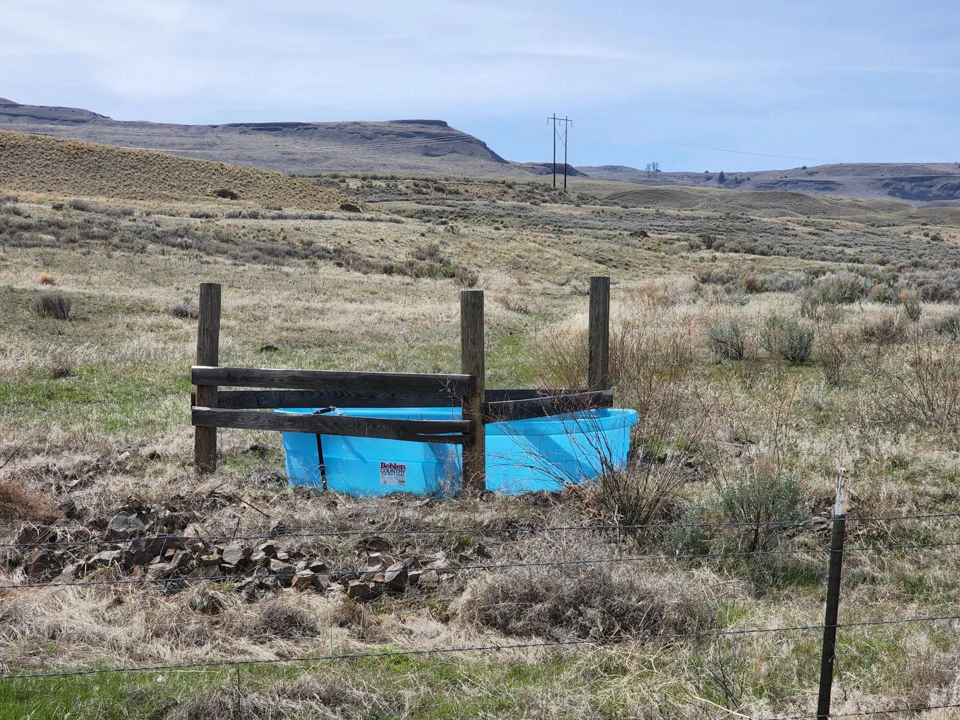
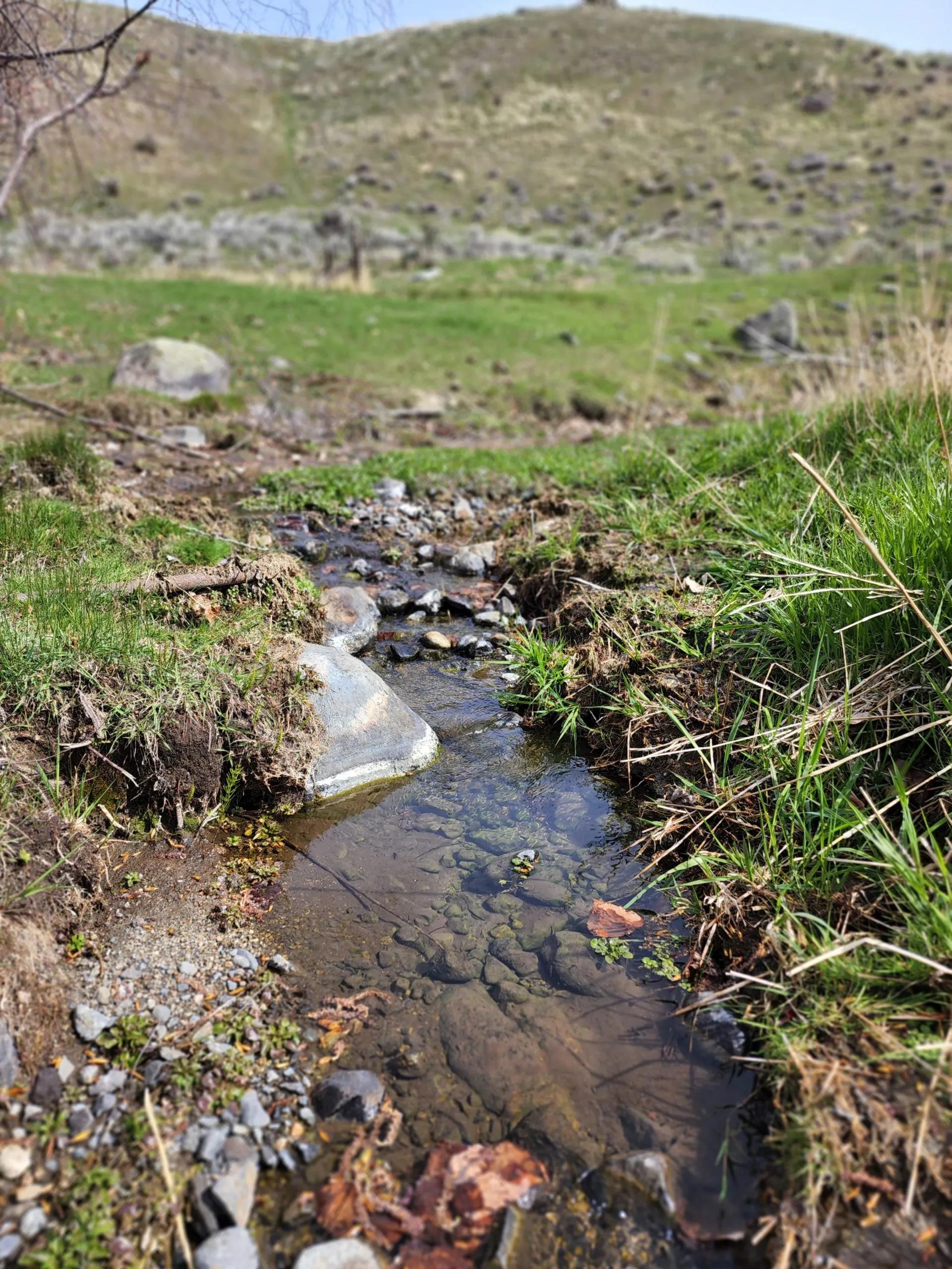
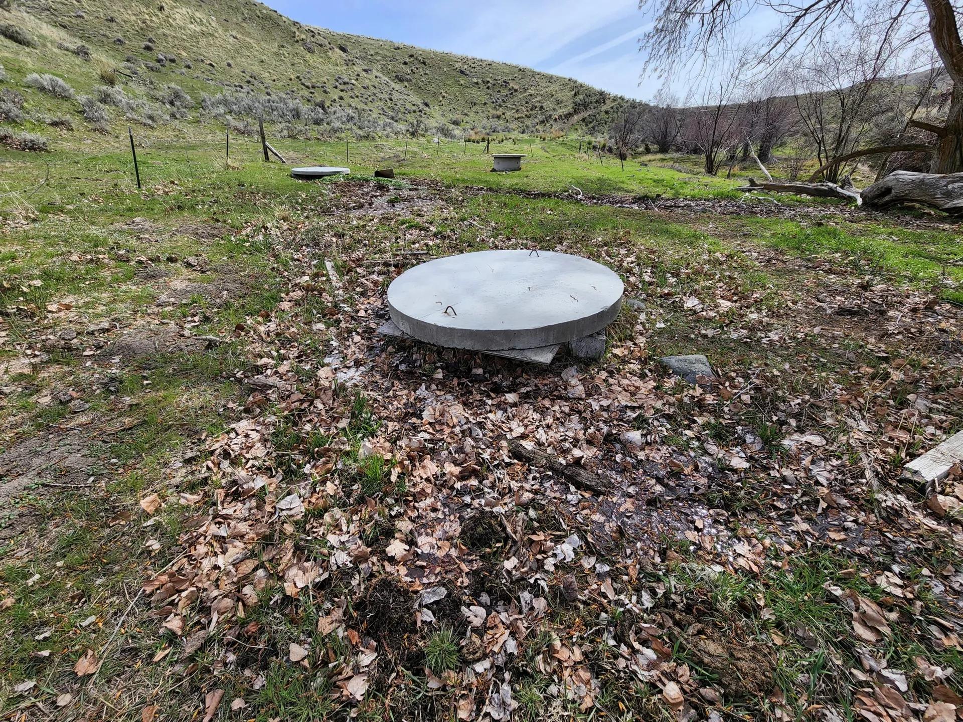
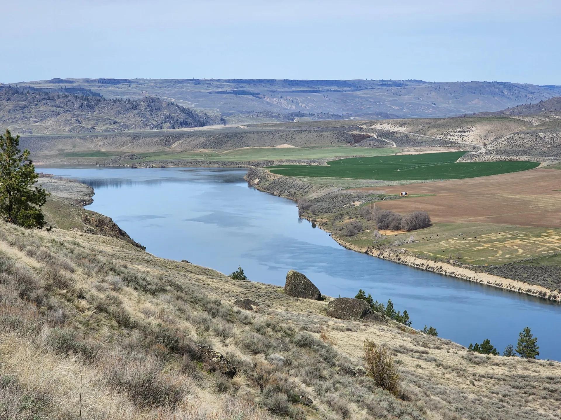
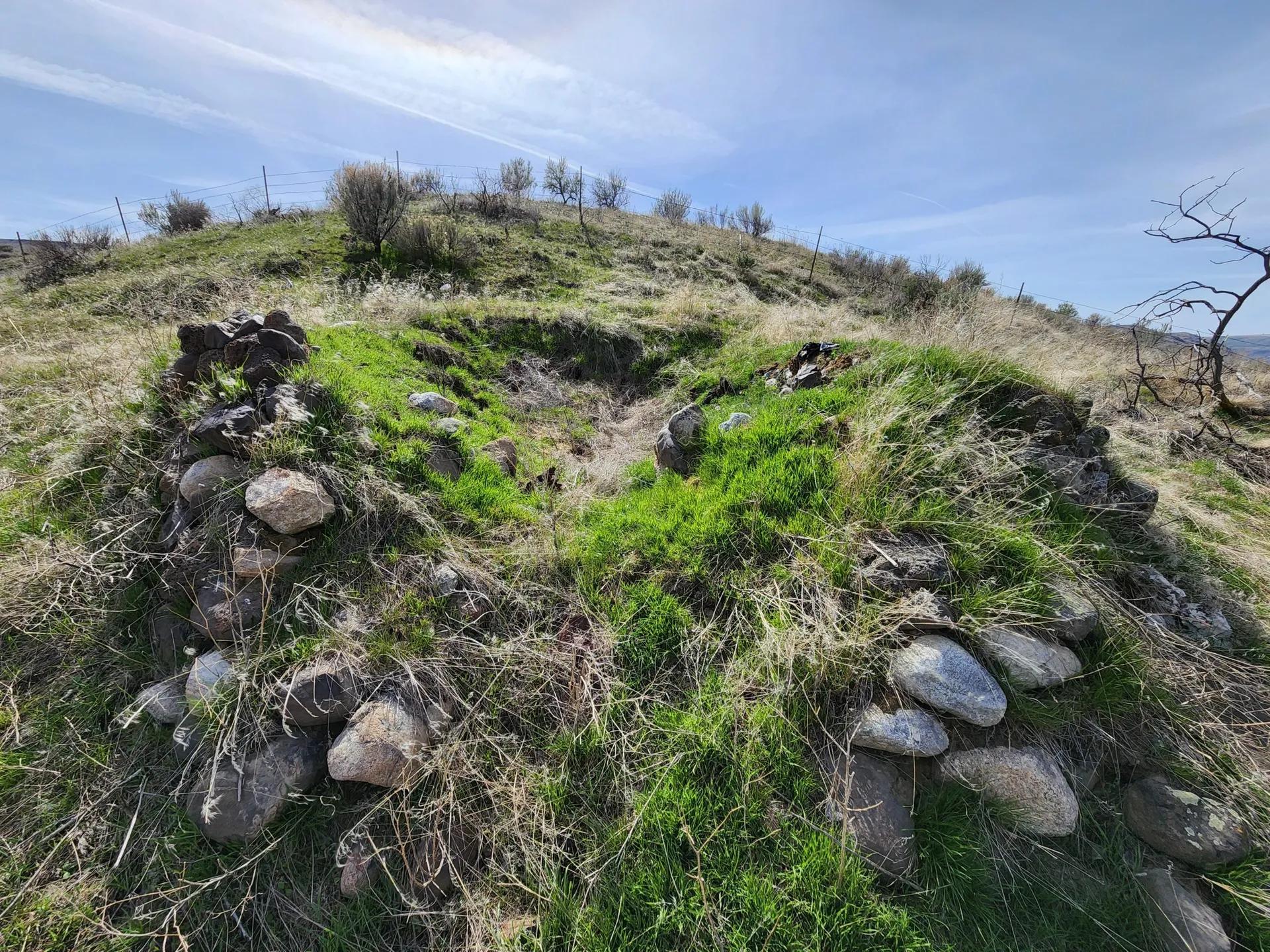
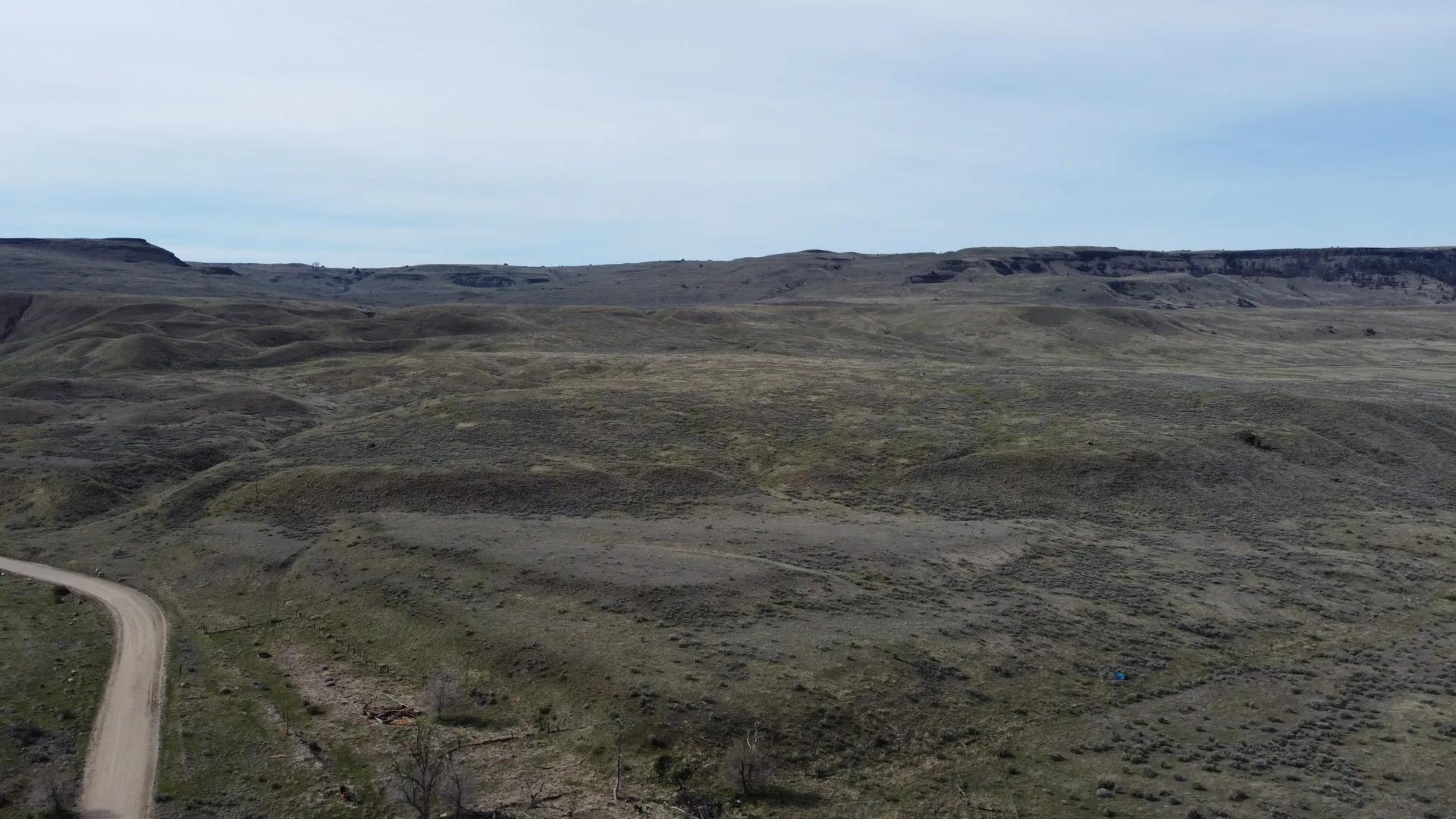
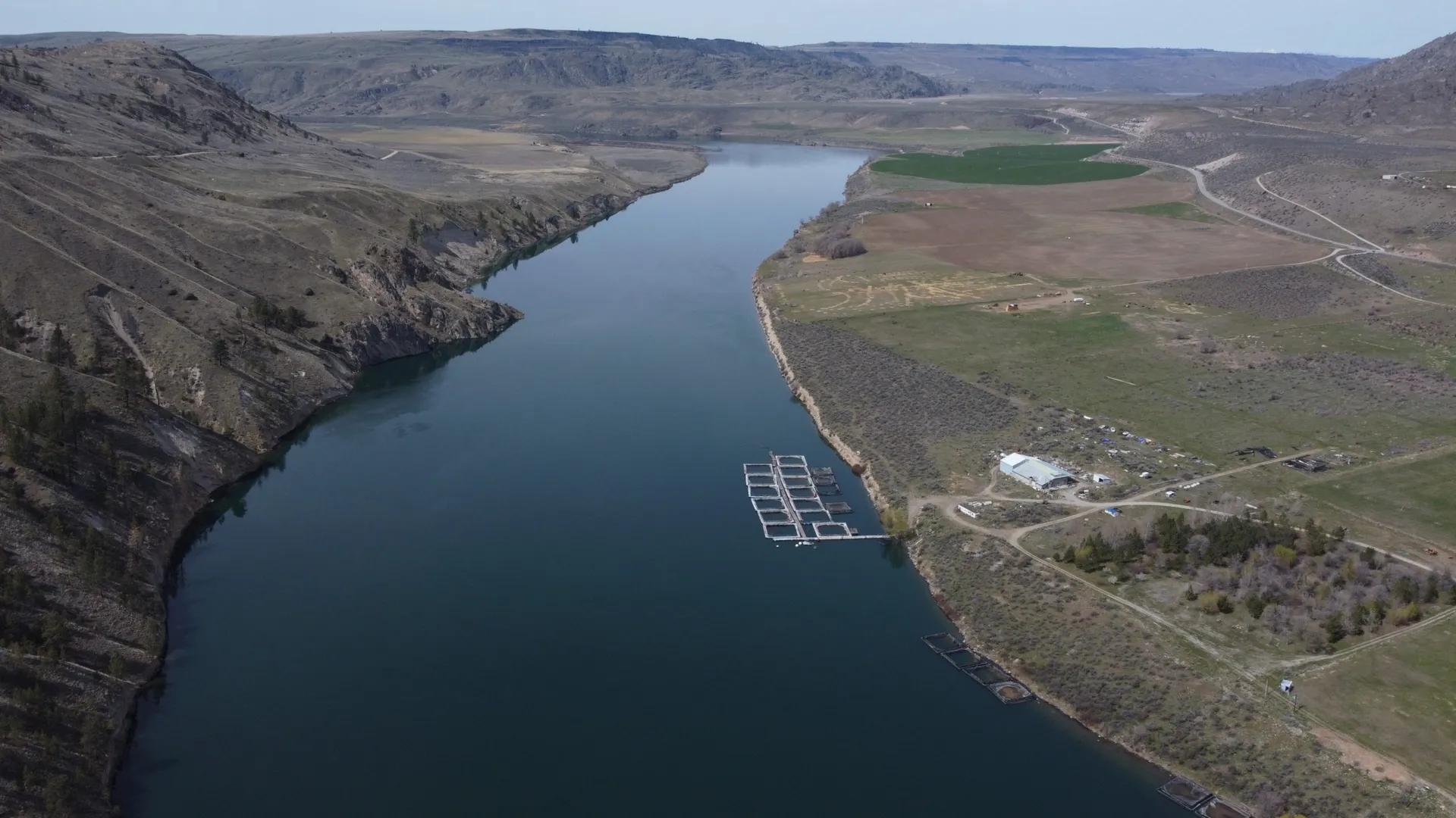
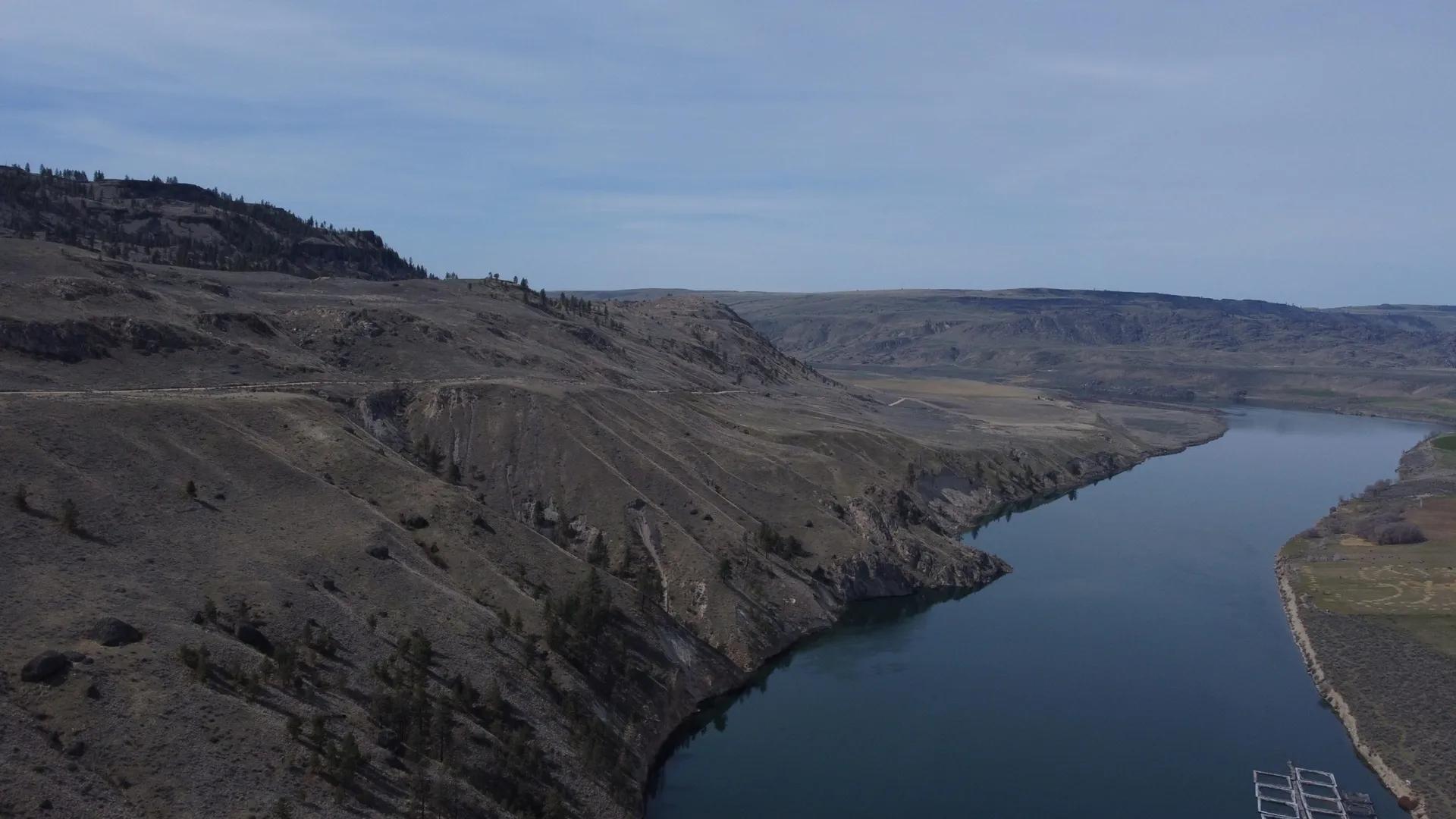
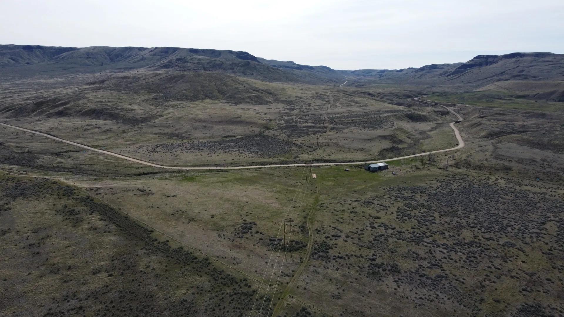
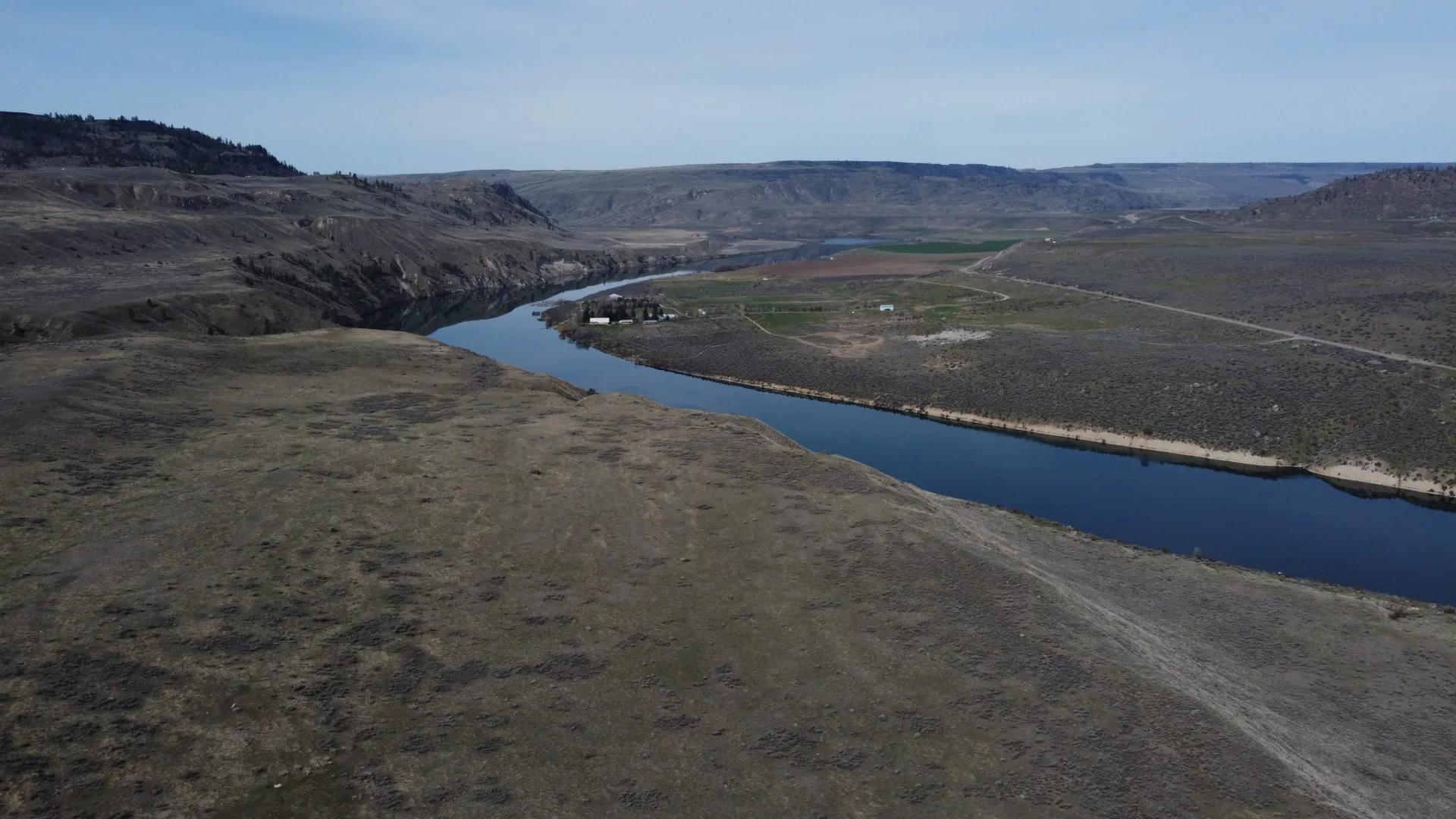
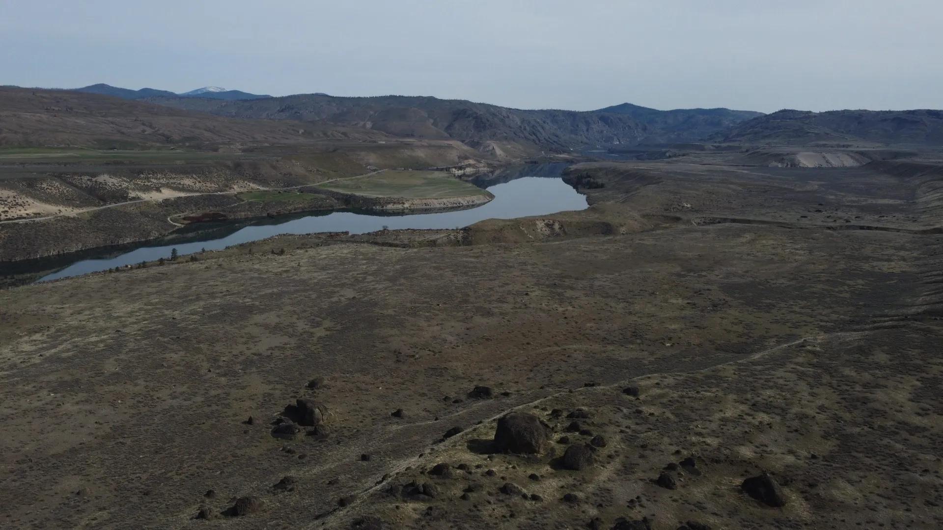
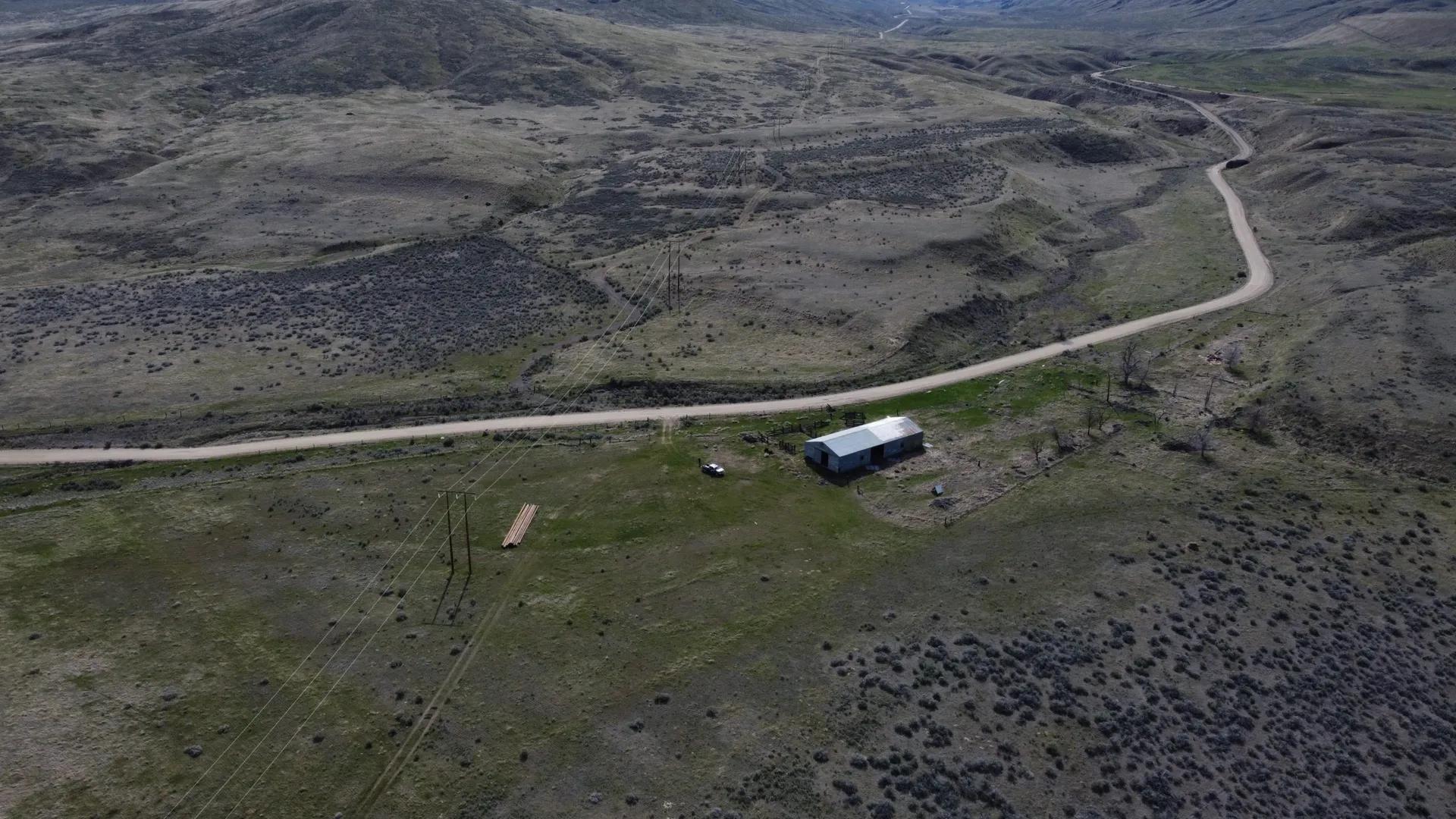
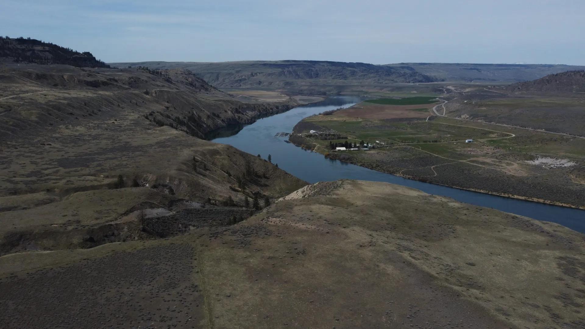
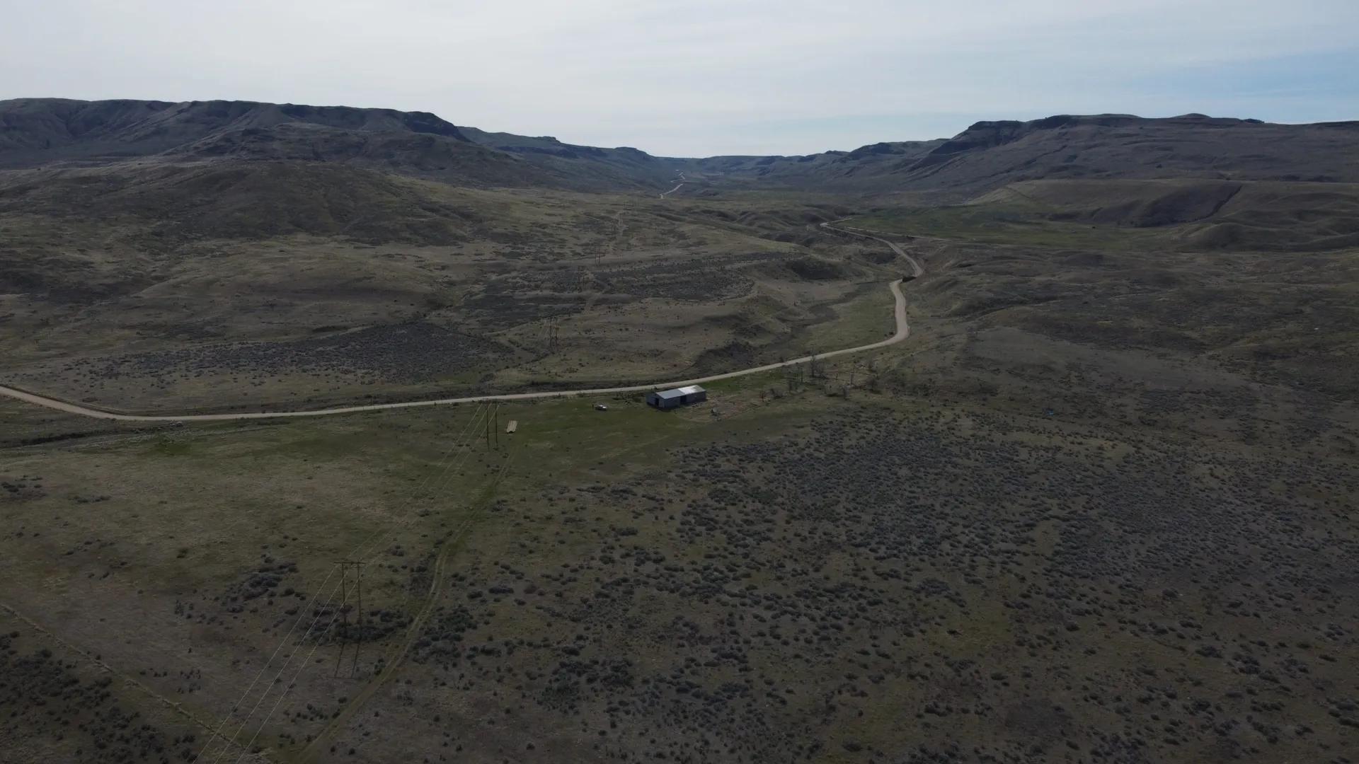
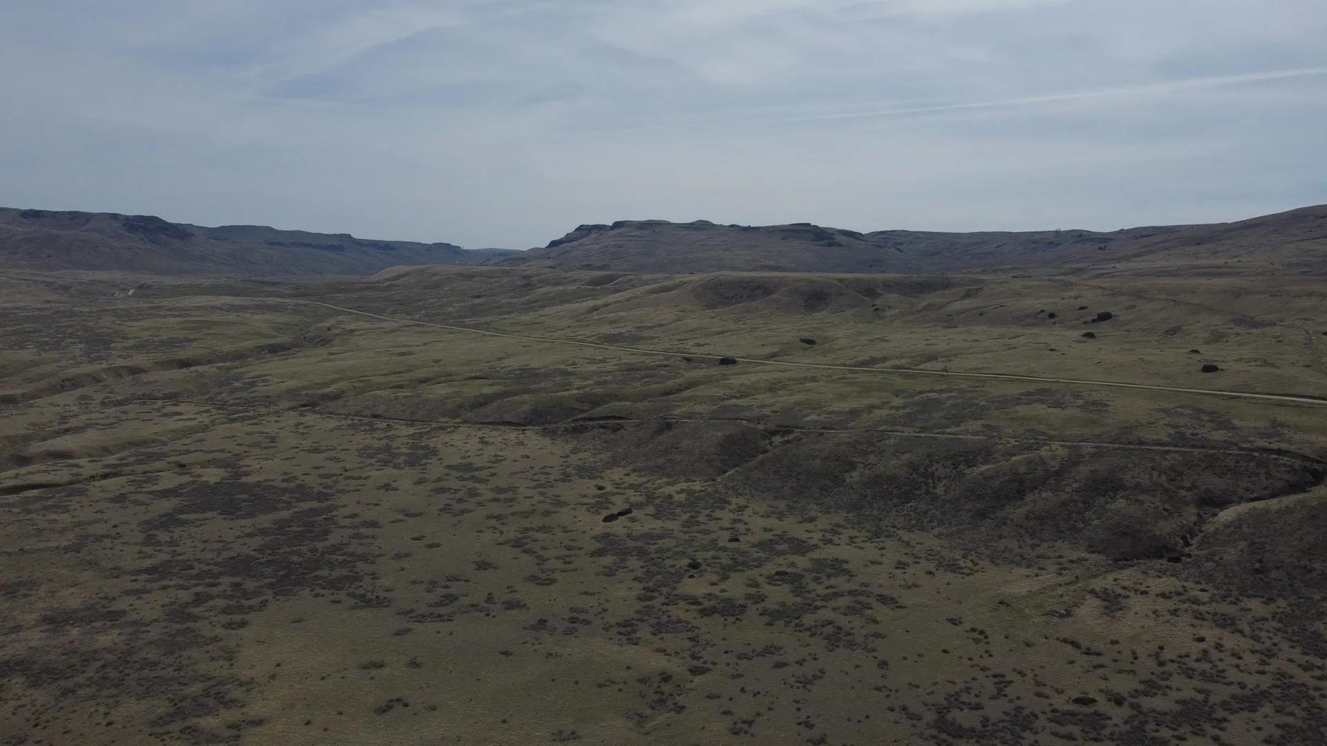
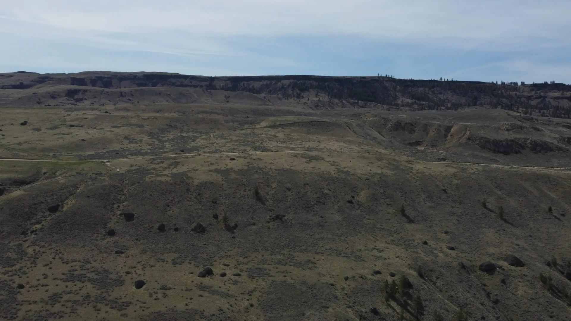
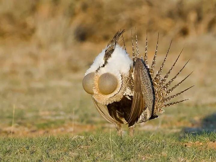
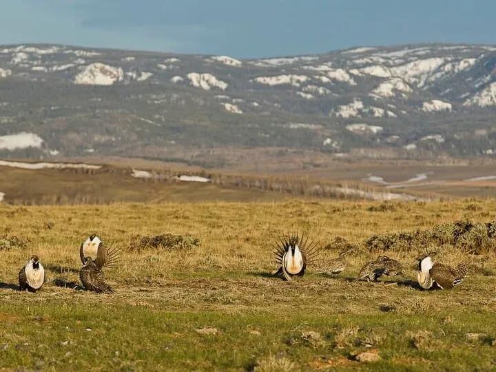
The Rufus Woods River Ranch located on the Columbia River consists of 103 individual parcels totaling 2,135 acres. 22 of these parcels have frontage on the Columbia River which is known for Great fishing in this area. The views from this property of the river and surrounding territory are amazing to say the least. This unique property has been in the family for generations and was originally built and farmed starting in the early 1900's Land The 2,1235 acres with nearly 8,000 feet of Columbia River frontage has multiple access sites to the river to be able to enjoy the fishing and recreational opportunities. The topography is rolling with many flat areas as the area is also known as Alameda Flats with vegetation consisting mostly of sage brush with a few scattered trees. This property had been previously used in the production of dryland wheat and could be returned to its previous state. Improvements There is an older steel frame building on the ranch that still has some life in it and a majority of the property is barb wire fenced. The property was surveyed when being subdivided into 20 acre parcels. Recreation (GMU 248) Located upstream of Chief Joseph Dam, Rufus Woods Reservoir is 51 miles long. Year round open season. Trout daily limit is two (2) over 14 inches. On the waters of Rufus Woods, or within designated fishing areas (DFA), which are located and marked as such on the Colville reservation shoreline, either a tribal permit or Washington State fishing license shall be acceptable. A Washington State license is required when fishing from the Douglas County shoreline. Walleye, yellow perch, smallmouth bass, and kokanee are also available. There is a state park with camping and boat launching facilities, an Army Corps of Engineers access area with boat launch, along with several access areas along the Colville side of the reservoir. HABITAT This wildlife area is comprised of basalt cliffs, rolling hills peppered with basalt haystack rocks, low buttes that overlook the Columbia River, riparian draws, permanent and seasonal creeks, and rugged slopes filled with Ponderosa pine. WILDLIFE Diverse habitats on the wildlife area provides habitat for sharp-tailed grouse, sage grouse, waterfowl, shorebirds, Neotropical migrants, songbirds, mule deer, butterflies, and wildflowers. VIEWING This unit has diverse habitats, including shrubsteppe, aspen and Ponderosa pine stands, wetlands, pothole lakes, basalt cliffs, low buttes, and caves, offering opportunities to view a variety of wildlife, including mule deer, chukar, golden eagle, four grouse species (dusky, ruffed, sharp-tailed and sage), gray partridge, California quail, sage thrasher, and wild turkey. Agriculture Approximately 100 acres of previously tilled ground now covered with sage brush but could be reclaimed to grow dry crops or food plots for wildlife. Region & Climate In Grand Coulee, the summers are warm, dry, and mostly clear and the winters are freezing, snowy, and mostly cloudy. Over the course of the year, the temperature typically varies from21Fto90Fand is rarely below6For above98F. Based on thetourism score, the best time of year to visit Grand Coulee for warm-weather activities is fromearly Julytolate August. History Coulee Dam is a town in Douglas, Grant, and Okanogan counties in the State of Washington. The Douglas County portion of Coulee Dam is part of the Wenatchee-East Wenatchee Metropolitan Statistical Area. The Okanogan County portion lies within the Colville Indian Reservation, and forms the southern limit of the Okanogan Highlands. The population was 1098 as of the 2010. Coulee Dam was founded by the U.S Bureau of Reclamation in 1933, to serve as headquarters for construction of the Grand Coulee dam. The Okanogan County portion was known as Mason City, location of the head contractor. The Portions in Douglas and Grant Counties was known as Engineers Town and was government owned. In 1942 with the end of the contract in sight, CBI transferred control of Mason City to the Municipal Division of the Columbia Basin Project. In 1948 Mason City was incorporated in Coulee Dam. Government began the process of selling the town to the public in 1957, finishing in 1959. It is the headquarters ofLake Roosevelt National Recreation Area, and home of one of the worlds largest man-made piles of sand, a 12,000,000-cubic-yard (9,200,000 m3), 230-foot (70 m)-high hill remaining from dam construction. Location The city of Grand Coulee, between Lake Roosevelt and Banks Lake, both formed because of Grand Coulee Dam. Located 93 miles from Spokane Int. airport and 132 miles away from Seatac Int. airport. There is also Grant County Int. airport which is 15 miles way.
Basic Details
Property Types:
Farm, Ranch, Acreage, Recreational Land, Hunting Land, Fishing Land, River Frontage, Cattle RanchListing Type:
Under ContractListing ID:
15999168Price:
$2,323,000Acres:
2135 AcresAddress Map
Country:
United StatesState:
WashingtonCounty:
DouglasCity:
Grand CouleeLatitude:
48.0983874684Longitude:
-119.226286138Street Address:
2135 Strahl Canyon RDLand for Sale in the USA by State
- Alabama
- Alaska
- Arizona
- Arkansas
- California
- Colorado
- Connecticut
- Delaware
- Florida
- Georgia
- Hawaii
- Idaho
- Illinois
- Indiana
- Iowa
- Kansas
- Kentucky
- Louisiana
- Maine
- Maryland
- Massachusetts
- Michigan
- Minnesota
- Mississippi
- Missouri
- Montana
- Nebraska
- Nevada
- New Hampshire
- New Jersey
- New Mexico
- New York
- North Carolina
- North Dakota
- Ohio
- Oklahoma
- Oregon
- Pennsylvania
- Puerto Rico
- Rhode Island
- South Carolina
- South Dakota
- Tennessee
- Texas
- Utah
- Vermont
- Virginia
- Washington
- West Virginia
- Wisconsin
- Wyoming
Land for Sale in Costa Rica, Mexico & Canada
Property For Sale
Copyright ©️ 2024 by LandHub.com. LandHub ©️ is a registered trademark and cannot be used without permission.