


Scan with Smart
Phone Camera
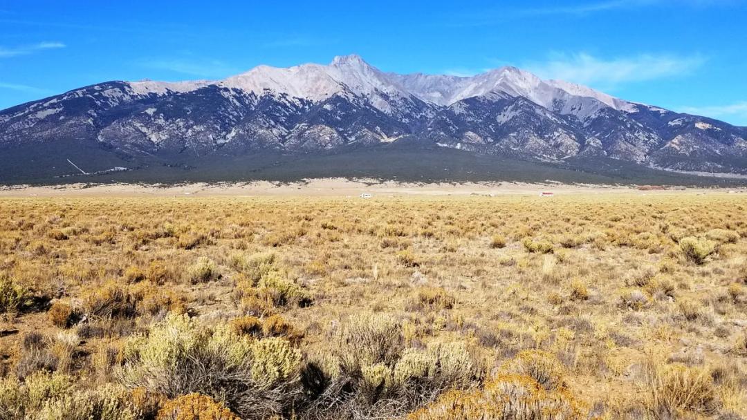
Stunning Mountain Views * Near Base Of The Mountains And Mountain Home Reservoir
United States /Colorado, Garson Rd & Williams Rd.>, 5.47
For Sale
Listing ID :
75460659MLS ID :
4652355Acres :
5.47 Acres$12,000
View Agent's Properties and Profile:

Kent Taylor
 Show Number
Show Number1881.com investments
Contact Seller
Property Description
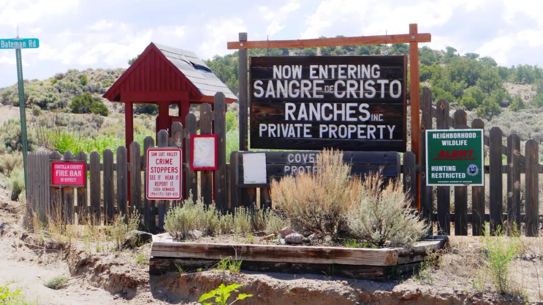
Base of the Mountains.near Mountain Home Reservoirno other pictures at this timeSIZE: 5.468 +/- ac APN#: 70204560LEGAL DESCRIPTION: Sangre De Cristo Mountain Ranch Unit B, Block 56, Lot 610STATE: ColoradoCOUNTY: CostillaGENERAL LOCATION : Corner of Garson and Williams road. 1 mile south of Mountain Home reservoir. about 5 miles SE of Fort Garland. 3 miles East of Hwy 159. GPS(approx.): 37.375408, -105.376104GENERAL ELEVATION: approx. 8280'-8320' GENERAL INFORMATION: near the base of the mountins . Off the beaten path. Camp, RV, build, Mobile, Modulars, site builds allowed. Check with the county for your intended usage.TYPE OF TERRAIN: level-rollingZONING: ResidentialPOWER: noPHONE: noWATER: Must install well if you buildSEWER: No. Only needed when/if you build.ROADS: graded dirtPROPERTY TAX: approx. $108 a year CLOSING/DOC. FEES: $125 TIME LIMIT TO BUILD: noneASSOCIATION DUES: NONETITLE INFORMATION: Free and clear If/when more info becomes available we will update listingFINANCING INFO and PURCHASE INFO Go to 1881.com Area Land pageThese stunning, 5-10 acre+/- land parcels are nestled at the western base of the Sangre de Cristo (Blood of Christ) mountain Range, named in 1719 by the Spanish Explorer, Antonio Valverde y Cosio. It is said he named the area due to the deep red hues reflected off the snowcapped mountain peaks at sunrise and sunset. The Sangre de Cristo Ranches occupy over 51,000 acres of privatized land in south central Colorado in addition to almost 5,000 acres of common lands dedicated to the Ranches. The majority of the developed acreage rests between 8,000 and 9,000 feet elevation with majestic views of the range sprawling more than 180 degrees around from the northwestern edge across the north and down south along the eastern border. There are 22 peaks over 13,500 feet with 9 of Colorado’s 14’ers piercing the sky throughout the range, Blanca peak being the highest of the Range to the northeast and surrounded by three other 14’ers.Directly to the east is the San Isabel National Forest and due west lies the fertile San Luis Valley stretching across until the Rio Grande National Forest. Other notable geographical features easily accessible are the Great Sand Dunes National Park, the Monte Vista National Wildlife Refuge and the Carson National Forest. The terrain is widely varied here with grassland valleys at the lower levels, rising through dense forests of conifers and culminating with majestic, snow-capped peaks. Easy access to the subdivisions are managed from Highways 159 and 160 which run just to the west. The Sangre de Cristo Ranches are an unincorporated community of privately held land in a rural subdivision. The community has grown from a couple of massive land purchases over the last 100 years. Originating from an initial land grant of over 1 million acres in 1843, Malcolm Forbes purchased hundreds of thousands of acres in 1969 as and investment and for conservation and development. The Forbes family then sold their remaining holdings of more than 170,000 acres in 200 to Louis Bacon, a capital wealth and hedge fund manager. The lands are comprised of a mix of private ownership and lands dedicated to conservation efforts. The Sangre de Cristo Mountains (Spanish for "Blood of Christ") are the southernmost subrange of the Rocky Mountains. They are located in southern Colorado and northern New Mexico in the United States. The mountains run from Poncha Pass in South-Central Colorado, trending southeast and south, ending at Glorieta Pass, southeast of Santa Fe, New Mexico. The mountains contain a number of fourteen thousand foot peaks in the Colorado portion, as well as several peaks in New Mexico which are over thirteen thousand feet .Highest point is Blanca Peak, East of Alamosa, Colorado with an Elevation of 14,351 ft >
Basic Details
Property Types:
Land, Home, Recreational propertiesListing Type:
For SaleListing ID:
75460659Price:
$12,000Acres:
5.47 AcresAddress Map
Country:
United StatesState:
ColoradoCounty:
Costilla CountyCity:
Fort GarlandLatitude:
37.375408Longitude:
-105.376104Street Address:
Garson Rd & Williams Rd.>Similar Listings


Land for Sale in the USA by State
- Alabama
- Alaska
- Arizona
- Arkansas
- California
- Colorado
- Connecticut
- Delaware
- Florida
- Georgia
- Hawaii
- Idaho
- Illinois
- Indiana
- Iowa
- Kansas
- Kentucky
- Louisiana
- Maine
- Maryland
- Massachusetts
- Michigan
- Minnesota
- Mississippi
- Missouri
- Montana
- Nebraska
- Nevada
- New Hampshire
- New Jersey
- New Mexico
- New York
- North Carolina
- North Dakota
- Ohio
- Oklahoma
- Oregon
- Pennsylvania
- Puerto Rico
- Rhode Island
- South Carolina
- South Dakota
- Tennessee
- Texas
- Utah
- Vermont
- Virginia
- Washington
- West Virginia
- Wisconsin
- Wyoming
Land for Sale in Costa Rica, Mexico & Canada
Property For Sale


Copyright ©️ 2026 by LandHub.com. LandHub ©️ is a registered trademark and cannot be used without permission.