


Scan with Smart
Phone Camera
San Luis Valley Southern Colorado * Star Filled Nights. Vibrant Blue Skies
United States /Colorado, 2nd street>, 5
For Sale
Listing ID :
94593494MLS ID :
9733119Acres :
5 Acres$9,000
View Agent's Properties and Profile:

Kent Taylor
 Show Number
Show Number1881.com investments
Contact Seller
Property Description
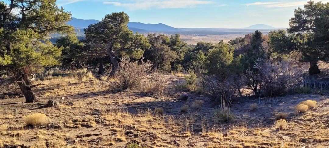
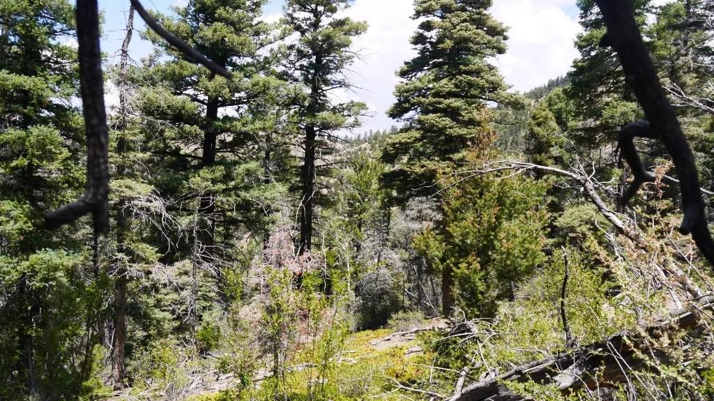
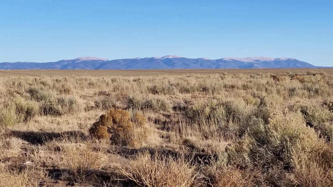
Views of Sangre De Cristo Mountains San Luis ValleySIZE: 5.0+/- ac APN#: 70344150LEGAL DESCRIPTION: San Luis Valley Ranches Unit 4, Block 12, Lot 11STATE: ColoradoCOUNTY: CostillaGENERAL LOCATION: North side of 2nd street. north side of Highway 160 . 1.5 miles NW of Blanca. 17.5 miles East of AlamosaGPS(approx.): 37.454505, -105.546954GENERAL ELEVATION: approx. 7725'GENERAL INFORMATION: Mountain and Valley Views. Elk and antelope in the area. Easy Access to Highway 160. Camp, RV, build, Mobile, Modulars, site builds allowed. Check with the county for your intended usage.TYPE OF TERRAIN: levelZONING: residentialPOWER: noPHONE: noWATER: Must install well if you buildSEWER: No. Only needed when/if you build.ROADS: graded dirtPROPERTY TAX: approx. $89 a year CLOSING/DOC. FEES: $125 TIME LIMIT TO BUILD: noneASSOCIATION DUES: NONETITLE INFORMATION: Free and clear Go to 1881.com Area Land pagehe San Luis Valley is a region in south-central Colorado with a small portion overlapping into New Mexico. The valley is approximately 122 miles (196 km) long and 74 miles wide, making it the largest alpine valley in the world. It extends from the Continental Divide on the northwest rim into New Mexico on the south. It contains 6 counties and portions of 3 others. It is an extensive high-elevation depositional basin of approximately 8,000 square miles (21,000 km2) with an average elevation of 7,664 feet (2,336 m) above sea level. The valley is a section of the Rio Grande Rift and is drained to the south by the Rio Grande, which rises in the San Juan Mountains to the west of the valley and flows south into New Mexico. The San Luis Valley has a cold desert climate but has substantial water resources from the Rio Grande and groundwater.The San Luis Valley was ceded to the United States by Mexico following the Mexican–American War. Hispanic settlers began moving north and settling in the valley after the United States made a treaty with the Utes and established a fort in the early 1850s. Prior to the Mexican war the Spanish and Mexican governments had reserved the valley to the Utes. Later in the 19th century Anglo settlers began to settle in the valley and engaged in mining, ranching, and irrigated agriculture. Today the valley has a diverse Anglo and Hispanic population.The San Luis Valley is the broad, generally flat, valley at the headwaters of the Rio Grande in south central Colorado and far north central New Mexico. The northern portion of the San Luis Valley is an endorheic basin; surface water does not exit this area. Irrigated agriculture is possible in the area due to groundwater and streams fed by the average 100 inches of snow the surrounding mountain ranges receive.[7] The southern portion is drained by the Rio Grande.There is no clear southern boundary but the term is generally used to include the San Luis Hills of southern Colorado and the Taos Plateau of northern New Mexico. About 50 miles from east to west and about 150 miles from north to south, the valley is bounded on the east by the Sangre de Cristo Mountains and on the west by the San Juan Mountains.Within Colorado the San Luis Valley is generally considered to comprise five Colorado counties: Saguache, Alamosa, Rio Grande, Conejos, and Costilla. The principal towns are: Alamosa, Monte Vista, Del Norte, South Fork, Saguache, Center, Moffat, Fort Garland, San Luis, Blanca, Antonito, La Jara, Capulin, Manassa, Sanford, Romeo, Crestone, Villa Grove, Hooper, Mosca, San Acacio and a number of smaller locations. A few other counties of Colorado have some land in the Rio Grande Basin including Archuleta, Mineral, Hinsdale, and San Juan.Blanca Peak is prominent in the Sierra Blanca at the southern end of the northernmost section of the mountains, which is known as the Sangre de Cristo Range. There are several passes, with elevations between 9,000 and 10,000 feet (2,700 and 3,000 m), giving access to the valley. North La Veta Pass, through the Sangre de Cristo Mountains, is used by U.S. Highway 160 and by the Colorado Pacific Rio Grande Railroad (formerly a branch of the Denver & Rio Grande Western) tracks. Other passes used historically were Medano, Mosca and Sangre de Cristo Passes.The Great Sand Dunes are a famous feature of the valley. They lie directly to the west of the Sangre de Cristo Mountains. The dunes can reach 750 feet (230 m) high. The Great Sand Dunes National Park and Preserve is now in place to protect both the dunes and the numerous archeological sites found in the area. The natural valley aquifer is close to the surface in this part of the valley, and helps with maintenance of water levels in the San Luis Lakes, just to the west of the sand dunes.Elevation rises as you go north in the valley to Poncha Pass, used now by U.S. Highway 285 and historically by the narrow gauge tracks of the Denver and Rio Grande Railroad. Otto Mears, then of Saguache, built and operated a historic toll road over Poncha Pass at the north end of the valley into the San Luis Valley during Colorado's 19th century mining era when the valley was the gateway to the San Juan and Gunnison country and the Ute agency was in the mountains west of Saguache. Mount Otto on the east side of the valley is named after him.[8]Cumbres Pass is a 10,015 ft. pass between Antonito, Colorado and Chama, New Mexico. The pass is traversed by State Highway 17 and the Cumbres and Toltec Scenic Railroad (originally built as the San Juan Extension of the Denver and Rio Grande Railroad that ran to Durango, Colorado). From the headwaters of the Rio Grande Wolf Creek Pass is the route of U.S. Highway 160 between Del Norte, Colorado and Pagosa Springs, Colorado, while Spring Creek Pass is the route of State Highway 149 between U.S. Highway 160 and Lake City, Colorado. Stony Pass, sometimes spelled Stoney Pass, a historic wagon road to the mining camps of the San Juans, is now a jeep trail. At the north end of the valley, North Pass is the route of State Highway 114 between Saguache, Colorado and Gunnison, Colorado, bypassing the original route over Cochetopa Pass, now a county road.The Rio Grande follows a course through the southern valley from Del Norte southeastward via Alamosa to New Mexico. South of Alamosa it is joined by several streams from the west including the Alamosa River and the Conejos River and Culebra Creek from the east. Most of the northern valley is an endorheic basin called the San Luis Closed Basin. Generally, within the Closed Basin the major streams such as Saguache Creek, San Luis Creek, and the streams from the west face of the Sangre de Cristos flow only a short distance onto the valley floor as surface streams. Only in very wet years, perhaps every 20 years, does the stream system in the Closed Basin flow as a contiguous unit into San Luis Lake at the low point of the Closed Basin west of the Great Sand Dunes. COURTESY of WIKIPEDIA>
Basic Details
Property Types:
Land, Home, Recreational propertiesListing Type:
For SaleListing ID:
94593494Price:
$9,000Acres:
5 AcresAddress Map
Country:
United StatesState:
ColoradoCounty:
Costilla CountyCity:
BlancaLatitude:
37.453928968332Longitude:
-105.54701143405Street Address:
2nd street>Similar Listings


Land for Sale in the USA by State
- Alabama
- Alaska
- Arizona
- Arkansas
- California
- Colorado
- Connecticut
- Delaware
- Florida
- Georgia
- Hawaii
- Idaho
- Illinois
- Indiana
- Iowa
- Kansas
- Kentucky
- Louisiana
- Maine
- Maryland
- Massachusetts
- Michigan
- Minnesota
- Mississippi
- Missouri
- Montana
- Nebraska
- Nevada
- New Hampshire
- New Jersey
- New Mexico
- New York
- North Carolina
- North Dakota
- Ohio
- Oklahoma
- Oregon
- Pennsylvania
- Puerto Rico
- Rhode Island
- South Carolina
- South Dakota
- Tennessee
- Texas
- Utah
- Vermont
- Virginia
- Washington
- West Virginia
- Wisconsin
- Wyoming
Land for Sale in Costa Rica, Mexico & Canada
Property For Sale


Copyright ©️ 2026 by LandHub.com. LandHub ©️ is a registered trademark and cannot be used without permission.