Scan with Smart
Phone Camera
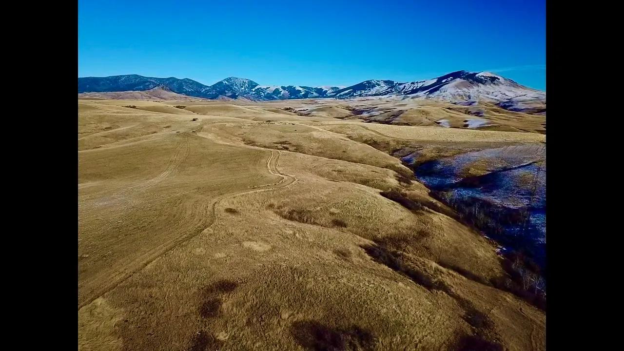
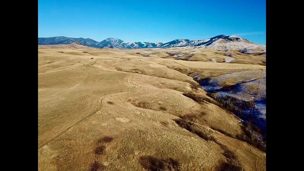
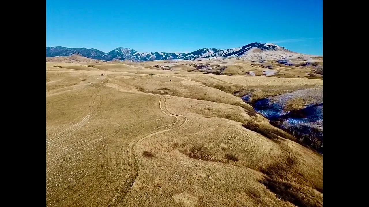
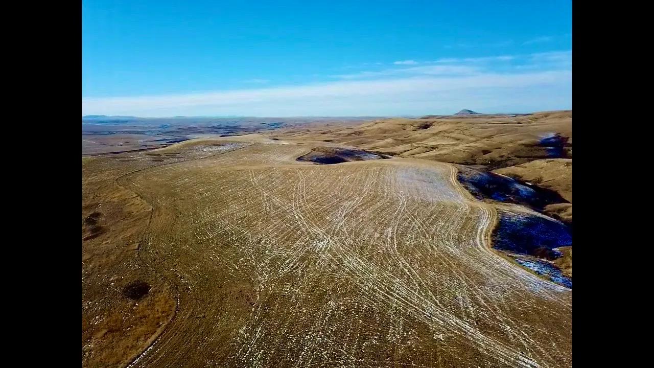
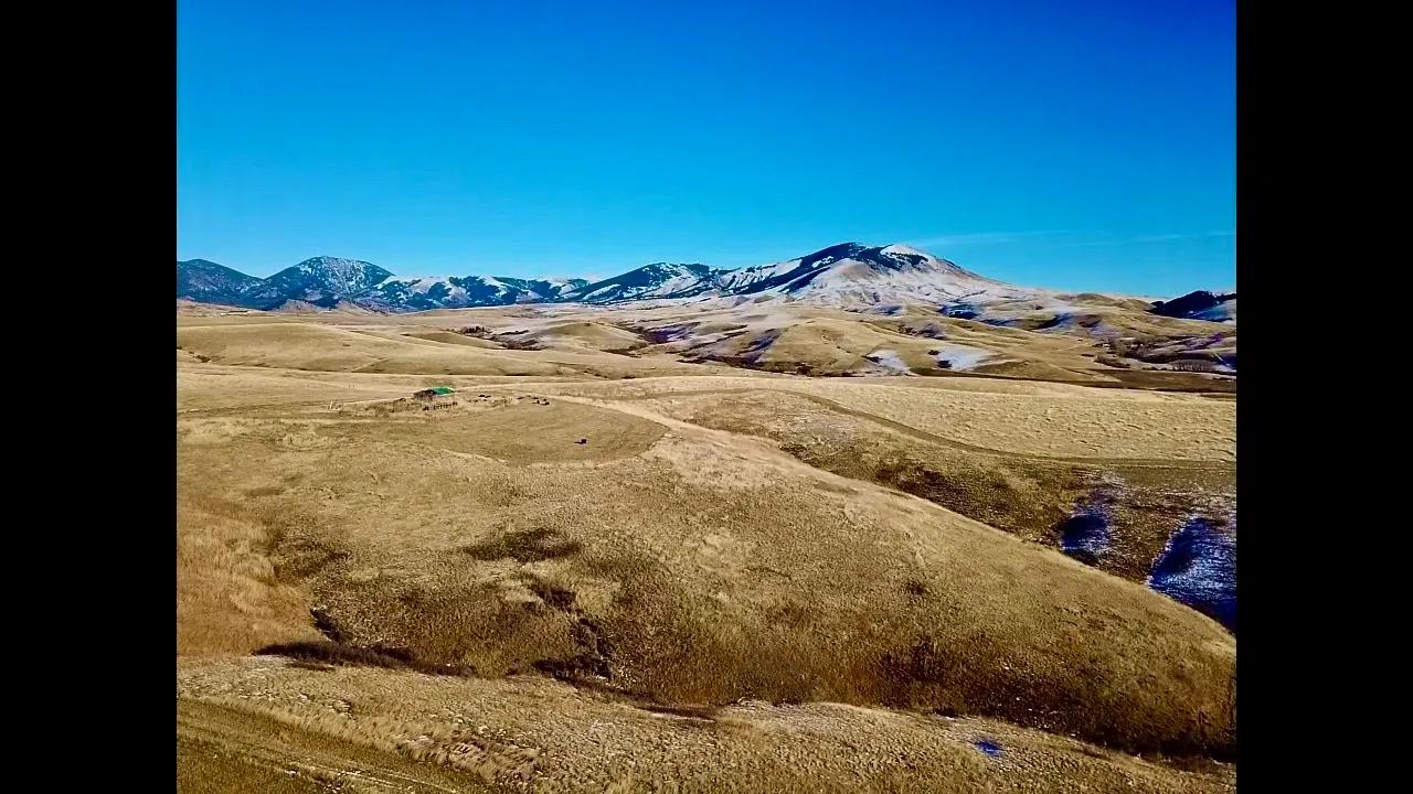
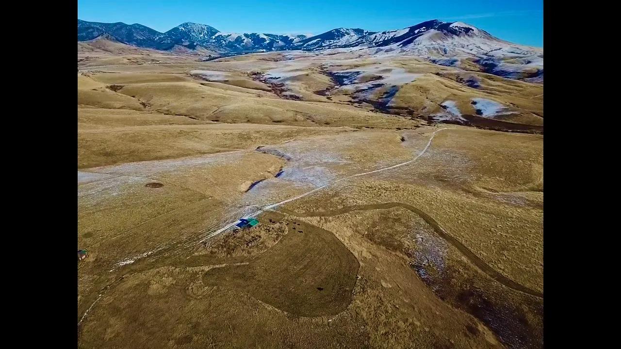
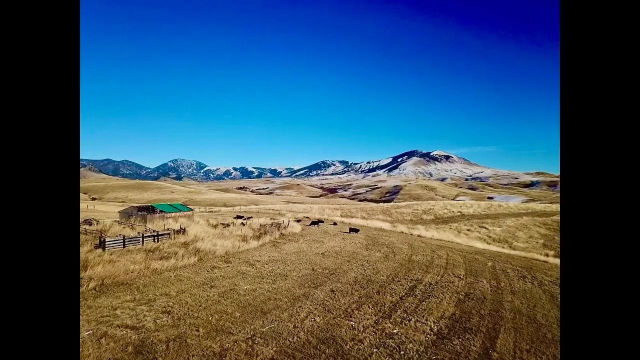
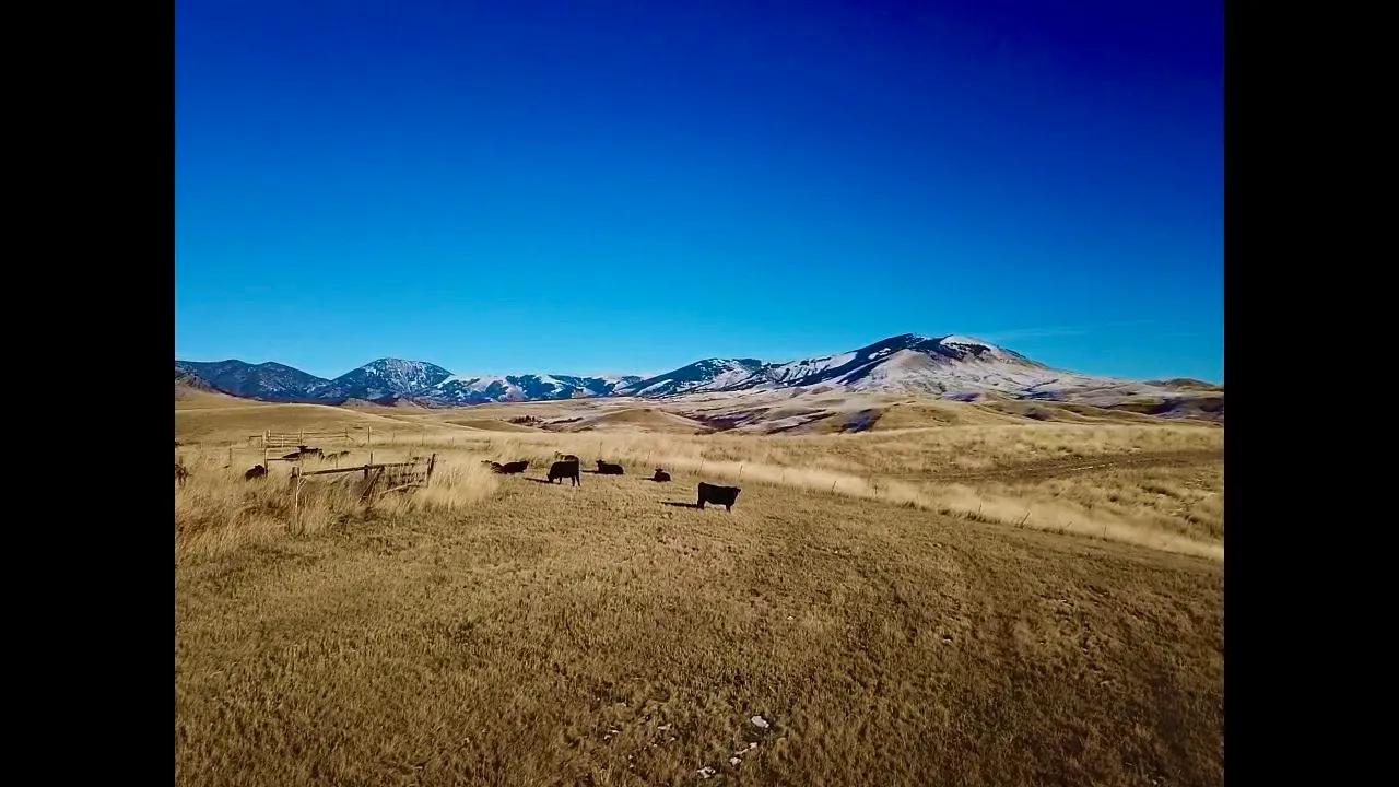
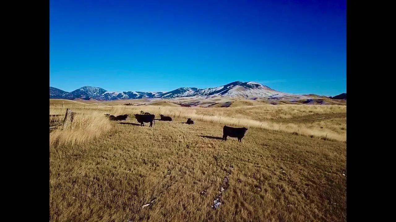
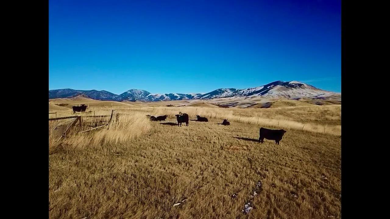
Cora Creek Farm And Furs
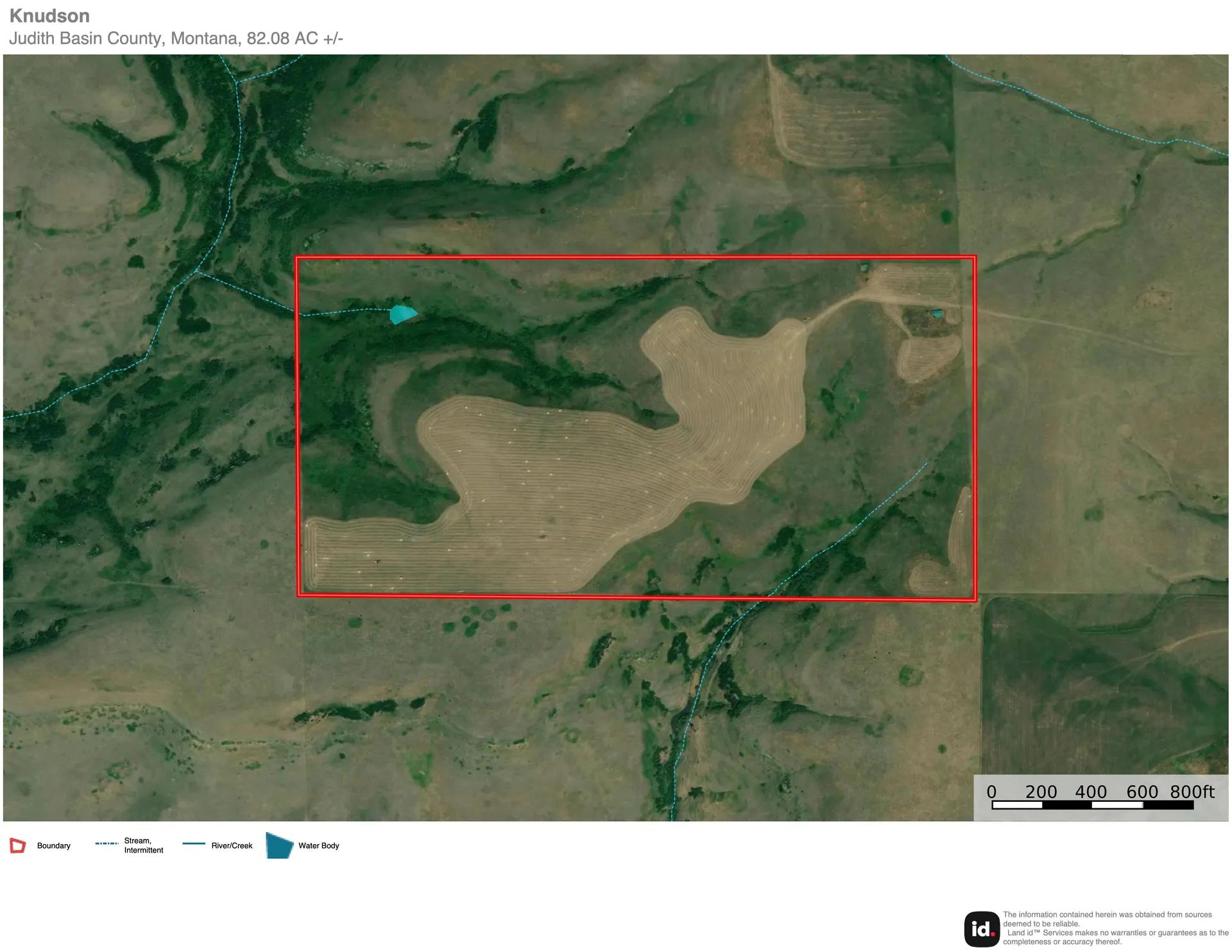
United States /Montana, 0 Cora Creek Road, 59469, 82.08
For Sale
Listing ID :
3499568Acres :
82.08 Acres$640,000
View Agent's Properties and Profile:

Staci Corder Show Number
Contact Seller
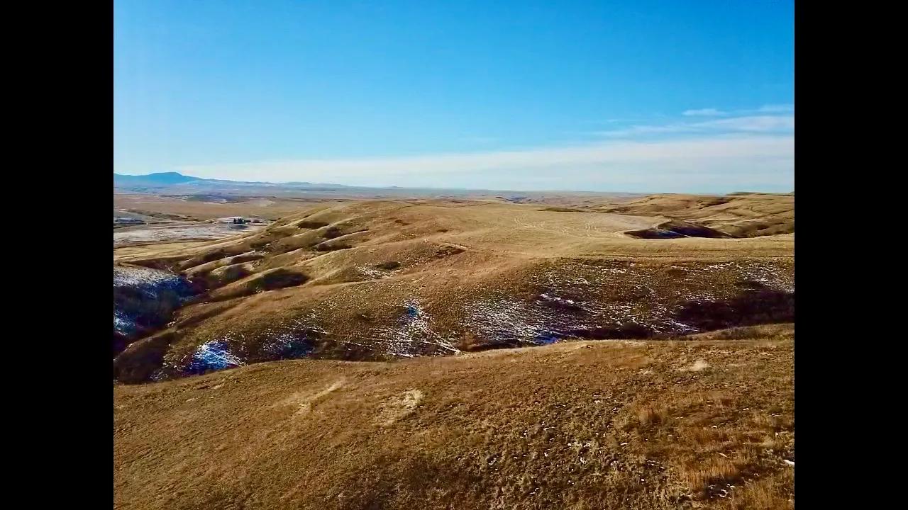
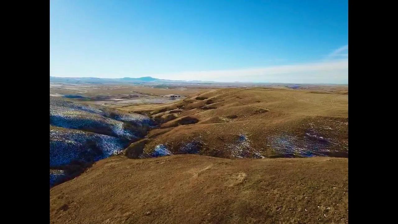
Property Description
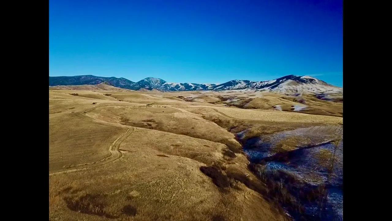
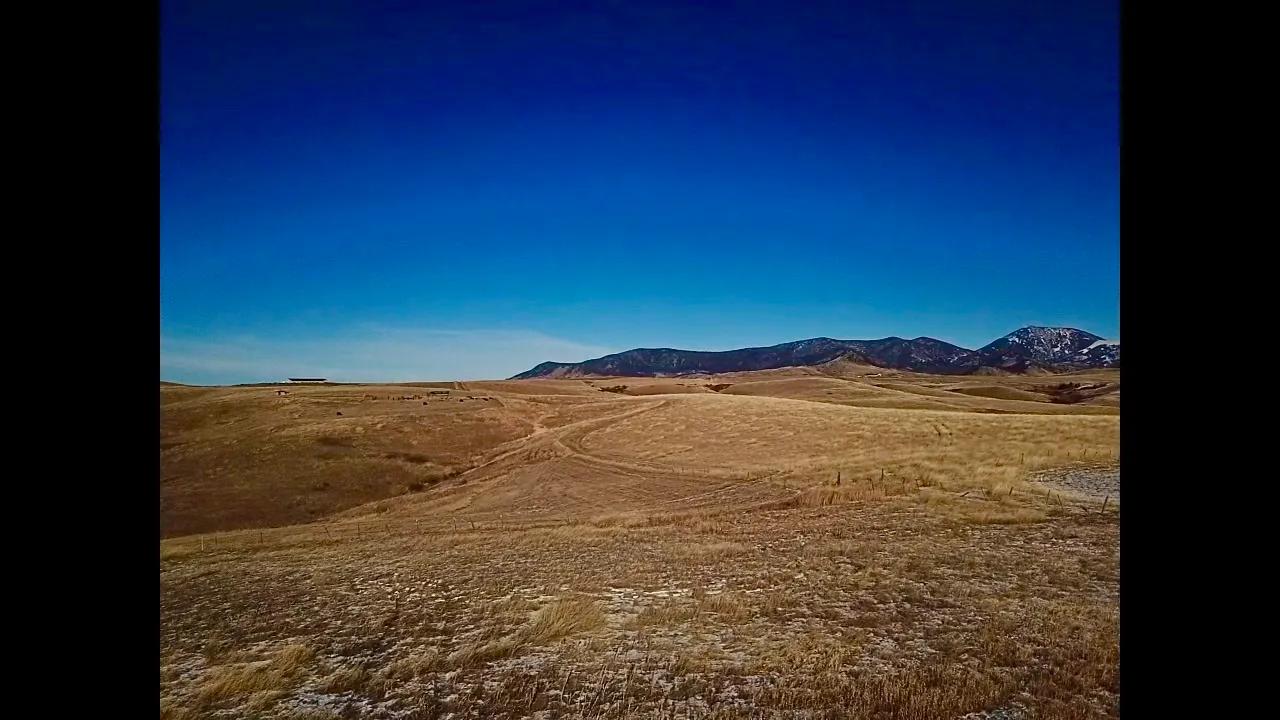
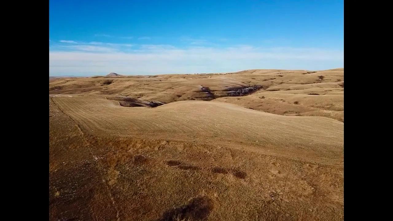
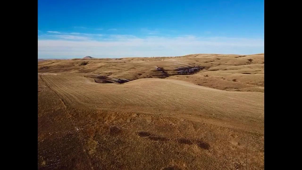
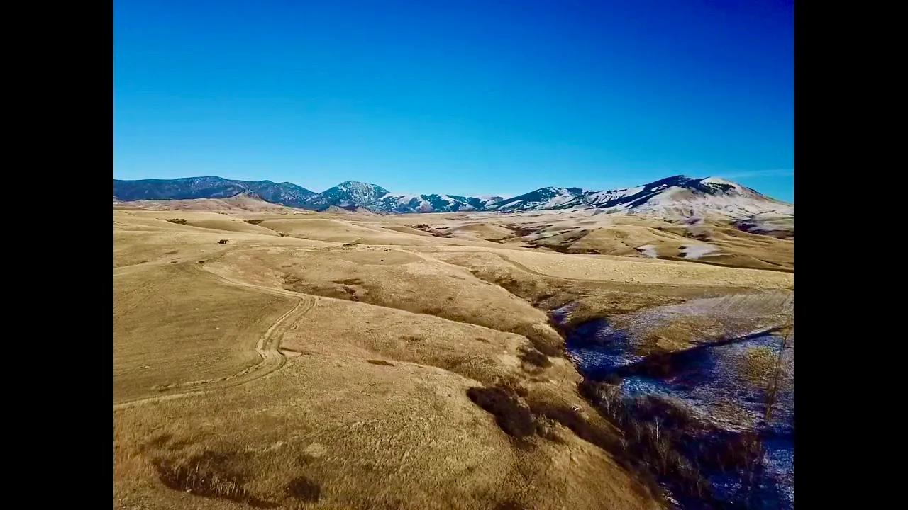
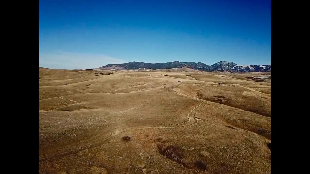
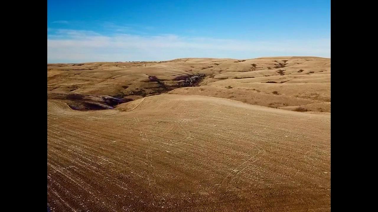
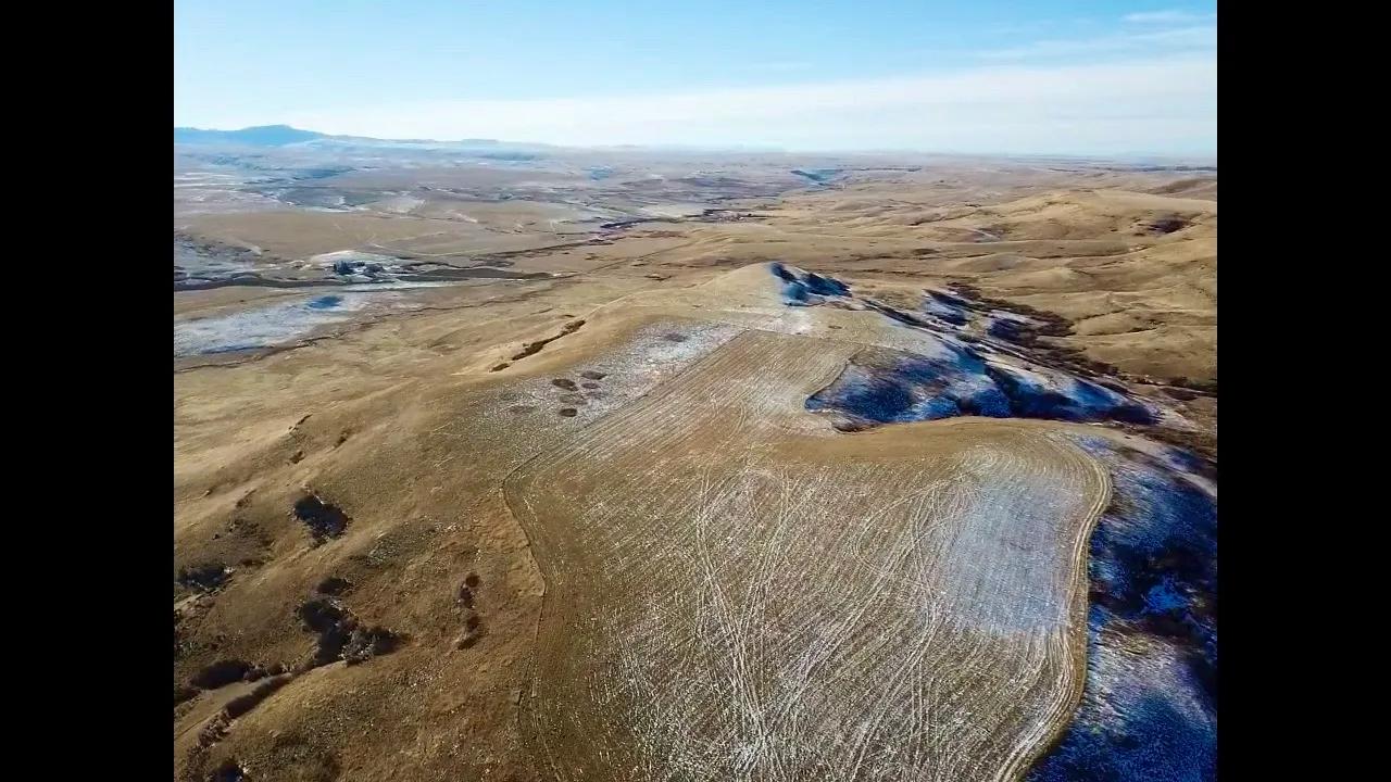
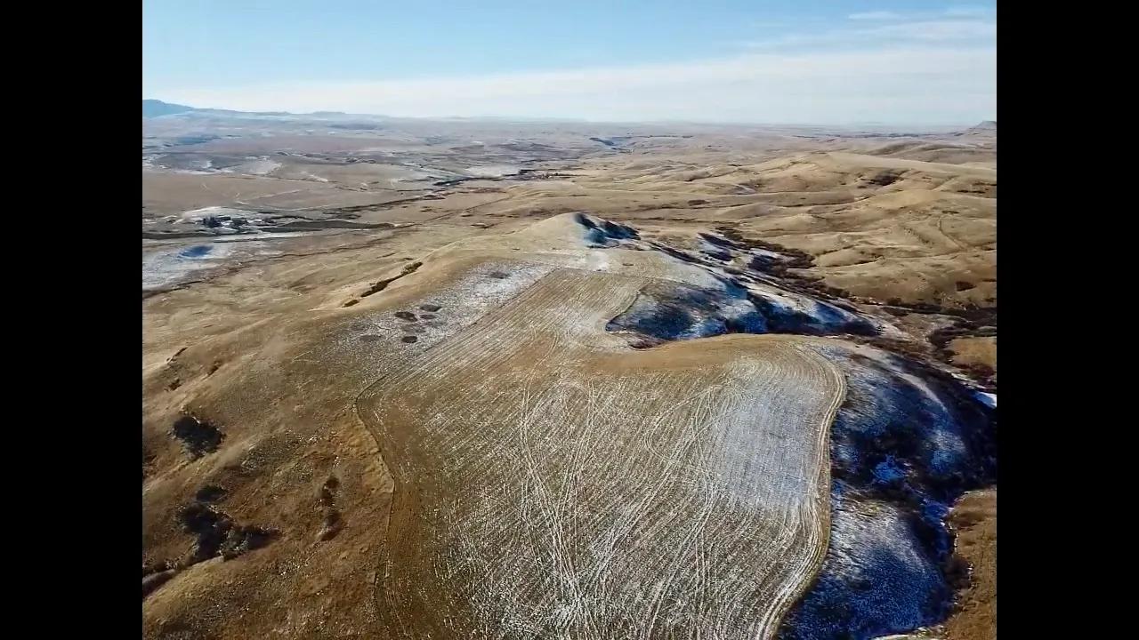
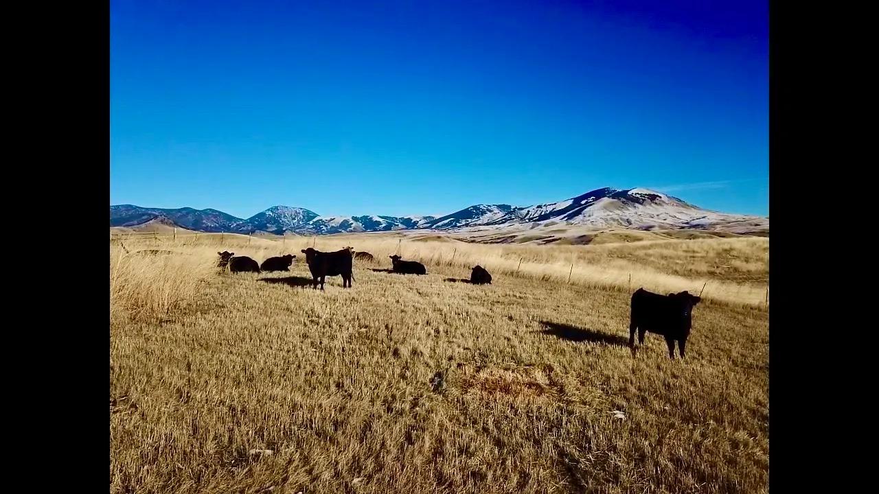
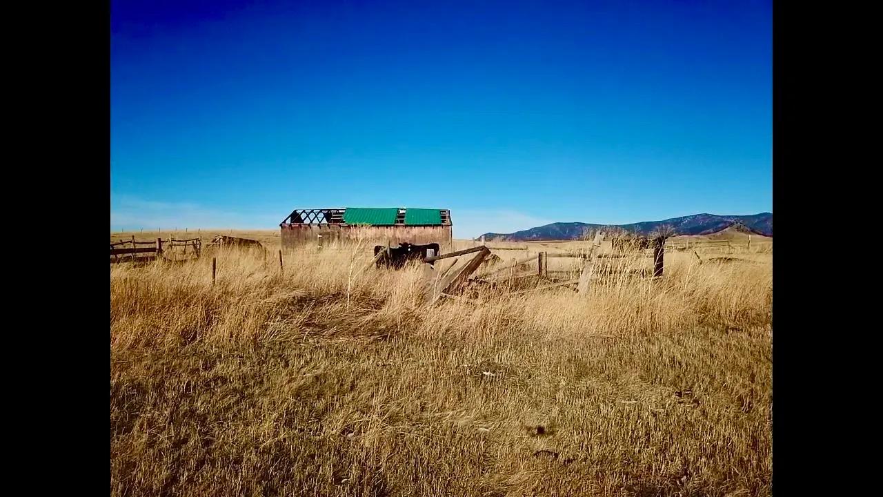
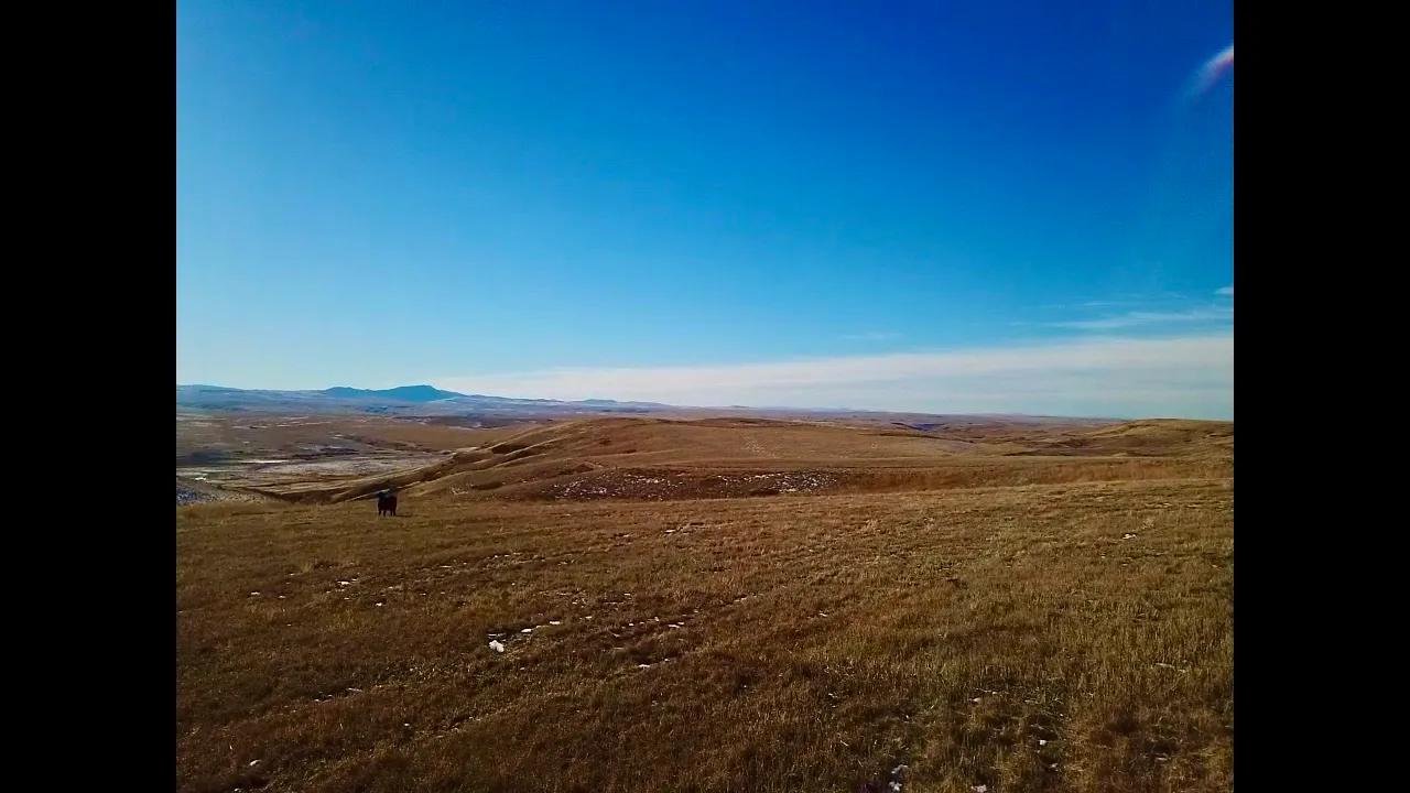
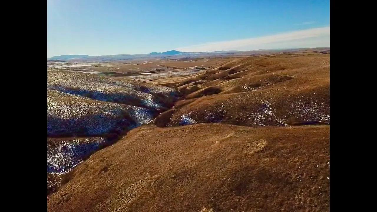
Versatile vistas outstretching to unveil the Highwood Mountains, this property offers dry land farming, hunting, and a peaceful plot to escape to. The contoured coulees provide habitat and cover for elk, mule and white-tailed deer, game birds, pheasant, and coyotes. The 82.08 acres are situated east of Armington Junction and north of Raynesford, a short commute to Great Falls, Montana. Seasonal springs trickle through and water rights accompany the sale! A beautiful area in Central Montana, raw land is rare and desirable, especially with the coinciding bird and game hunting. Upon the foothills of the Highwoods, camping, hiking, brookie fishing, and elk hunting (with permit) await. Skiing in Showdown Ski Resort is south of the property approximately 50 miles. Opportunities abound for a dry hunting cabin or bring in electricity that is a half a mile away and build a dream home. One piece of Montana land with numerous ways to utilize! Local Area Beginning as a railroad town, Raynesford was named after the daughter of the man who sold the land to the railroad. Raynesford joins the countless small settlements that fill the coulees and gulches east of Great Falls and lies north of the ghost towns of Albright and Hughesville. Additionally, Sluice Boxes State Park is just south consisting of eight miles of the Belt Creek Canyon. Soaring cliffs and precipitous ledges mark the Belt Creek Canyon as it slices out of the Little Belt Mountains and winds toward the town of Belt. Many features make Belt, Montana a much-desired haven. For example, it attracts rugged competition from all over to participate in its annual rodeo and is still able to offer a small-town feel and experience. Belt is home to the famous Harvest Moon Brewery which combines Montana’s luscious grain with fresh and clean water out of local streams and wells to make a variety of beers sought after by connoisseurs from all over. You can find ample history throughout the town or in the Belt Museum housed in the old town jail! In addition, Belt is listed on the National Register of Historic Places and claims Montana’s very first coal mine. Belt’s name comes from a nearby mountain, Belt Butte, which looks like it has a belt of rocks around it. The Highwood and Little Belt mountains provide areas for hiking, biking, camping, creek fishing, hunting, and recreating, and the Sluice Boxes State Park is nearby as well. Great Falls is a mere 23 miles away and has an International Airport and prestigious medical facilities for your convenience. Highwood, Montana is 25 miles east of Great Falls and south of Fort Benton. The small close-knit community is mostly comprised of farmers and ranchers as the area is a fertile part of the Golden Triangle. Wheat that is produced here supplies much of the world. The Highwood Mountains are nearby and offer exceptional recreating. Camp, hike, fish, and enjoy nature at this northern end of the Lewis and Clark National Forest. Highwood Baldy is the highest point at 7,760 feet. Area Attractions Central Montana features some of Montana’s best representation of the rolling plains and rugged mountain ranges. Recreational and cultural opportunities display Montana’s western past and illustrate the beauty of its present. Fishing Central Montana is excellent walleye county. The mighty Missouri River is the longest in North America flowing over 2,341 miles. Widow Coulee offers a public fishing site. The terrain surrounding this area is beautifully described as a painting with colors streaming through the cliffs along the river as they wind along the prairie. In this stretch of the Missouri River, game fish to hook include Catfish, Bass, Northern Pike, Walleye, and Trout. A variety of methods can be used as well as a variety of bait. Belt Creek One of Montana’s many hidden gems, Belt Creek flows through the central portion of the state. Perhaps one of the most beautiful sections of the creek is the Sluice Box Canyon section. It is an 8-mile stretch that displays stunning limestone formations with sheer cliff walls that climb for hundreds of feet. In the deep pools, fish for rainbow or brown trout. You can also catch cutthroat or brook trout. Willow, cottonwood, chokecherry, and wild roses grow along the banks while the scenery unfolds and captivates. Ackley Lake State Park Nestled in the heart of Montana, Ackley Lake State Park offers 290 acres of park that includes mountain views and Ackley Lake. The lake provides fishing, boating, swimming, birdwatching, picnicking, and camping. It is stocked with Rainbow Trout and Tiger Muskie. The park has camping sites and two boat launches. Hunting Hunting is a Montana tradition. Central Montana still lives up to that tradition. Residents and nonresidents alike enjoy hunting a variety of big game animals and upland game birds. For non-residents, the permit application deadline for deer and elk hunting in Montana is April 1. All applications are submitted online. The antelope hunting license deadline is early June. The Montana Fish, Wildlife and Parks website has forms and more information about licenses. The property is located in Hunting District 447. The Highwood Mountains are excellent for elk hunting, but you must be drawn for a special tag. The grain fields that encompass this region supply food for antelope, white-tailed and mule deer, and game birds. The coulees are essential cover for game as they are going to and from the river for hydration and lush vegetation. If you are a bow and arrow hunter, be sure to check archery requirements. A bow license, in addition to the proper hunting license, is required during Archery Only Season for any species or to archery hunt in an Arch-Equip-only area or hunting district. Upland game bird licenses, including a license for pheasants, may be purchased over the counter along with your conservation license. Hungarian Partridge and several varieties of grouse are common in Central Montana. Turkey licenses are also sold over the counter except for special spring and fall turkey hunts. Hunting for Montana migratory birds requires a Montana migratory bird license and a federal waterfowl stamp. The Block Management program managed through Montana Fish, Wildlife and Parks offers access to private land from 1,230 landowners and covers 7.4 million acres of land. There is no charge to hunt on Block Management land. A Hunters Access Guide is published each year giving details about the program, and it is usually available by August 15. Central Montana also has public land managed by the U. S. Forest Service and Bureau of Land Management. Highwood Mountains In Chouteau County near Highwood, Belt Creek and Highwood Creek provide Brookie Trout fishing. The deep pools along the cliffs and rock formations are great for fly fishing or for catching bigger trout. The Highwood Mountains are a popular destination for camping, fishing, ATV-ing, horseback riding, hiking, and enjoying a fantastic scenic drive. There is a campground with maintained sites and a scenic mountain drive that takes you through several creek crossings, mountain meadows, and gorgeous forests until you reach Geyser, Montana. Wildlife is abundant as you drive past farm fields and ranches. It isn’t uncommon to meet a cattle drive! Moose, black bear, bald eagle, fox, coyote, white-tailed and mule deer, and mountain lion are some animals you can catch glimpses of. Showdown Ski Area Ski in the heart of Montana at Showdown Ski Area and the Silver Crest Nordic Trail System which consists of weekly groomed trails for cross-country skiing or snowshoeing. The Kings Hill Snowmobiling System is considered to be one of the finest in Montana and has over 200 miles of marked and groomed trails.
Basic Details
Property Types:
Acreage, Cattle Ranch, Hunting Land, Recreational Land, Equestrian PropertyListing Type:
For SaleListing ID:
3499568Price:
$640,000Acres:
82.08 AcresFeatures:
SpringAddress Map
Country:
United StatesState:
MontanaCounty:
Judith BasinCity:
RaynesfordLatitude:
47.35714159333339Longitude:
-110.7499122619629Street Address:
0 Cora Creek RoadLand for Sale in the USA by State
- Alabama
- Alaska
- Arizona
- Arkansas
- California
- Colorado
- Connecticut
- Delaware
- Florida
- Georgia
- Hawaii
- Idaho
- Illinois
- Indiana
- Iowa
- Kansas
- Kentucky
- Louisiana
- Maine
- Maryland
- Massachusetts
- Michigan
- Minnesota
- Mississippi
- Missouri
- Montana
- Nebraska
- Nevada
- New Hampshire
- New Jersey
- New Mexico
- New York
- North Carolina
- North Dakota
- Ohio
- Oklahoma
- Oregon
- Pennsylvania
- Puerto Rico
- Rhode Island
- South Carolina
- South Dakota
- Tennessee
- Texas
- Utah
- Vermont
- Virginia
- Washington
- West Virginia
- Wisconsin
- Wyoming
Land for Sale in Costa Rica, Mexico & Canada
Property For Sale
Copyright ©️ 2024 by LandHub.com. LandHub ©️ is a registered trademark and cannot be used without permission.